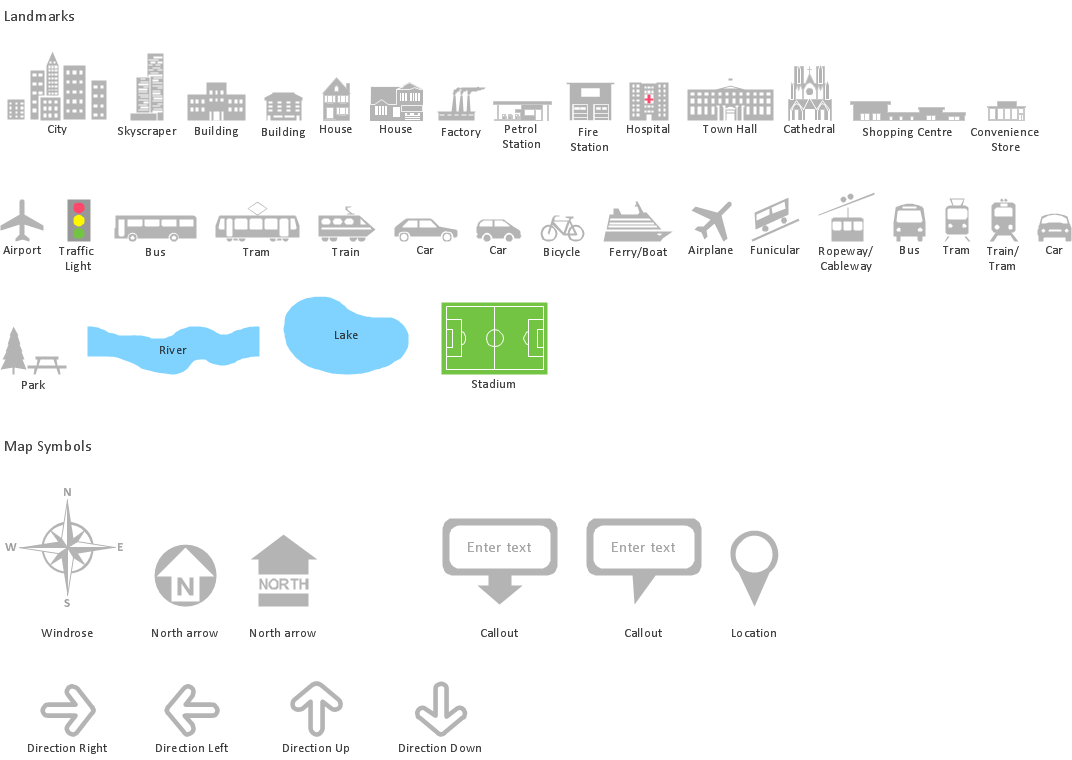
Spatial infographics Design Elements: Location Map

HelpDesk
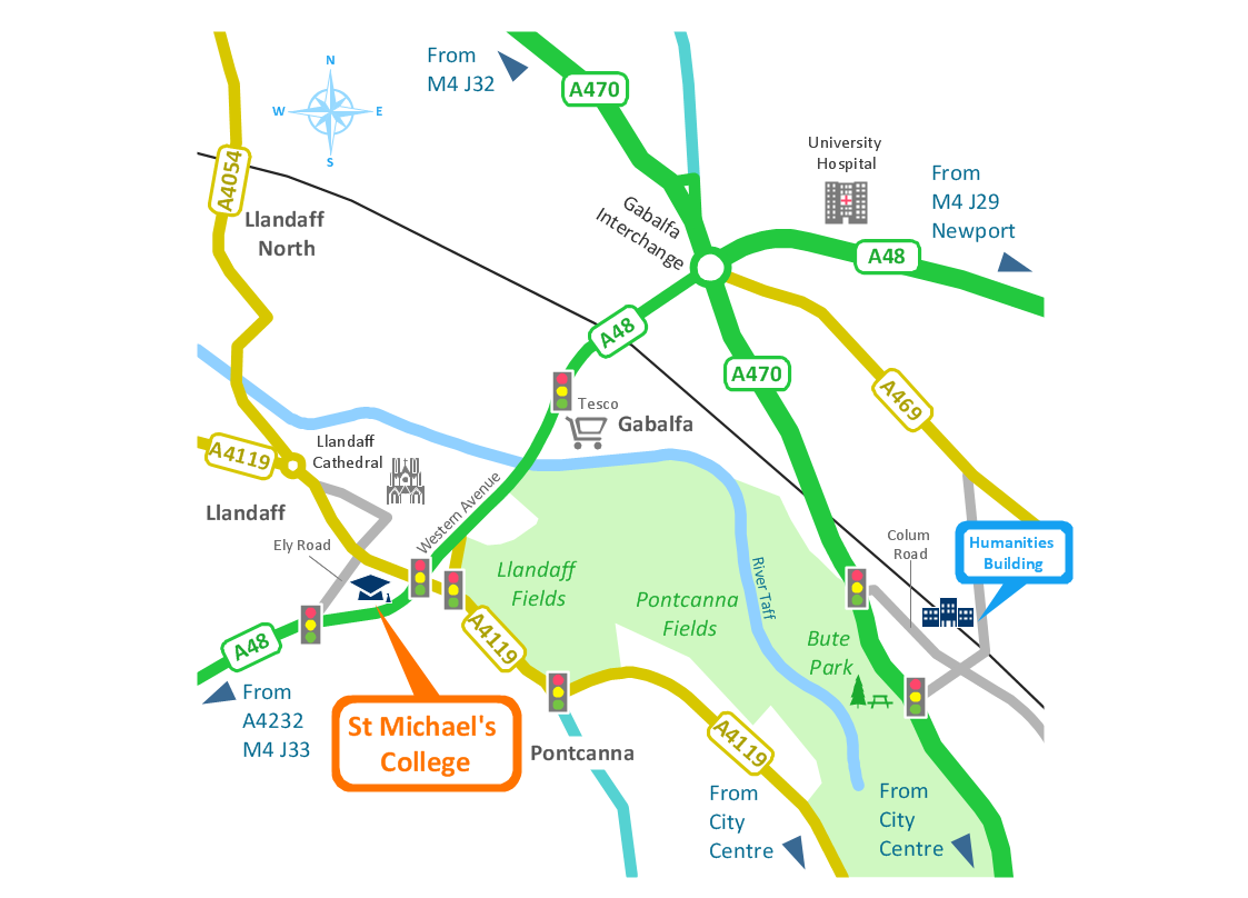
How to Create a Directional Map

Map Infographic Tool
Best Tool for Infographic Construction
How tо Represent Information Graphically

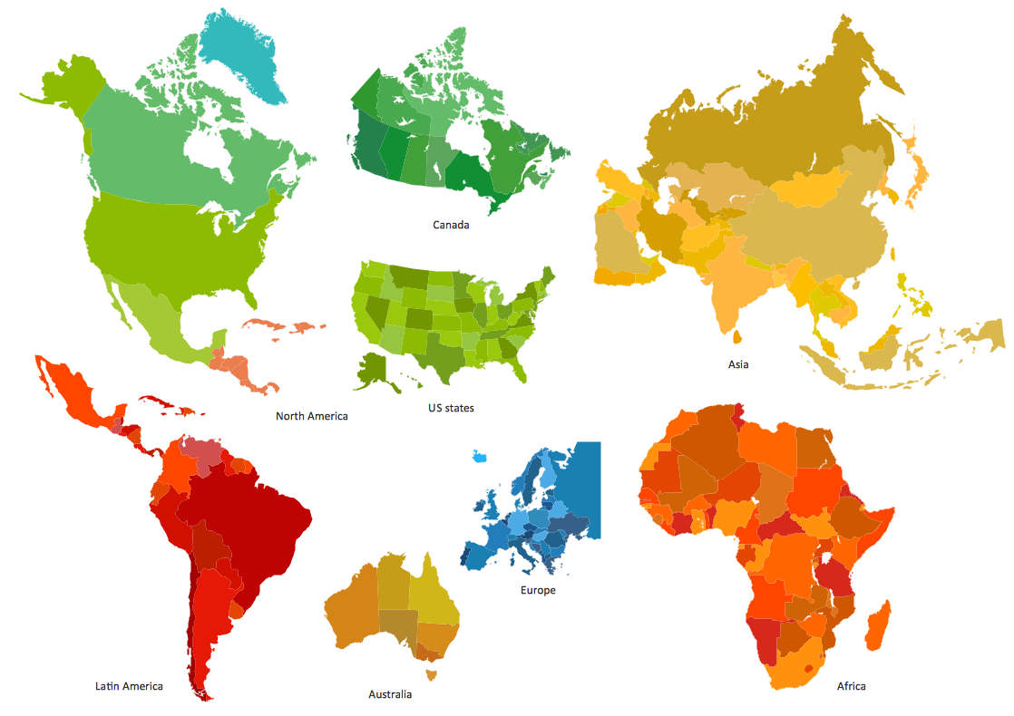
Geo Map — South America Continent

Map Infographic Design
 Directional Maps
Directional Maps solution extends ConceptDraw DIAGRAM software with templates, samples and libraries of vector stencils for drawing the directional, location, site, transit, road and route maps, plans and schemes.
Brilliant Examples of Infographics Map, Transport, Road

Geo Map — Asia

- Conference centre location map | How to Draw a Map of North ...
- Spatial infographics Design Elements: Location Map | Superb ...
- Design elements - Transport map | Design elements - Location map ...
- Design elements - Location map | How to draw Metro Map style ...
- USA Maps | Design elements - Location map | Website Wireframe ...
- Map Infographic Design | Spatial infographics Design Elements ...
- How To Draw Building Plans | Design elements - Location map ...
- Spatial infographics Design Elements: Location Map | Map ...
- How to Create a Directional Map Using ConceptDraw PRO ...
- Drawing Simple Road Map Software