The vector stencils library "Geography" contains 14 clipart images of natural landscapes and water features for drawing illustrations.
"A natural landscape is a landscape that is unaffected by human activity. A natural landscape is intact when all living and nonliving elements are free to move and change. The nonliving elements distinguish a natural landscape from a wilderness. A wilderness includes areas within which natural processes operate without human interference, but a wilderness must contain life. As implied, a natural landscape may contain either the living or nonliving or both." [Natural landscape. Wikipedia]
The clip art example "Geography - Vector stencils library" was created using the ConceptDraw PRO diagramming and vector drawing software extended with the Nature solution from the Illustration area of ConceptDraw Solution Park.
www.conceptdraw.com/ solution-park/ illustrations-nature
Ocean

Forest

River

Lake

Waterfall

Mountains

Mountain

Ravine

Volcano

Desert

Hills

Iceberg

Conifer tree

Tree

"Ski jumping is a sport in which skiers go down a take-off ramp, jump and attempt to land as far as possible down the hill below. In addition to the length of the jump, judges give points for style. The skis used for ski jumping are wide and long (260 to 275 centimetres (100 to 108 in)). Ski jumping is predominantly a winter sport, performed on snow, and is part of the Winter Olympic Games, but can also be performed in summer on artificial surfaces – porcelain or frost rail track on the inrun, plastic on the landing hill. Ski jumping belongs to the nordic type of competitive skiing." [Ski jumping. Wikipedia]
The vector icon example "Ski jumping" represents one of 20 symbols from the Winter sports pictograms library for the ConceptDraw PRO diagramming and vector drawing software.
The design elements library Winter sports pictograms is included in the Winter Sports solution from the Sport area of ConceptDraw Solution Park.
Ski jumping

The vector clipart library Geography contains 14 images of geographical features: ocean, forest, river, lake, waterfall, mountains, ravine, volcano, desert, hills, iceberg, trees.
Use the design elements library Geography to draw illustrations with landform images using the ConceptDraw PRO diagramming and vector drawing software.
"A landform in the earth sciences comprises a geomorphological unit, and is largely defined by its surface form and location in the landscape. As part of the terrain a landform is an element of topography. Landform elements also include land such as hills, mountains, plateaus,canyons,valleys, seascape and oceanic waterbody interface features such as bays, peninsulas, seas and so forth, including sub-aqueous terrain features such as mid-ocean ridges, volcanoes,and the great ocean basins." [Landform. Wikipedia]
This landscape illustration example is included in the Nature solution from the Illustration area of ConceptDraw Solution Park.
Vector illustration

The vector stencils library "Geography" contains 14 clipart images of natural landscapes and water features for drawing illustrations.
"A natural landscape is a landscape that is unaffected by human activity. A natural landscape is intact when all living and nonliving elements are free to move and change. The nonliving elements distinguish a natural landscape from a wilderness. A wilderness includes areas within which natural processes operate without human interference, but a wilderness must contain life. As implied, a natural landscape may contain either the living or nonliving or both." [Natural landscape. Wikipedia]
The clip art example "Geography - Vector stencils library" was created using the ConceptDraw PRO diagramming and vector drawing software extended with the Nature solution from the Illustration area of ConceptDraw Solution Park.
www.conceptdraw.com/ solution-park/ illustrations-nature
"A natural landscape is a landscape that is unaffected by human activity. A natural landscape is intact when all living and nonliving elements are free to move and change. The nonliving elements distinguish a natural landscape from a wilderness. A wilderness includes areas within which natural processes operate without human interference, but a wilderness must contain life. As implied, a natural landscape may contain either the living or nonliving or both." [Natural landscape. Wikipedia]
The clip art example "Geography - Vector stencils library" was created using the ConceptDraw PRO diagramming and vector drawing software extended with the Nature solution from the Illustration area of ConceptDraw Solution Park.
www.conceptdraw.com/ solution-park/ illustrations-nature
Ocean
Forest
River
Lake
Waterfall
Mountains
Mountain
Ravine
Volcano
Desert
Hills
Iceberg
Conifer tree
Tree
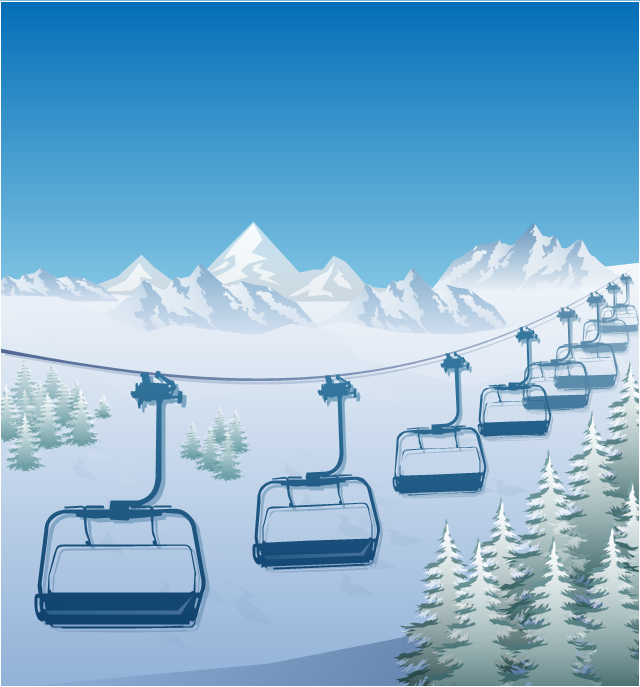
"The term ski lift generally refers to any cable transport device that carries skiers up a hill. A ski lift may fall into one of the following three main classes:
Aerial lifts, including:
Aerial tramways,
Chairlifts,
Detachable chairlifts,
Funifors,
Funitels,
Gondola lifts,
Telemix.
Surface lifts, including:
J-bars,
T-bars,
Magic carpets,
Platter / Button / Poma lifts,
Rope tows & handle tows.
Cable railways, including:
Funiculars." [Ski lift. Wikipedia]
The winter sport illustration example "Ski lift in the snow capped mountains" was created using the ConceptDraw PRO diagramming and vector drawing software extended with the Winter Sports solution from the Sport area of ConceptDraw Solution Park.
Winter sport illustration
Rainfall Bar Chart

 Correlation Dashboard
Correlation dashboard solution extends ConceptDraw PRO software with samples, templates and vector stencils library with Scatter Plot Charts for drawing the visual dashboard visualizing data correlation.
 Frequency Distribution Dashboard
Frequency distribution dashboard solution extends ConceptDraw PRO software with samples, templates and vector stencils libraries with histograms and area charts for drawing the visual dashboards showing frequency distribution of data.
 Composition Dashboard
Composition dashboard solution extends ConceptDraw PRO software with templates, samples and vector stencils library with charts and indicators for drawing visual dashboards showing data composition.
Australia Map — New South Wales

Geo Map - Asia - Kazakhstan

 Comparison Dashboard
Comparison dashboard solution extends ConceptDraw PRO software with samples, templates and vector stencils library with charts and indicators for drawing the visual dashboard comparing data.
Geo Map - Europe - Greece

 Time Series Dashboard
Time series dashboard solution extends ConceptDraw PRO software with templates, samples and vector stencils libraries with charts, graphs and plots for drawing the visual dashboards showing data time series.
- Geography - Vector stencils library
- Geography - Vector stencils library | Forest On Hill Clipart
- Hill Clipart Png
- Hill Clipart
- Elements Of Nature River Ocean Mountain Hill Forest Volcano
- Hill Vector Image
- Small Hill Clipart
- Hill Nataurl Cartoon Png
- Snow Hill Clipart
- Alpine skiing - Winter sports pictograms | Cross Hill Clipart
- Draw Hill Mountain River Forest
- Mountain Hill Clipart Png
- Hill Clipart Water 3d Png
- Hill Vector Connect
- Landforms Hill Clipart
- Elements Of Hill And Mountain
- Hill Vector Silhouette
- Winter Olympics - Ski jumping | Winter Sports | Ski Jumping Clip Art
- Winter Olympics - Ski jumping | Winter Olympics - Cross-country ...
- Winter Olympics - Ski jumping | Winter Sports | Winter Sports. Using ...