This site uses cookies. By continuing to browse the ConceptDraw site you are agreeing to our Use of Site Cookies.

Geo Map - USA - Vermont

Vermont is a state in the New England region of the northeastern United States.
The vector stencils library Vermont contains contours for ConceptDraw DIAGRAM diagramming and vector drawing software. This library is contained in the Continent Maps solution from Maps area of ConceptDraw Solution Park.

Geo Map - Europe - Bulgaria

Bulgaria, officially the Republic of Bulgaria, is a country located in Southeastern Europe.
Use the Continent Maps solution to create Bulgaria geographical map, cartograms and thematic map, to help visualize the business and thematic information connected with geographic areas, locations or customs.

Visualization Spatial Data Using Thematic Maps Combined with Infographics

Now anyone can build an infographics from their data using ConceptDraw.
Nice and simple, but the features it have are power-packed!

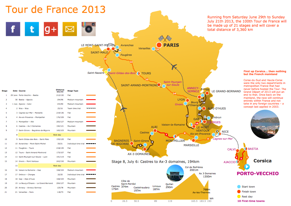
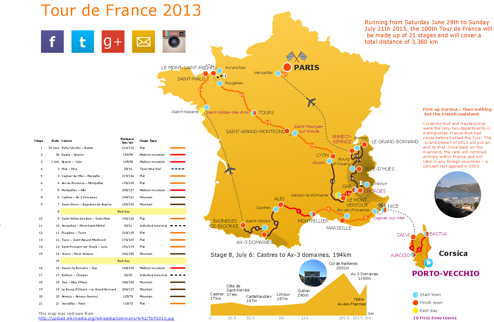
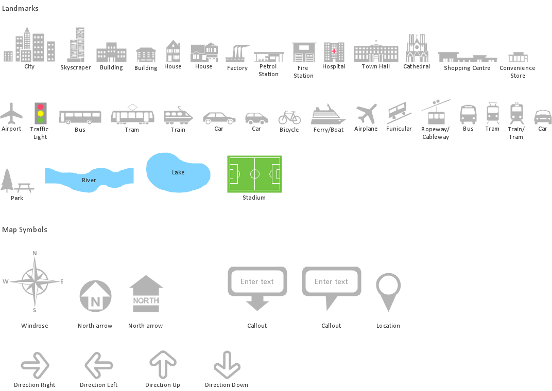
Spatial infographics Design Elements: Transport Map

Do you like infographics and data visualization? Creating infographics is super-easy with ConceptDraw.

Geospatial Data

Effective spatial infographics design, easy geospatial data presenting, now it is reality thanks to the extensive drawing tools of the Spatial Infographics Solution included in “Infographics” Area of ConceptDraw Solution Park.

Geo Map - USA - Illinois

Illinois is a state in the Midwestern United States. It is the 5th most populous and 25th most extensive state, and is often noted as a microcosm of the entire country.
The vector stencils library Illinois contains contours for ConceptDraw DIAGRAM diagramming and vector drawing software. This library is contained in the Continent Maps solution from Maps area of ConceptDraw Solution Park.

Geo Map - Africa - Central African Republic

The Central African Republic is a landlocked country in Central Africa. It is bordered by Chad in the north, Sudan in the northeast, South Sudan in the east, the Democratic Republic of the Congo and the Republic of the Congo in the south and Cameroon in the west.
The vector stencils library Central African Republic contains contours for ConceptDraw DIAGRAM diagramming and vector drawing software. This library is contained in the Continent Maps solution from Maps area of ConceptDraw Solution Park.

Transportation Infographics

ConceptDraw is a visualization Software for making transportation infographics. Infographics design vector elements and vector graphics which will surely help you in your design process.

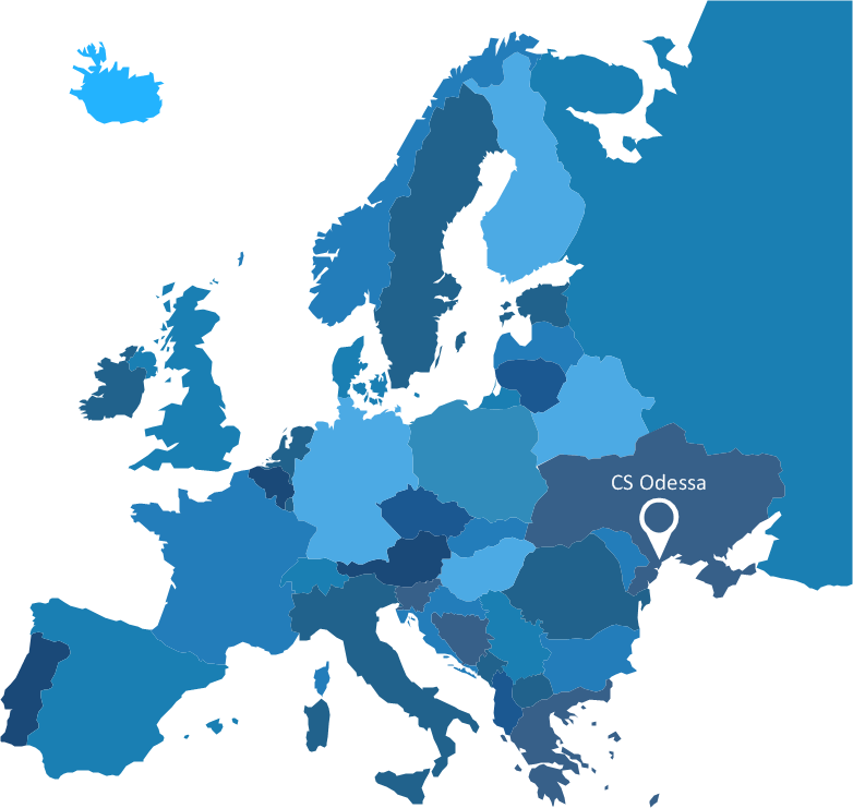
Spatial infographics Design Elements: Location Map

Infographic Design Elements for visually present various geographically distributed information.

Map Infographic Design

ConceptDraw collection of vector elements for infographics design.