This site uses cookies. By continuing to browse the ConceptDraw site you are agreeing to our Use of Site Cookies.

Geo Map - USA - Georgia

Georgia is a state located in the southeastern United States.
The vector stencils library Georgia contains contours for ConceptDraw DIAGRAM diagramming and vector drawing software. This library is contained in the Continent Maps solution from Maps area of ConceptDraw Solution Park.

Geo Map - USA - Maryland

Maryland is a U.S. state located in the Mid-Atlantic region of the United States, bordering Virginia, West Virginia, and Washington, D.C. to its south and west; Pennsylvania to its north; and Delaware to its east.
The vector stencils library Maryland contains contours for ConceptDraw DIAGRAM diagramming and vector drawing software. This library is contained in the Continent Maps solution from Maps area of ConceptDraw Solution Park.

USA Map

Usually designing of maps, including the USA Map is a quite complex, long and labour-intensive process. But now we have an excellent possibility to make it easier with ConceptDraw DIAGRAM diagramming and vector drawing software extended with powerful USA Maps Solution from the Maps Area of ConceptDraw Solution Park.
The vector stencils library "Asia" contains 57 Asian state map contours for drawing thematic and political maps of Asia. Use it for visual representation of geospatial information, statistics and quantitative data.
"Asia is the Earth's largest and most populous continent, located primarily in the eastern and northern hemispheres. ... Countries: 49 (and 5 disputed)." [Asia. Wikipedia]
The state map contours example "Asia - Vector stencils library" was created using the ConceptDraw PRO diagramming and vector drawing software extended with the Continent Maps solution from the Maps area of ConceptDraw Solution Park.
Asia
Asia, Singapore, Indonesia, Asia, Asia map,
Central Asia
Central Asia, Central Asia,
South Asia
South Asia, South Asia, Southern Asia, Southern Asia map,
East Asia
East Asia, East Asia,
Southeast Asia
Southeast Asia, Southeast Asia, Southeastern Asia map,
Afghanistan
Afghanistan, Afghanistan, Afghanistan map,
Armenia
Armenia, Armenia, Armenia map,
Azerbaijan
Azerbaijan, Azerbaijan, Azerbaijan map,
Bahrain
Bahrain, Bahrain, Bahrain map,
Bangladesh
Bangladesh, Bangladesh, Bangladesh map,
Bhutan
Bhutan, Bhutan, Bhutan map,
Brunei
Brunei, Brunei, Brunei map,
Burma (Myanmar)
Burma (Myanmar), Burma, Myanmar, Burma map, Myanmar map,
Cambodia
Cambodia, Cambodia, Cambodia map,
China
China, China, China map, People's Republic of China, PRC,
Cyprus
Cyprus, Cyprus, Cyprus map,
Georgia
Georgia, Georgia, Georgia map,
India
India, India, India map,
Indonesia
Indonesia, Indonesia, Indonesia map,
Iran
Iran, Iran, Iran map,
Iraq
Iraq, Iraq, Iraq map,
Israel
Israel, Israel, Israel map,
Japan
Japan, Japan, Japan map,
Jordan
Jordan, Jordan, Jordan map,
Kazakhstan
Kazakhstan, Kazakhstan, Kazakhstan map,
Kuwait
Kuwait, Kuwait, Kuwait map,
Kyrgyzstan
Kyrgyzstan, Kyrgyzstan, Kyrgyzstan map,
Laos
Laos, Laos, Laos map,
Lebanon
Lebanon, Lebanon, Lebanon map,
Malaysia
Malaysia, Malaysia, Malaysia map,
Maldives
Maldives, Maldives, Maldives map, Maldive Islands,
Mongolia
Mongolia, Mongolia, Mongolia map,
Nepal
Nepal, Nepal, Nepal map,
North Korea
North Korea, North Korea, North Korea map,
Oman
Oman, Oman, Oman map,
Pakistan
Pakistan, Pakistan, Pakistan map,
Papua New Guinea
Papua New Guinea, Papua New Guinea, Papua New Guinea map,
Philippines
Philippines, Philippines, Philippines map,
Qatar
Qatar, Qatar, Qatar map,
Russia (Asia)
Russia (Asia), Russia, Russian Federation, Asian part of Russia,
Saudi Arabia
Saudi Arabia, Saudi Arabia, Saudi Arabia map,
Singapore
Singapore, Singapore, Singapore map,
South Korea
South Korea, South Korea, South Korea map,
Sri Lanka
Sri Lanka, Sri Lanka, Sri Lanka map,
Syria
Syria, Syria, Syria map,
Taiwan
Taiwan, Taiwan, Republic of China, ROC,
Tajikistan
Tajikistan, Tajikistan, Tajikistan map,
Thailand
Thailand, Thailand, Thailand map,
Turkey
Turkey, Turkey, Turkey map,
Turkmenistan
Turkmenistan, Turkmenistan, Turkmenistan map,
United Arab Emirates
United Arab Emirates, United Arab Emirates, United Arab Emirates map,
Uzbekistan
Uzbekistan, Uzbekistan, Uzbekistan map,
Vietnam
Vietnam, Vietnam, Vietnam map,
Yemen
Yemen, Yemen, Yemen map,
Aral Sea
Aral Sea, Aral Sea,
Caspian Sea
Caspian Sea, Caspian Sea,
Lake Balkhash
Lake Balkhash, Lake Balkhash,
Used Solutions

Geo Map — USA — Oklahoma

Oklahom is a state located in the South Central United States.
The vector stencils library Oklahoma contains contours for ConceptDraw DIAGRAM diagramming and vector drawing software. This library is contained in the Continent Maps solution from Maps area of ConceptDraw Solution Park.
The vector stencils library "North America" contains 70 contours for drawing thematic maps of North America in spatial infographics.
Use it for visual representation of geospatial information, statistics and quantitative data in the ConceptDraw PRO diagramming and vector drawing software extended with the Spatial Infographics solution from the area "What is Infographics" of ConceptDraw Solution Park.
North America
North America, North America, North America map, North American countries,
Greenland (Denmark)
Greenland (Denmark), Greenland, Greenland map,
Canada
Canada, Canada, Canada map,
Canada (provinces and territories)
Canada (provinces and territories), Canada, Canada map, provinces, territories,
Alberta
Alberta, Alberta,
British Columbia
British Columbia, British Columbia,
Manitoba
Manitoba, Manitoba,
New Brunswick
New Brunswick, New Brunswick,
Newfoundland and Labrador
Newfoundland and Labrador, Newfoundland and Labrador,
Northwest Territories
Northwest Territories, Northwest Territories,
Nova Scotia
Nova Scotia, Nova Scotia,
Nunavut
Nunavut, Nunavut,
Ontario
Ontario, Ontario,
Prince Edward Island
Prince Edward Island, Prince Edward Island,
Quebec
Quebec, Quebec,
Saskatchewan
Saskatchewan, Saskatchewan,
Yukon
Yukon, Yukon,
USA
USA, USA, United States of America, U.S.A., United States, US, U.S., America,
US states
US states, USA, United States of America, U.S.A., United States, US, U.S., America,
Alabama
Alabama, Alabama,
Alaska
Alaska, Alaska,
Arizona
Arizona, Arizona,
Arkansas
Arkansas, Arkansas,
California
California, California,
Colorado
Colorado, Colorado,
Connecticut
Connecticut, Connecticut,
Delaware
Delaware, Delaware,
Florida
Florida, Florida,
Georgia
Georgia, Georgia,
Hawaii
Hawaii, Hawaii,
Idaho
Idaho, Idaho,
Illinois
Illinois, Illinois,
Indiana
Indiana, Indiana,
Iowa
Iowa, Iowa,
Kansas
Kansas, Kansas,
Kentucky
Kentucky, Kentucky,
Louisiana
Louisiana, Louisiana,
Maine
Maine, Maine,
Maryland
Maryland, Maryland,
Massachusetts
Massachusetts, Massachusetts,
Michigan
Michigan, Michigan,
Minnesota
Minnesota, Minnesota,
Mississippi
Mississippi, Mississippi,
Missouri
Missouri, Missouri,
Montana
Montana, Montana,
Nebraska
Nebraska, Nebraska,
Nevada
Nevada, Nevada,
New Hampshire
New Hampshire, New Hampshire,
New Jersey
New Jersey, New Jersey,
New Mexico
New Mexico, New Mexico,
New York
New York, New York,
North Carolina
North Carolina, North Carolina,
North Dakota
North Dakota, North Dakota,
Ohio
Ohio, Ohio,
Oklahoma
Oklahoma, Oklahoma,
Oregon
Oregon, Oregon,
Pennsylvania
Pennsylvania, Pennsylvania,
Rhode Island
Rhode Island, Rhode Island,
South Carolina
South Carolina, South Carolina,
South Dakota
South Dakota, South Dakota,
Tennessee
Tennessee, Tennessee,
Texas
Texas, Texas,
Utah
Utah, Utah,
Vermont
Vermont, Vermont,
Virginia
Virginia, Virginia,
Washington
Washington, Washington,
West Virginia
West Virginia, West Virginia,
Wisconsin
Wisconsin, Wisconsin,
Wyoming
Wyoming, Wyoming,
Mexico
Mexico, Mexico,
The vector stencils library "Asia" contains 47 country contours for drawing thematic maps of Asia.
Use it in your spatial infographics for visual representation of geospatial information, statistics and quantitative data in the ConceptDraw PRO diagramming and vector drawing software extended with the Spatial Infographics solution from the area "What is Infographics" of ConceptDraw Solution Park.
Asia
Asia, Asia, Asia map,
Afghanistan
Afghanistan, Afghanistan, Afghanistan map,
Armenia
Armenia, Armenia, Armenia map,
Azerbaijan
Azerbaijan, Azerbaijan, Azerbaijan map,
Bahrain
Bahrain, Bahrain, Bahrain map,
Bangladesh
Bangladesh, Bangladesh, Bangladesh map,
Bhutan
Bhutan, Bhutan, Bhutan map,
Brunei
Brunei, Brunei, Brunei map,
Burma (Myanmar)
Burma (Myanmar), Burma, Myanmar, Burma map, Myanmar map,
Cambodia
Cambodia, Cambodia, Cambodia map,
China
China, China, China map,
Cyprus
Cyprus, Cyprus, Cyprus map,
Georgia
Georgia, Georgia, Georgia map,
India
India, India, India map,
Indonesia
Indonesia, Indonesia, Indonesia map,
Iran
Iran, Iran, Iran map,
Iraq
Iraq, Iraq, Iraq map,
Israel
Israel, Israel, Israel map,
Japan
Japan, Japan, Japan map,
Jordan
Jordan, Jordan, Jordan map,
Kuwait
Kuwait, Kuwait, Kuwait map,
Kazakhstan
Kazakhstan, Kazakhstan, Kazakhstan map,
Kyrgyzstan
Kyrgyzstan, Kyrgyzstan, Kyrgyzstan map,
Laos
Laos, Laos, Laos map,
Lebanon
Lebanon, Lebanon, Lebanon map,
Malaysia
Malaysia, Malaysia, Malaysia map,
Mongolia
Mongolia, Mongolia, Mongolia map,
Nepal
Nepal, Nepal, Nepal map,
North Korea
North Korea, North Korea, North Korea map,
Oman
Oman, Oman, Oman map,
Pakistan
Pakistan, Pakistan, Pakistan map,
Papua New Guinea
Papua New Guinea, Papua New Guinea, Papua New Guinea map,
Philippines
Philippines, Philippines, Philippines map,
Qatar
Qatar, Qatar, Qatar map,
Saudi Arabia
Saudi Arabia, Saudi Arabia, Saudi Arabia map,
Singapore
Singapore, Singapore, Singapore map,
South Korea
South Korea, South Korea, South Korea map,
Sri Lanka
Sri Lanka, Sri Lanka, Sri Lanka map,
Syria
Syria, Syria, Syria map,
Tajikistan
Tajikistan, Tajikistan, Tajikistan map,
Thailand
Thailand, Thailand, Thailand map,
Turkey
Turkey, Turkey, Turkey map,
Turkmenistan
Turkmenistan, Turkmenistan, Turkmenistan map,
United Arab Emirates
United Arab Emirates, United Arab Emirates, United Arab Emirates map,
Uzbekistan
Uzbekistan, Uzbekistan, Uzbekistan map,
Vietnam
Vietnam, Vietnam, Vietnam map,
Yemen
Yemen, Yemen, Yemen map,
The vector stencils library "United States of America" contains 53 state map contours for drawing thematic maps of USA.
Use it for visual representation of geospatial information, statistics and quantitative data.
The state map contours example "United States of America - Vector stencils library" was created using the ConceptDraw PRO diagramming and vector drawing software extended with the Continent Maps solution from the Maps area of ConceptDraw Solution Park.
USA (color)
USA (color), USA, United States of America, U.S.A., United States, US, U.S., America,
USA
USA, USA,
Alabama
Alabama, Alabama,
Alaska
Alaska, Alaska,
Arizona
Arizona, Arizona,
Arkansas
Arkansas, Arkansas,
California
California, California,
Colorado
Colorado, Colorado,
Connecticut
Connecticut, Connecticut,
Delaware
Delaware, Delaware,
Florida
Florida, Florida,
Georgia
Georgia, Georgia,
Hawaii
Hawaii, Hawaii,
Idaho
Idaho, Idaho,
Illinois
Illinois, Illinois,
Indiana
Indiana, Indiana,
Iowa
Iowa, Iowa,
Kansas
Kansas, Kansas,
Kentucky
Kentucky, Kentucky,
Louisiana
Louisiana, Louisiana,
Maine
Maine, Maine,
Maryland
Maryland, Maryland,
Massachusetts
Massachusetts, Massachusetts,
Michigan
Michigan, Michigan,
Minnesota
Minnesota, Minnesota,
Mississippi
Mississippi, Mississippi,
Missouri
Missouri, Missouri,
Montana
Montana, Montana,
Nebraska
Nebraska, Nebraska,
Nevada
Nevada, Nevada,
New Hampshire
New Hampshire, New Hampshire,
New Jersey
New Jersey, New Jersey,
New York
New York, New York,
New Mexico
New Mexico, New Mexico,
North Dakota
North Dakota, North Dakota,
North Carolina
North Carolina, North Carolina,
Ohio
Ohio, Ohio,
Oklahoma
Oklahoma, Oklahoma,
Oregon
Oregon, Oregon,
Pennsylvania
Pennsylvania, Pennsylvania,
Rhode Island
Rhode Island, Rhode Island,
South Carolina
South Carolina, South Carolina,
South Dakota
South Dakota, South Dakota,
Tennessee
Tennessee, Tennessee,
Texas
Texas, Texas,
Utah
Utah, Utah,
Vermont
Vermont, Vermont,
Virginia
Virginia, Virginia,
Washington
Washington, Washington,
West Virginia
West Virginia, West Virginia,
Wisconsin
Wisconsin, Wisconsin,
Wyoming
Wyoming, Wyoming,
Great Lakes
Great Lakes, Great Lakes,
Used Solutions

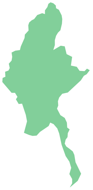
Geo Map - Asia - Myanmar

Burma, officially the Republic of the Union of Myanmar, commonly shortened to Myanmar, is a sovereign state in Southeast Asia bordered by Bangladesh, India, China, Laos and Thailand.
The vector stencils library Myanmar contains contours for ConceptDraw DIAGRAM diagramming and vector drawing software. This library is contained in the Continent Maps solution from Maps area of ConceptDraw Solution Park.

Geo Map — USA — Florida

Florida is a state in the southeastern region of the United States, bordered to the west by the Gulf of Mexico, to the north by Alabama and Georgia, to the east by the Atlantic Ocean, and to the south by the Straits of Florida.
The vector stencils library Florida contains contours for ConceptDraw DIAGRAM diagramming and vector drawing software. This library is contained in the Continent Maps solution from Maps area of ConceptDraw Solution Park.

Geo Map - Asia - Philippines

The Philippines, officially known as the Republic of the Philippines, is a sovereign island country in Southeast Asia situated in the western Pacific Ocean.
Use the Continent Maps solution and Philippines library to draw thematic maps, geospatial infographics and vector illustrations. This solution to help visualize the business and thematic information connected with geographic areas, locations or customs; for your business documents, presentations and websites.

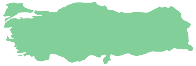
Geo Map - Asia - Turkey

Turkey, officially the Republic of Turkey, is a contiguous transcontinental country, located mostly on Anatolia in Western Asia, and on East Thrace in Southeastern Europe.
The vector stencils library Turkey contains contours for ConceptDraw DIAGRAM diagramming and vector drawing software. This library is contained in the Continent Maps solution from Maps area of ConceptDraw Solution Park.

Geo Map — United States of America Map

United States is a federal republic consisting of 50 states and a federal district.
ConceptDraw is idea to draw the geological map of the United States of America from the pre-designed vector geo map shapes.
Each map is scaled, with the option to add further levels of detail - county borders, their names, capitals and major cities can be shown or hidden using the action menu for each state map. ConceptDraw DIAGRAM gives you full control over map size, shading, color fills and alignment.
Use the Continent Maps solution for easy drawing professional looking geological maps, thematic maps, geospatial infographics and vector illustrations for your business documents, presentations and websites.

Geo Map of Americas

The Americas are the combined continental landmasses of North America and South America, in the Western Hemisphere. There are 35 sovereign states in the Americas.
ConceptDraw is idea to draw the geological maps of America from the pre-designed vector geo map shapes and vector images map of america.
Use Continent Maps solution from the Maps area of ConceptDraw Solution Park to draw thematic maps, geospatial infographics and vector illustrations for your business documents, presentations and websites.

Geo Map — USA — Montana

Montana is a state in the Western United States.
The vector stencils library Montana contains contours for ConceptDraw DIAGRAM diagramming and vector drawing software. This library is contained in the Continent Maps solution from Maps area of ConceptDraw Solution Park.