This site uses cookies. By continuing to browse the ConceptDraw site you are agreeing to our Use of Site Cookies.
HelpDesk

How to Draw a Map of North America

Geographic maps, cardiograms, and thematic maps are often used for geographical visualization of business information. Any country can inspire a wealth of geopolitical statistical data. A common way of assimilating this data is to create maps that convey a particular theme or subject matter in relation to a specific geographical area. Known as thematic maps, they cover themes such as population density, average rainfall, or political allegiance, differentiating the data by using graphical elements and annotation. Thematic maps contrast general reference maps, which tend to display information on a variety of subjects — vegetation, topology, roads, and highways, for example. A thematic map will always focus on one particular subject matter. ConceptDraw DIAGRAM can be helpful as a tool for creating maps of countries and regions of the world. It allows you to draw continental maps quickly and easily using the special templates and vector stencils libraries.

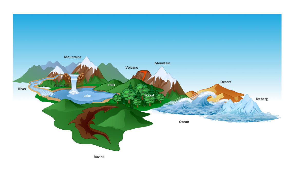
Beautiful Nature Scene: Drawing

The Nature Solution addition to ConceptDraw Solution Park for ConceptDraw DIAGRAM includes new libraries that provide a wide range nature objects and it can be used to augment documentation and graphics. Draw beautiful nature scenes using ConceptDraw DIAGRAM software with Nature solution.

Map Software

Create maps, flags, and more with ConceptDraw

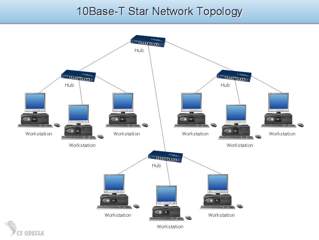
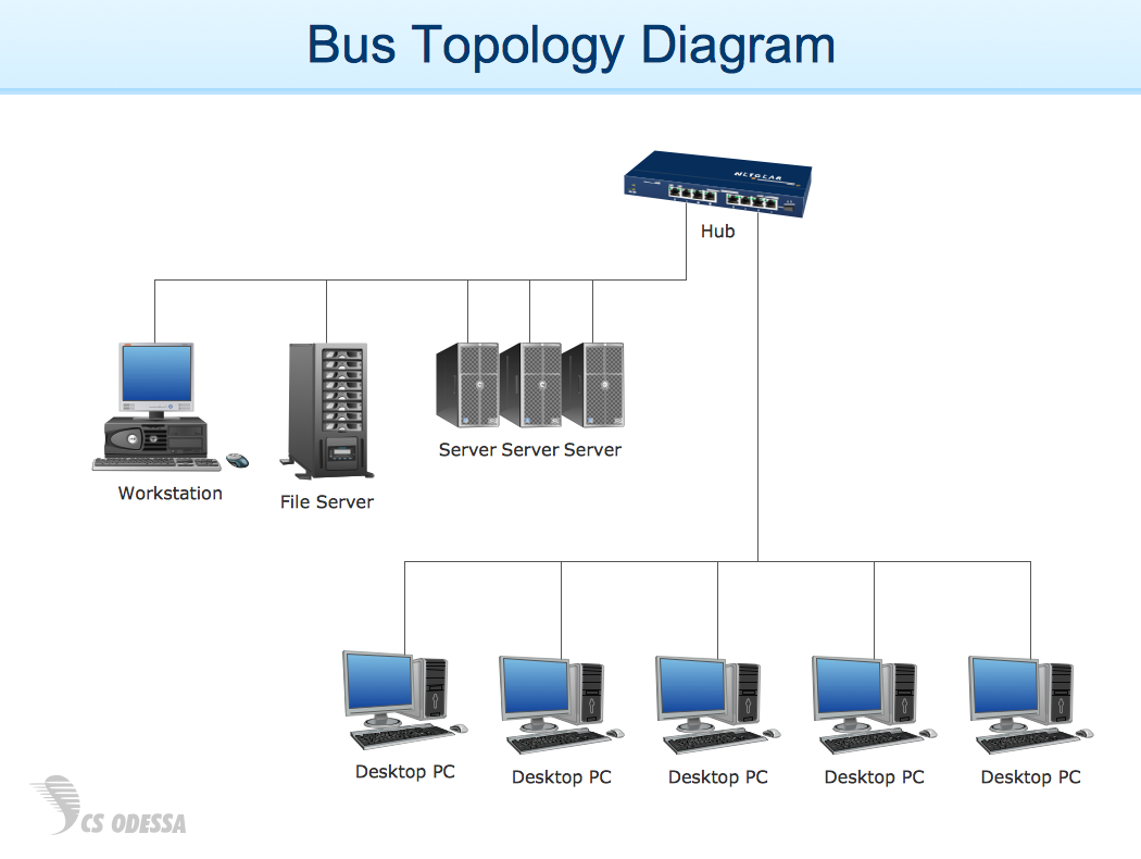
Network Diagram Software Topology Network

Draw Network Topology and Computer Network Diagrams, Designs, Schematics, and Network Maps using ConceptDraw in no Time!

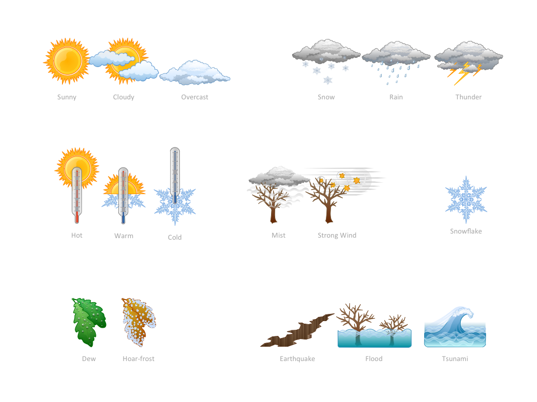
How can you illustrate the weather condition

Use it to make professional looking documents, presentations, and websites illustrated with color scalable vector clipart for geography, weather, and animals.

Network Diagram Examples

ConceptDraw DIAGRAM diagramming software includes huge collection of network diagrams examples, computer and network templates, design objects and stencils.

Types of Map - Overview

ConceptDraw defines some map types, divided into three categories. Every map type has specific shapes and examples.

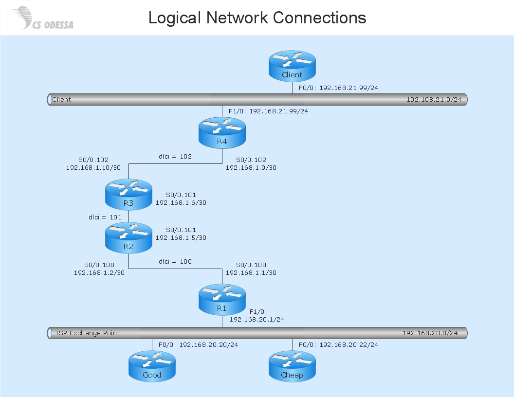
Network Diagram Software Logical Network Diagram

Perfect Network Diagramming Software with examples of LAN Diagrams. ConceptDraw Network Diagram is ideal for network engineers and network designers who need to draw Logical Network diagrams.
HelpDesk

How to Create a Map Depicting the United Kingdom Counties and Regions

The UK Map Solution for ConceptDraw DIAGRAM includes all of the UK counties with county outlined borders, from the largest, North Yorkshire, to the smallest Rutlandshire. Geographical thematic maps are used to visualize information on a number of subjects related with certain geographical location. It is a common way of representing any form of spatial data in relation to a specific geographical area. The UK Map Solution for ConceptDraw DIAGRAM includes all of the United Kingdom counties with county outlined borders and major cities. You can quickly create geographic maps, cartograms, and thematic maps for geographical visualization information for business and travels.

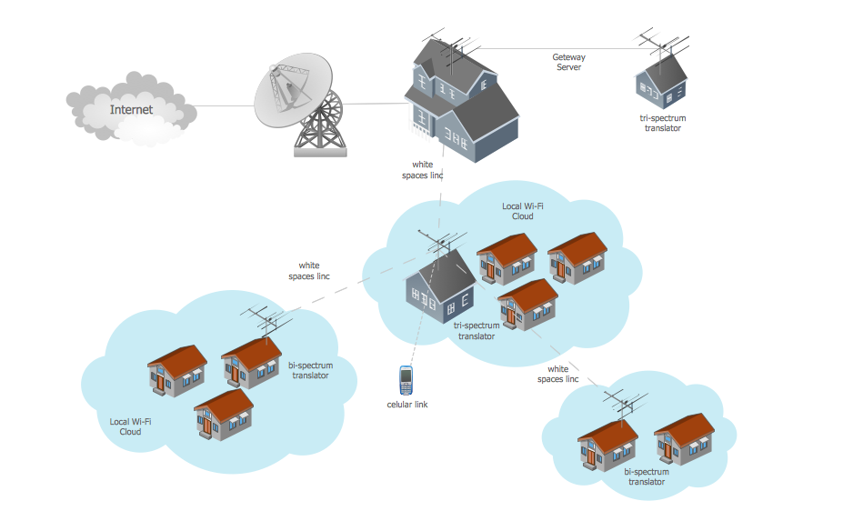
Wide area network (WAN) topology. Computer and Network Examples

A Wide area network (WAN) is a telecommunication network that is used for connecting computers and covers a wide geographical area. WANs often contain a few smaller networks (LANs, MANs, etc.). The packet switching and circuit switching technologies are effectively used in WANs.
This example was created in ConceptDraw DIAGRAM using the Computer and Networks Area of ConceptDraw Solution Park and shows the Wide area network topology.