The vector stencils library Map symbols contains 19 icons for labeling the maps using the ConceptDraw PRO diagramming and vector drawing software.
The vector stencils library Subway map contains 41 shapes for creating the subway (tube, metro) maps using the ConceptDraw PRO.
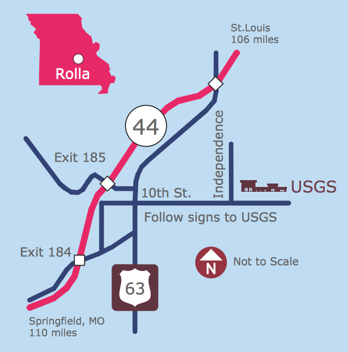
"The various features shown on a map are represented by conventional signs or symbols. For example, colors can be used to indicate a classification of roads. Those signs are usually explained in the margin of the map, or on a separately published characteristic sheet.
Some cartographers prefer to make the map cover practically the entire screen or sheet of paper, leaving no room "outside" the map for information about the map as a whole. These cartographers typically place such information in an otherwise "blank" region "inside" the map -- cartouche, map legend, title, compass rose, bar scale, etc. In particular, some maps contain smaller "sub-maps" in otherwise blank regions—often one at a much smaller scale showing the whole globe and where the whole map fits on that globe, and a few showing "regions of interest" at a larger scale in order to show details that wouldn't otherwise fit." [Map. Wikipedia]
The example "Design elements - Subway map, Map symbols" is included in the Directional Maps solution from the Maps area of ConceptDraw Solution Park.
The vector stencils library Subway map contains 41 shapes for creating the subway (tube, metro) maps using the ConceptDraw PRO.
"The various features shown on a map are represented by conventional signs or symbols. For example, colors can be used to indicate a classification of roads. Those signs are usually explained in the margin of the map, or on a separately published characteristic sheet.
Some cartographers prefer to make the map cover practically the entire screen or sheet of paper, leaving no room "outside" the map for information about the map as a whole. These cartographers typically place such information in an otherwise "blank" region "inside" the map -- cartouche, map legend, title, compass rose, bar scale, etc. In particular, some maps contain smaller "sub-maps" in otherwise blank regions—often one at a much smaller scale showing the whole globe and where the whole map fits on that globe, and a few showing "regions of interest" at a larger scale in order to show details that wouldn't otherwise fit." [Map. Wikipedia]
The example "Design elements - Subway map, Map symbols" is included in the Directional Maps solution from the Maps area of ConceptDraw Solution Park.
Map symbols

Electrical Symbols, Electrical Diagram Symbols

Map of Germany

Fire Exit Plan. Building Plan Examples

ConceptDraw Arrows10 Technology

Maps and Directions
Geo Map - Asia - Singapore

Spatial infographics Design Elements: Location Map

3 Ways to Quickly Create Excellent Presentations
Directions Maps

- Conventional Symbol Of Drawing
- Details Of Conventional Signs And Symbols In Technical Drawing
- How to draw Metro Map style infographics? (New York) | Landmarks ...
- Draw 5o Conventional Sign And Symbol Use On Map
- Conventional Sign To Indicate Railway Lines
- Conventional Signs In Building Planning And Drawing
- Draw Conventional Symbol For Metro
- The Diagrams Of Conventional Signs Or Symbols
- Basic Flowchart Symbols and Meaning | How to draw Metro Map ...
- Landscape Conventional Signs And Symbols For Architecture