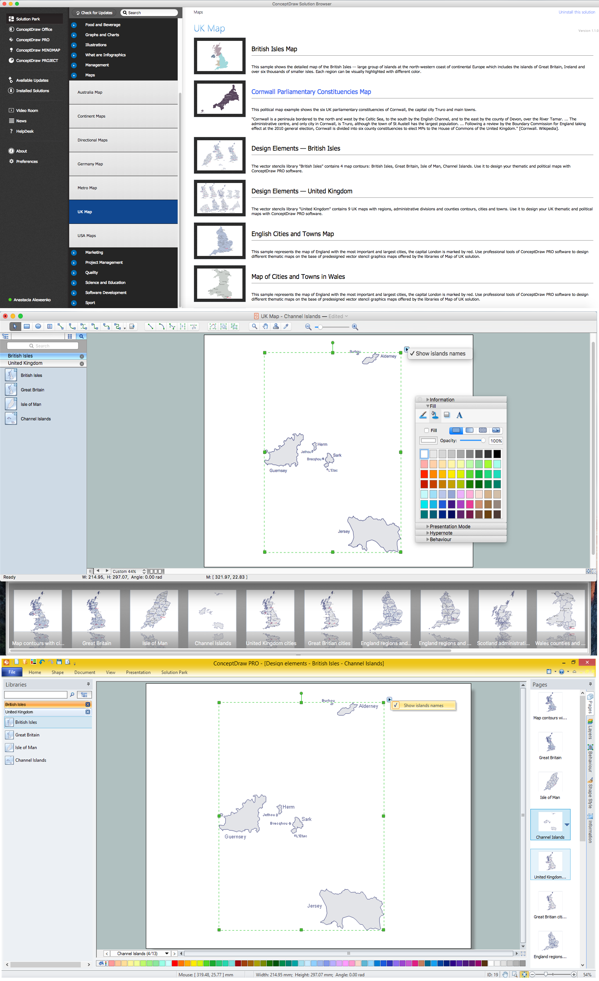
Map of UK — Channel Islands
 UK Map
The Map of UK solution contains collection of professionally designed samples and scalable vector stencil graphics maps, representing the United Kingdom counties, regions and cities. Use the Map of UK solution from ConceptDraw Solution Park as the base fo
Map of UK

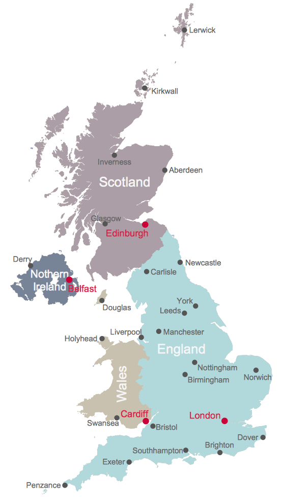
United Kingdom Map
Geo Map Software

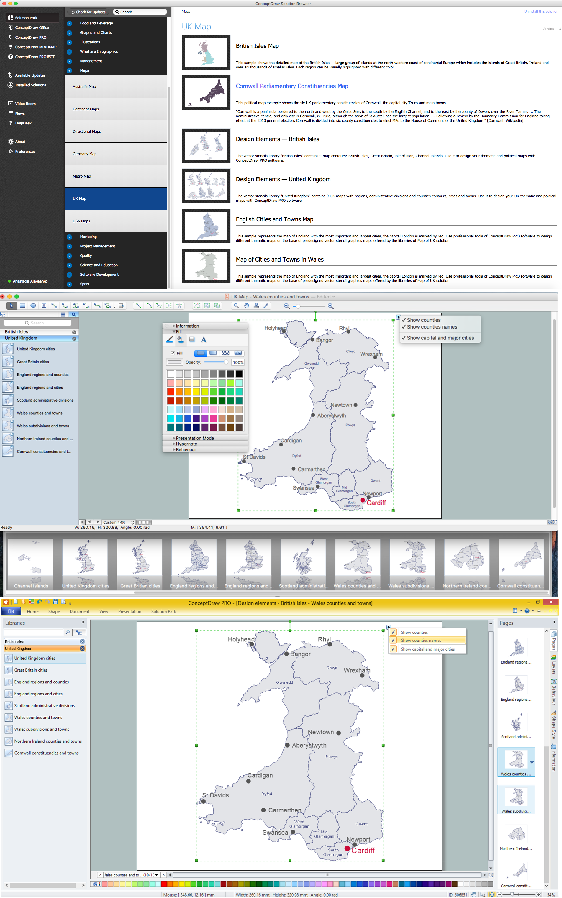
Map of UK — Wales Counties and Towns
World Continents Map

Map of Continents

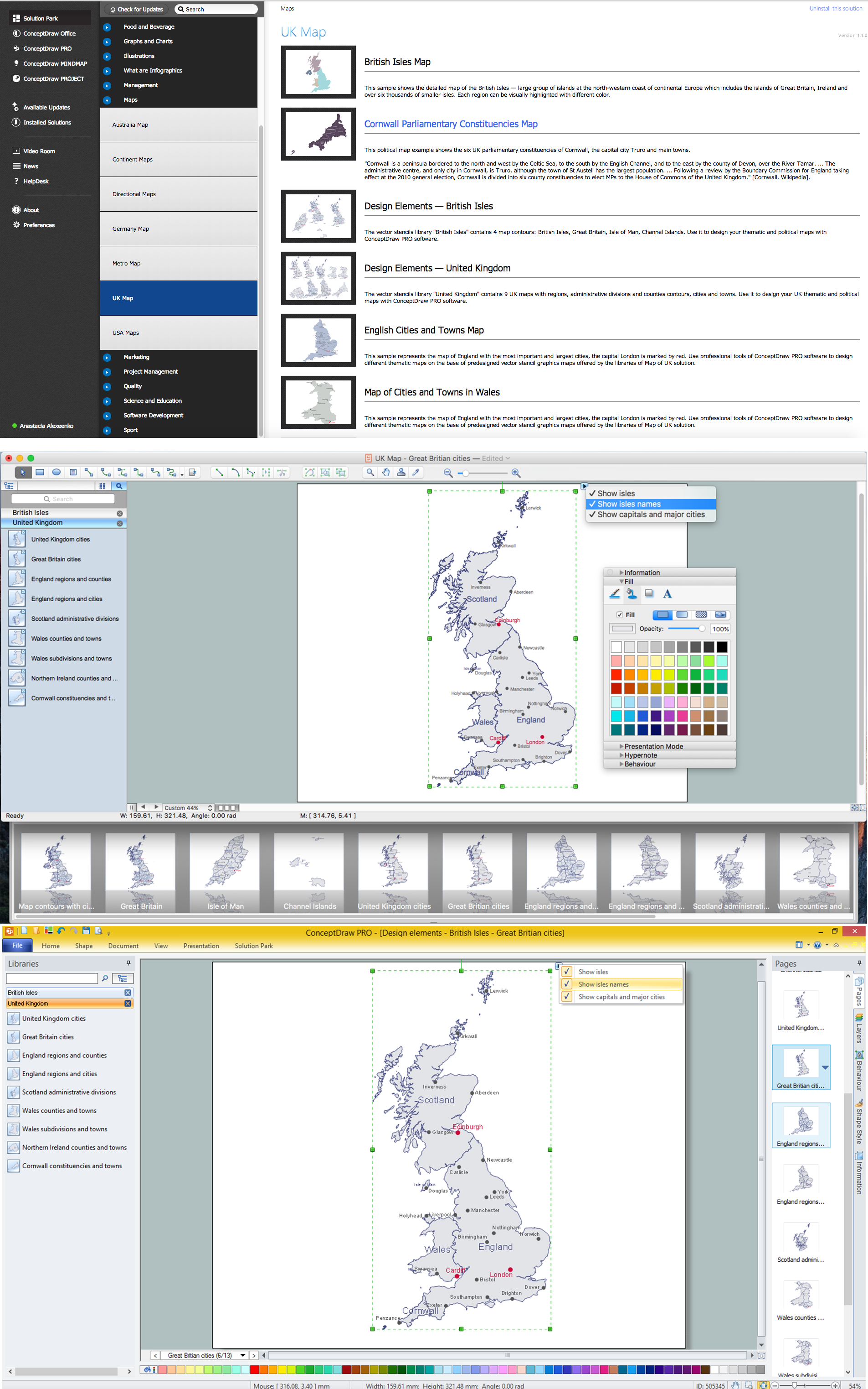
Map of UK — Great Britain Cities
UK Map

- UK Map | Map of UK | Map of UK — Channel Islands | British Isles Map
- Design elements - British Isles | Map of UK | Map of the British Isles ...
- Map Of The British Isles Counties
- Continents and Oceans Map | Map of Continents | World Continents ...
- Vector Map of Germany
- Map of Scotland
- Map of UK — Great Britain
- Map of UK — England Regions and counties | Map of England | UK ...
- Map of UK — Great Britain Cities | Geo Map - Europe - Norway | Geo ...
- Map of Germany | Spatial infographics Design Elements: Location ...