Map of UK — Great Britain Cities
“Great Britain, also known as Britain, is an island in the North Atlantic off the north-west coast of continental Europe. With an area of 209,331 km2 (80,823 sq mi), it is the largest island in Europe and the ninth-largest in the world. In 2011 the island had a population of about 61 million people, making it the third-most populous island in the world, after Java in Indonesia and Honshu in Japan. It accounts for the majority of the British Isles archipelago, along with over 1,000 smaller surrounding islands, including the island of Ireland to its west.
The island is part of the United Kingdom of Great Britain and Northern Ireland, constituting most of its territory: most of England, Scotland, and Wales are on the island, with their respective capital cities, London, Edinburgh, and Cardiff. Politically, the term Great Britain usually extends to include surrounding islands that form part of England, Scotland, and Wales. The island is dominated by an oceanic climate with quite narrow temperature differences between seasons.”
Cities
- Aberdeen
- Birmingham
- Brighton
- Bristol
- Cardiff
- Carlisle
- Douglas
- Dover
- Edinburgh
- Exeter
- Glasgow
- Holyhead
- Inverness
- Kirkwall
- Leeds
- Lerwick
- Liverpool
- London
- Manchester
- Newcastle
- Norwich
- Nottingham
- Penzance
- Southampton
- Swansea
- York
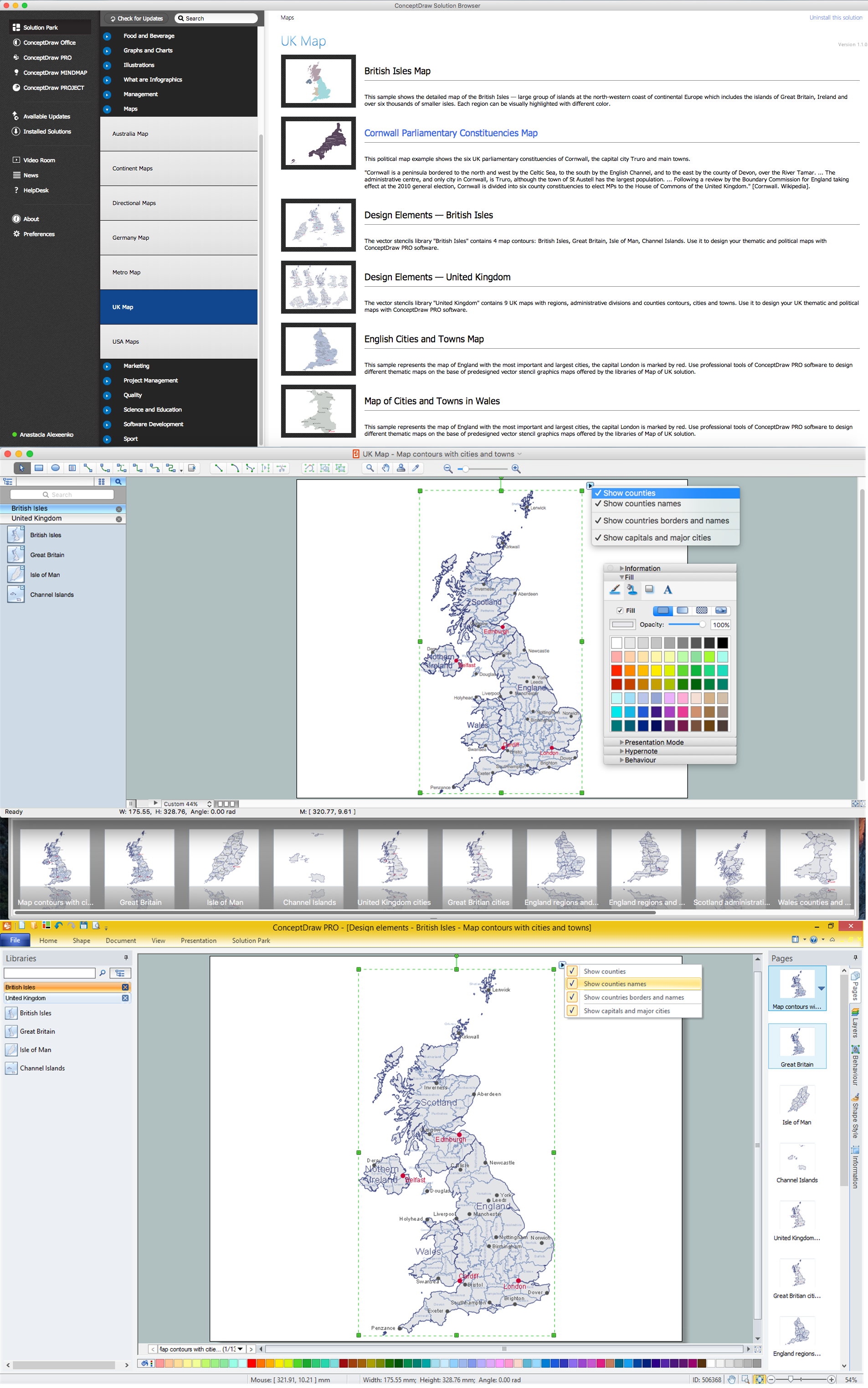
How to design the Map of UK fast and easy? It is incredibly convenient to use special software. ConceptDraw DIAGRAM diagramming and vector drawing software offers the Map of UK Solution from the Maps Area of ConceptDraw Solution Park specially developed to make easier drawing the maps of UK counties, various UK related thematic maps and cartograms on their base.
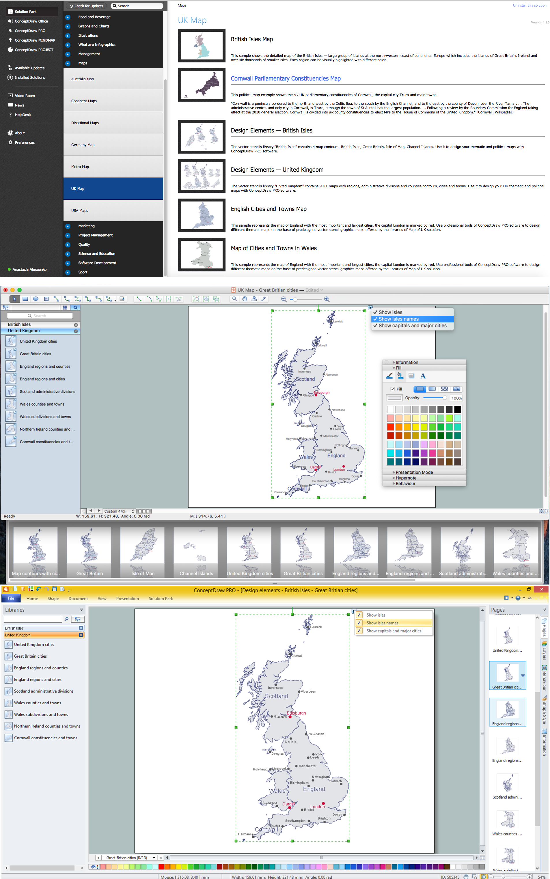
Example 1. UK Map Solution — Great Britain Cities
Map of UK Solution provides wide collection of predesigned maps of UK countries, islands and counties, and 2 libraries with 12 ready-to-use vector maps objects which lie at the base of included samples.

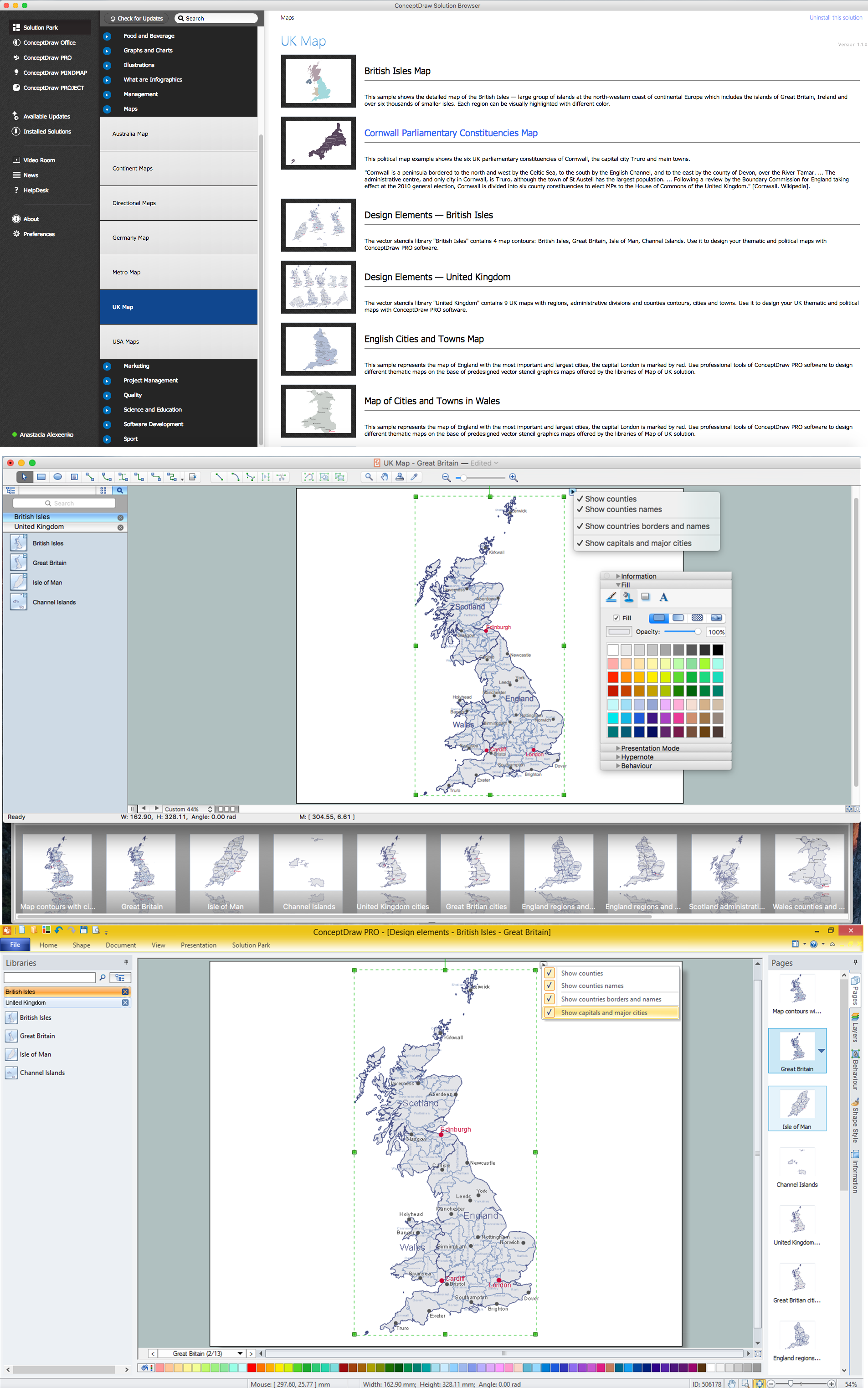
Example 2. British Isles Library Design Elements

Example 3. United Kingdom Library Design Elements
Thanks to all these tools, now design of UK Map and thematic maps for the countries included to UK is very simple process. All that you need is follow the next steps:
- create new ConceptDraw document,
- drag the needed objects from the libraries of Map of UK Solution,
- make changes in color style and apply the commands from the object's action menu to make your map colorful and successful.

Example 4. Map of UK — British Isles Counties
The maps, geospatial infographics and especially thematic maps which are the popular visual way of studying different points of interest and geographical data, all they are incredibly useful in various scientific fields. Design them easy in ConceptDraw DIAGRAM
Use the Map of UK solution for ConceptDraw DIAGRAM software to design your own Map of UK quick, easy and effective, and then successfully use it in your life or work activity.
All source documents are vector graphic documents. They are available for reviewing, modifying, or converting to a variety of formats (PDF file, MS PowerPoint, MS Visio, and many other graphic formats) from the ConceptDraw STORE. The Map of UK Solution is available for all ConceptDraw DIAGRAM users.