The vector stencils library "Local vehicular networking" contains 88 icon symbols for drawing local vehicular computer network diagrams.
"A vehicular ad hoc network (VANET) uses cars as mobile nodes in a MANET to create a mobile network. A VANET turns every participating car into a wireless router or node, allowing cars approximately 100 to 300 metres of each other to connect and, in turn, create a network with a wide range. As cars fall out of the signal range and drop out of the network, other cars can join in, connecting vehicles to one another so that a mobile Internet is created. It is estimated that the first systems that will integrate this technology are police and fire vehicles to communicate with each other for safety purposes." [Vehicular ad hoc network. Wikipedia]
The clip art example "Local vehicular networking - Vector stencils library" was created using the ConceptDraw PRO diagramming and vector drawing software extended with the Vehicular Networking solution from the Computer and Networks area of ConceptDraw Solution Park.
www.conceptdraw.com/ solution-park/ vehicular-networking
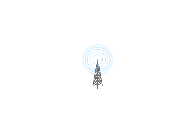
Cell Tower

Radio Tower
Satellite Dish

Antenna
In-vehicle Station
PC
Laptop Computer
IP Phone
Cell Phone
Router
Cloud
Coverage Area
Coverage Area 2
Car red
Car red (back view)
-local-vehicular-networking---vector-stencils-library.png--diagram-flowchart-example.png)
Car green
Car green (back view)
-local-vehicular-networking---vector-stencils-library.png--diagram-flowchart-example.png)
Car blue
Car blue (back view)
-local-vehicular-networking---vector-stencils-library.png--diagram-flowchart-example.png)
Taxi
Taxi (back view)
-local-vehicular-networking---vector-stencils-library.png--diagram-flowchart-example.png)
Truck
Truck (back view)
-local-vehicular-networking---vector-stencils-library.png--diagram-flowchart-example.png)
Airplane
Satellite
Ship
Traffic Light
Crosswalks

Bridge

Figure green

Figure blue

Figure purple

Figure red

Figure yellow

Figure white

Figure grey

House
Bungalow
Block
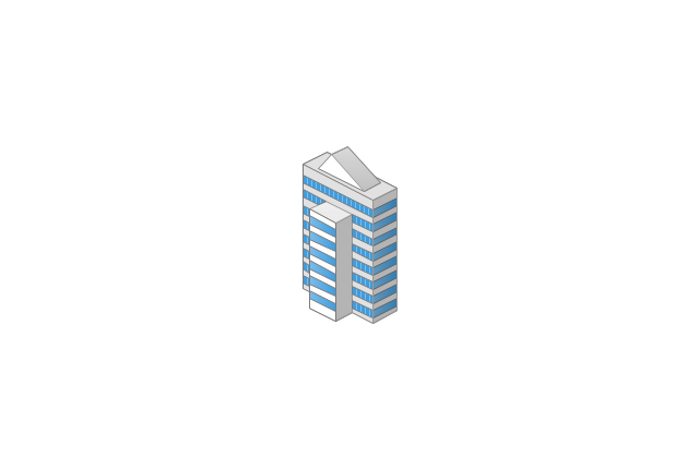
Office Building
High Rise Block
Factory
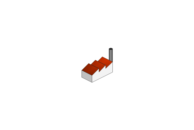
Factory (detailed)
-local-vehicular-networking---vector-stencils-library.png--diagram-flowchart-example.png)
Airport
Mote large

Fir Tree

Tree

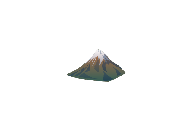
Mountain
Lake

The vector stencils library "Landmarks" contains 34 landmark symbols.
Use it to mark maps for spatial infographics in the ConceptDraw PRO diagramming and vector drawing software extended with the Spatial Infographics solution from the area "What is Infographics" of ConceptDraw Solution Park.
Use it to mark maps for spatial infographics in the ConceptDraw PRO diagramming and vector drawing software extended with the Spatial Infographics solution from the area "What is Infographics" of ConceptDraw Solution Park.
Airport

Skyscraper

City

Building 1

Building 2
House 1

House 2

Factory
Petrol Station
Fire Station

Hospital
Town Hall

Cathedral

Shopping Centre

Convenience Store

Park

Traffic Light
Bus 1

Bus 2

Tram 1
Tram 2

Train

Train/Tram

Car 1
Car 2

Car 3

Bicycle

Ferry/Boat
Airplane

Funicular

Ropeway/Cableway

River

Lake

Stadium
The vector stencils library "Landmarks" contains 69 landmark symbols of buildings, waterways, scale and directional indicators for labeling transportation and directional maps, road and route maps, street and transit maps, locator and tourist maps.
The pictograms example "Landmarks - Vector stencils library" was created using the ConceptDraw PRO diagramming and vector drawing software extended with the Directional Maps solution from the Maps area of ConceptDraw Solution Park.
The pictograms example "Landmarks - Vector stencils library" was created using the ConceptDraw PRO diagramming and vector drawing software extended with the Directional Maps solution from the Maps area of ConceptDraw Solution Park.
Viewpoint

North arrow
North arrow
Building

Building

Town house

Suburban home

Skyscraper

Town hall

Public house

Petrol station

Gas station

Factory

School

Warehouse

Hospital

Fire station

Train station

Condos

Barn

Motel

Convenience store

Shopping centre

City

Church

Cathedral

National tail train station

Train railway

Bus stop

Tramlink

Marina / Ferry dock

Car ferry

Stop light

Airport

Airport

Underground / Subway / Metro

Taxi

Bicycle parking

Parking

Fuel / Gas / Petrol

Police

Hospital

Wheelchair access

First aid

Telephone

Post office

Landmarks and museums

University

Shopping

Refreshments / Public House

Restrooms / Toilets

Park

Zoo

Information center

Stadium 1

Stadium 2

Park

Tree

Fir-tree

Ocean

Lake

River

Angled river

Forked river

Curved river

Curved river

Flexible river

Bridge

Scale

Process Flowchart


The vector stencils library "Landmarks" contains 69 landmark symbols of buildings, waterways, scale and directional indicators for labeling transportation and directional maps, road and route maps, street and transit maps, locator and tourist maps.
The pictograms example "Landmarks - Vector stencils library" was created using the ConceptDraw PRO diagramming and vector drawing software extended with the Directional Maps solution from the Maps area of ConceptDraw Solution Park.
The pictograms example "Landmarks - Vector stencils library" was created using the ConceptDraw PRO diagramming and vector drawing software extended with the Directional Maps solution from the Maps area of ConceptDraw Solution Park.
Viewpoint
North arrow
North arrow
Building
Building
Town house
Suburban home
Skyscraper
Town hall
Public house
Petrol station
Gas station
Factory
School
Warehouse
Hospital
Fire station
Train station
Condos
Barn
Motel
Convenience store
Shopping centre
City
Church
Cathedral
National tail train station
Train railway
Bus stop
Tramlink
Marina / Ferry dock
Car ferry
Stop light
Airport
Airport
Underground / Subway / Metro
Taxi
Bicycle parking
Parking
Fuel / Gas / Petrol
Police
Hospital
Wheelchair access
First aid
Telephone
Post office
Landmarks and museums
University
Shopping
Refreshments / Public House
Restrooms / Toilets
Park
Zoo
Information center
Stadium 1
Stadium 2
Park
Tree
Fir-tree
Ocean
Lake
River
Angled river
Forked river
Curved river
Curved river
Flexible river
Bridge
Scale
 Event-driven Process Chain Diagrams
Event-driven Process Chain (EPC) Diagram is a type of flowchart widely used for modeling in business engineering and reengineering, business process improvement, and analysis. EPC method was developed within the Architecture of Integrated Information Systems (ARIS) framework.
How to Create Cisco Network Diagram

Vehicular Network

Network Engineering

 Building Plans Area
The Building Plans Area collects solutions for drawing the building and site plans.
The vector stencils library "Landmarks" contains 34 signs and pictograms for drawing road and transit maps.
The vector stencils library "Map symbols" contains 10 signs and pictograms for drawing road and transit maps.
"A landmark is a recognizable natural or man-made feature used for navigation, a feature that stands out from its near environment and is often visible from long distances.
In modern use, the term can also be applied to smaller structures or features, that have become local or national symbols." [Landmark. Wikipedia]
The pictograms example "Design elements - Location map" was created using the ConceptDraw PRO diagramming and vector drawing software extended with the Spatial Infographics solution from the Maps area of ConceptDraw Solution Park.
Landmarks and Map symbols

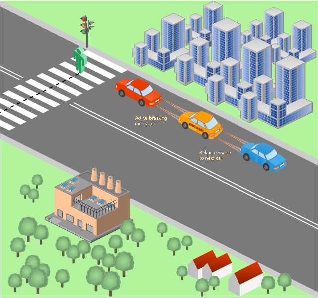
This vehicular network diagram sample was drawn on the base of picture illustrating the post "Intelligent transportation system" from the blog "Technology New Here".
"Intelligent transportation systems are projects that aim to integrate modern communication and information technology into existing transportation management systems in order to optimize vehicle life, fuel efficiency, safety, and traffic in urbanized cities.
The need for intelligent transportation systems stems from the fact that traffic congestion has been increasing all around the world because of increasing population, increasing amount of transportation vehicles and increasing urbanization."
[technologynewhere.wordpress.com/ 2010/ 05/ 12/ intelligent-transportation-system/ ]
The vehicular network diagram example "Intelligent transportation system" was created using the ConceptDraw PRO diagramming and vector drawing software extended with the Vehicular Networking solution from the Computer and Networks area of ConceptDraw Solution Park.
Vehicular network diagram

Used Solutions
This vehicular network diagram sample was drawn on the base of picture illustrating the post "LED Traffic Signals and Vehicle Lights for Optical Broadband Communications" from the blog "Terranautix".
"Visible Light Communication (VLC) is a rapidly emerging field that focuses on the use of light sources (between 400 THz and 800 THz) for the primary purpose of broadband communications. In order to transmit data over light, the light source (transceiver) is pulsed on and off rapidly to create a data stream, similar to fiber optic communications, but in the wireless form, or “Free-Space Optical Transmission“. By pulsing lights many thousands (and millions) of times per second, data transmission occurs at a rate undetectable by the human eye. Optical receivers convert the light pulses to an electronic signal on the receiver end. The Light Emitting Diode (LED) is the primary form factor currently undergoing extensive research."
[terranautix.com/ tag/ communications]
The vehicular network diagram example "Visible light communication" was created using the ConceptDraw PRO diagramming and vector drawing software extended with the Vehicular Networking solution from the Computer and Networks area of ConceptDraw Solution Park.
Vehicular network diagram
Used Solutions
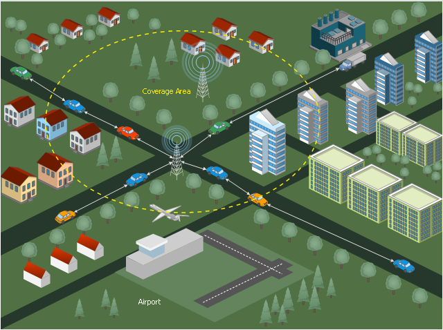
This diagram sample illustrates the cooperative vehicular delay-tolerant network operation.
"Delay-tolerant networking (DTN) is an approach to computer network architecture that seeks to address the technical issues in heterogeneous networks that may lack continuous network connectivity. Examples of such networks are those operating in mobile or extreme terrestrial environments, or planned networks in space.
Recently, the term disruption-tolerant networking has gained currency in the United States due to support from DARPA, which has funded many DTN projects. Disruption may occur because of the limits of wireless radio range, sparsity of mobile nodes, energy resources, attack, and noise." [Delay-tolerant networking. Wikipedia]
"Routing in delay-tolerant networking concerns itself with the ability to transport, or route, data from a source to a destination, which is a fundamental ability all communication networks must have. Delay- and disruption-tolerant networks (DTNs) are characterized by their lack of connectivity, resulting in a lack of instantaneous end-to-end paths. In these challenging environments, popular ad hoc routing protocols such as AODV and DSR fail to establish routes. This is due to these protocols trying to first establish a complete route and then, after the route has been established, forward the actual data. However, when instantaneous end-to-end paths are difficult or impossible to establish, routing protocols must take to a "store and forward" approach, where data is incrementally moved and stored throughout the network in hopes that it will eventually reach its destination. A common technique used to maximize the probability of a message being successfully transferred is to replicate many copies of the message in hopes that one will succeed in reaching its destination." [Routing in delay-tolerant networking. Wikipedia]
The example "Cooperative vehicular delay-tolerant network diagram" was created using the ConceptDraw PRO diagramming and vector drawing software extended with the Vehicular Networking solution from the Computer and Networks area of ConceptDraw Solution Park.
Vehicular network diagram
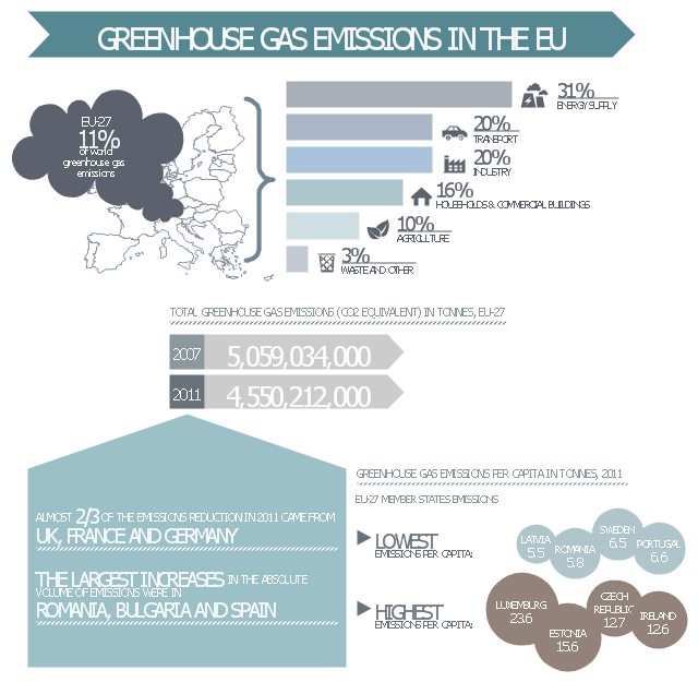
This ecology infographic example was created on the base of the infographics "Greenhouse gas emissions in the EU" from the Debating Europe website. [debatingeurope.eu/ wp-content/ uploads/ 2013/ 06/ TH_ 2_ social.png]
"A greenhouse gas (sometimes abbreviated GHG) is a gas in an atmosphere that absorbs and emits radiation within the thermal infrared range. This process is the fundamental cause of the greenhouse effect. The primary greenhouse gases in the Earth's atmosphere are water vapor, carbon dioxide, methane, nitrous oxide, and ozone. Greenhouse gases greatly affect the temperature of the Earth; without them, Earth's surface would average about 33 °C colder, which is about 59 °F below the present average of 14 °C (57 °F)." [Greenhouse gas. Wikipedia]
The ecology infographic example "EU greenhouse gas emissions" was created using the ConceptDraw PRO diagramming and vector drawing software extended with the Management Infographics solition from the area "Business Infographics" in ConceptDraw Solution Park.
Ecology infographics example
Used Solutions
- Car Factory Chart
- Process Flowchart | Floor Plan Of A Car Assemble Factory
- Benefits and cons of car leasing - Presentation slide | Road transport ...
- Floor Plan Sample Of Car Factory
- Factory Vector Png Hd
- Factory layout floor plan | Buildings and green spaces - Vector ...
- Transport pictograms - Vector stencils library | Landmarks - Vector ...
- Car Ferry
- Factory Vector
- Rail transport - Design elements | Rail transport - Vector stencils ...
- Industrial transport - Design elements | Design elements - Industrial ...
- Local vehicular networking - Vector stencils library | Local vehicular ...
- How To use House Electrical Plan Software | Landmarks - Vector ...
- Road Transport - Design Elements | Road transport - Vector stencils ...
- Maintenance Flow Chart Of A Car
- Buildings and green spaces - Vector stencils library | Design ...
- Car Trafaret
- Class Diagram For Car Manufacturing
- Car Vector Png
- Class Diagram For Car Manufacturing Process