This political map of Canada exhibits its ten provinces and three territories, and their capitals.
"Canada is a country in North America consisting of 10 provinces and 3 territories. Located in the northern part of the continent, it extends from the Atlantic to the Pacific and northward into the Arctic Ocean. At 9.98 million square kilometers in total, Canada is the world's second-largest country by total area, and its common border with the United States is the world's longest land border shared by the same two countries." [Canada. Wikipedia]
This Canada political map was redesigned from Wikipedia file Map Canada political 2.png. [commons.wikimedia.org/ wiki/ File:Map_ Canada_ political_ 2.png]
The example "Canada political map" was created using the ConceptDraw PRO diagramming and vector drawing software extended with the Continent Maps solution from the Maps area of ConceptDraw Solution Park.
Political map - Canada

Geo Map - Canada

Geo Mapping Software Examples - World Map Outline

Geo Map - World

 Continent Maps
Continent Maps solution extends ConceptDraw DIAGRAM software with templates, samples and libraries of vector stencils for drawing the thematic maps of continents, state maps of USA and Australia.
World Continents Map

Geo Map — Europe

Geo Map - Canada - Saskatchewan

Types of Map - Overview

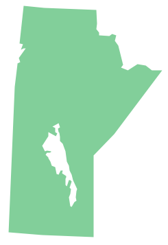
Geo Map - Canada - Manitoba
- South America regions - Political map | Middle East - Political map ...
- Canada political map | Canada - Vector stencils library | Canada ...
- Geo Map - Canada - Yukon
- South America regions - Political map | East Africa - Political map ...
- South America regions - Political map | Canada regions - Political ...
- North Asia - Political map | Political map of Central America | South ...
- Geo Map - USA - Michigan | North America - Vector stencils library ...
- Common joint types | Canada political map | Geo Map - Europe ...
- Map of Germany — Lower Saxony State | Geo Map - Europe ...
- Geo Map - World | Geo Map Software | Types of Map - Overview ...