Map of Germany — Mecklenburg-Vorpommern State
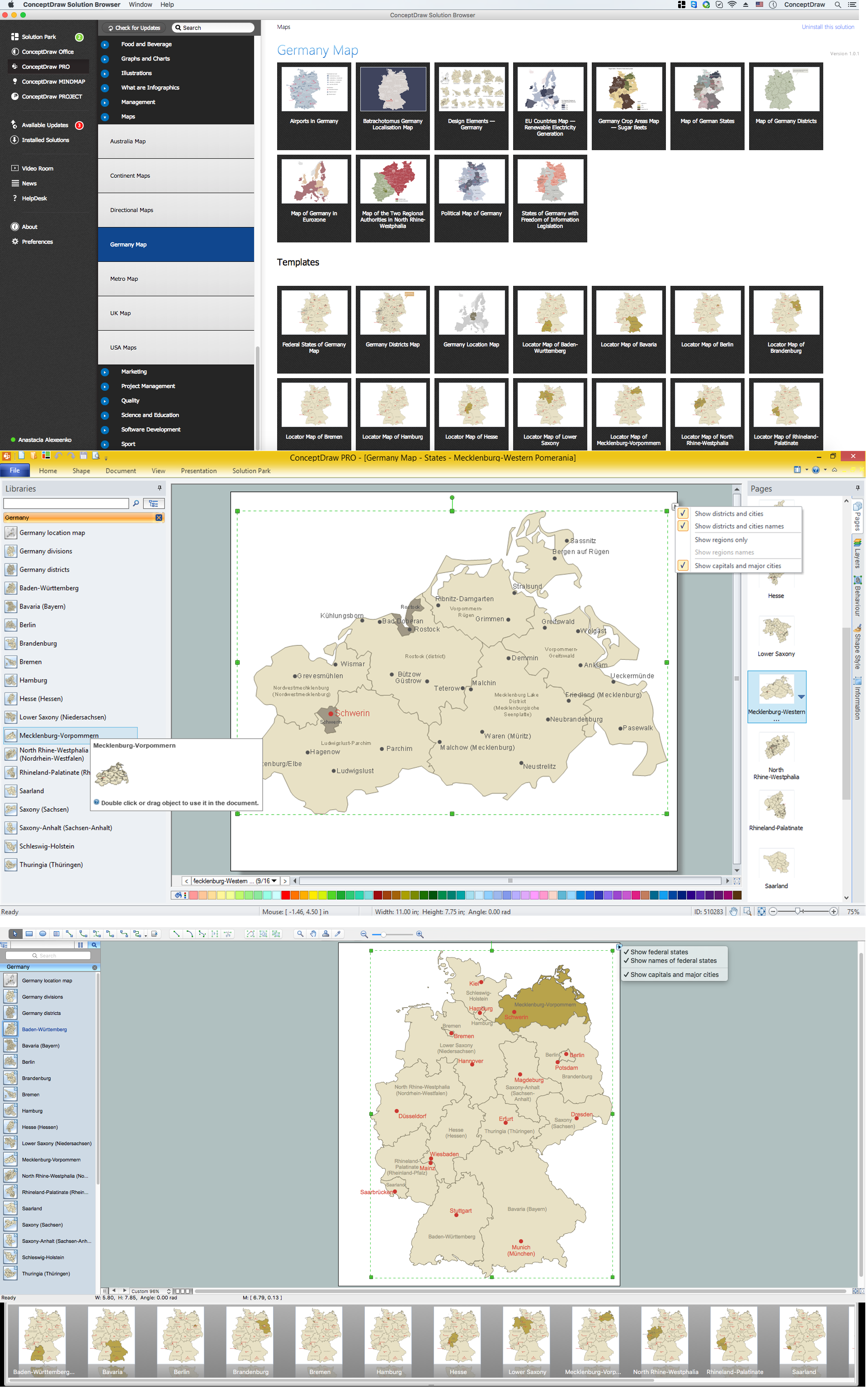
Mecklenburg-Vorpommern is a federated state in northern Germany. The capital city is Schwerin. Despite the fact that the maps surround us everywhere in our life, usually the process of their drawing is sufficienly complex and labor-intensive. But now, thanks to the ConceptDraw DIAGRAM diagramming and vector drawing software extended with Germany Map Solution from the Maps Area of ConceptDraw Solution Park, we have the possibility to make easier this process. Design fast and easy your own pictorial maps of Germany, map of Germany with cities, and thematic Germany maps in ConceptDraw DIAGRAM !This template shows Mecklenburg-Vorpommern location on the Germany federal states map with major cities.
Use it to design Germany political and thematic maps with ConceptDraw PRO software.
You can show or hide federal state borders and names, or capitals and major cities by map selecting and Action menu commands.
The template "Locator map of Mecklenburg-Vorpommern" is included in the Map of Germany solution from the Maps area of ConceptDraw Solution Park.
 Germany Map
The Germany Map solution contains collection of samples, templates and scalable vector stencil graphic maps, representing map of Germany and all 16 states of Germany. Use the Germany Map solution from ConceptDraw Solution Park as the base for various them
Maps of Germany With Cities
Despite the fact that the maps surround us everywhere in our life, usually the process of their drawing is sufficienly complex and labor-intensive. But now, thanks to the ConceptDraw DIAGRAM diagramming and vector drawing software extended with Germany Map Solution from the Maps Area of ConceptDraw Solution Park, we have the possibility to make easier this process. Design fast and easy your own pictorial maps of Germany, map of Germany with cities, and thematic Germany maps in ConceptDraw DIAGRAM !HelpDesk
How to Create a Map of Germany
Geographical thematic maps are used to display information on a variety of subjects. It is a common way of representing any form of spatial data in relation to a specific geographical area. The Germany Map Solution for ConceptDraw DIAGRAM includes all of the German federal states with county outlined borders and major cities. You can quickly create geographic maps, cartograms, and thematic maps for geographical visualization information for business and travels.Map of Germany — Saarland State
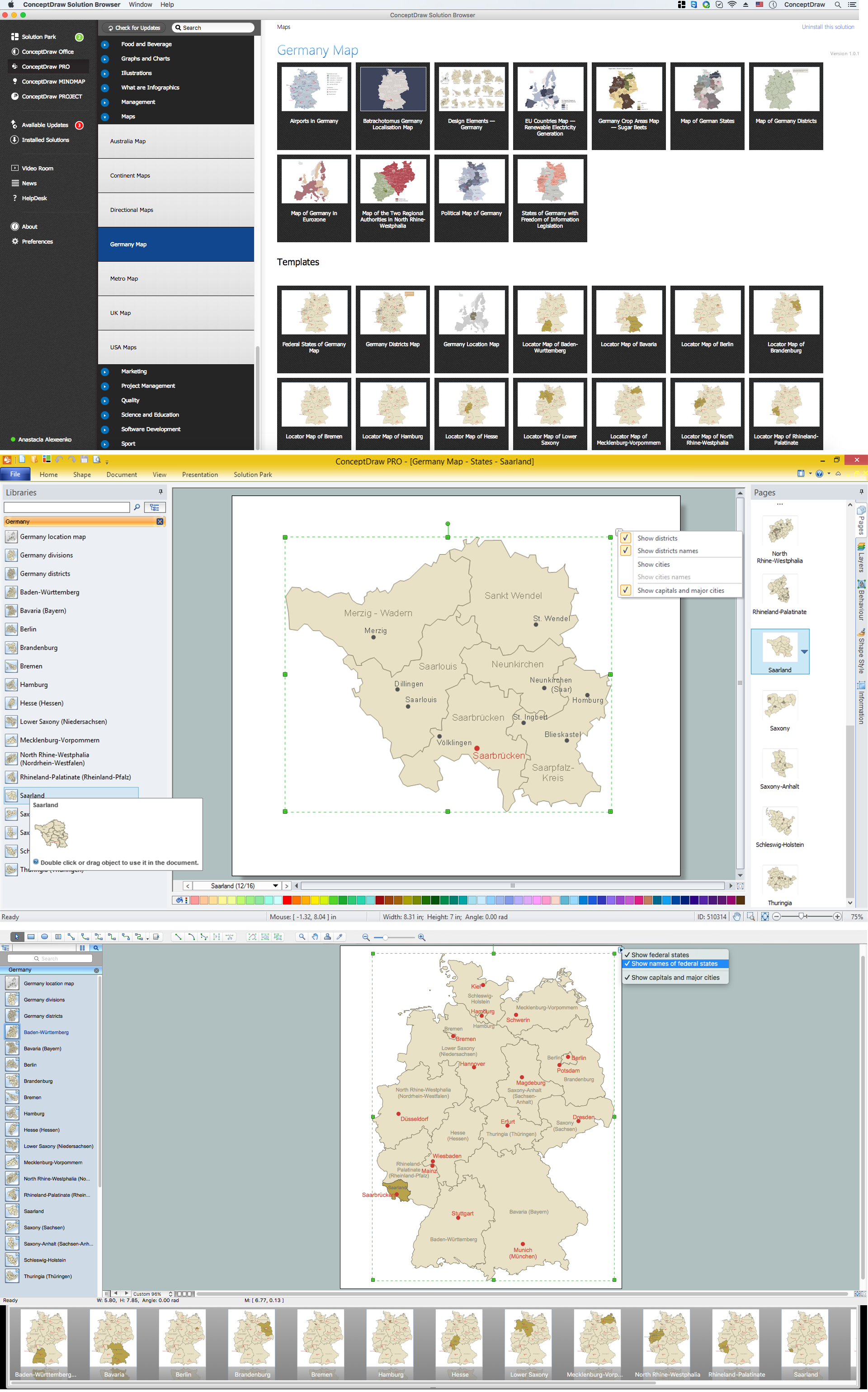
The Saarland is one of the sixteen federal states (or Bundesländer) of Germany. The capital city is Saarbrücken. Despite the fact that the maps surround us everywhere in our life, usually the process of their drawing is sufficienly complex and labor-intensive. But now, thanks to the ConceptDraw DIAGRAM diagramming and vector drawing software extended with Germany Map Solution from the Maps Area of ConceptDraw Solution Park, we have the possibility to make easier this process. Design fast and easy your own pictorial maps of Germany, map of Germany with cities, and thematic Germany maps in ConceptDraw DIAGRAM !Map of Germany — Berlin
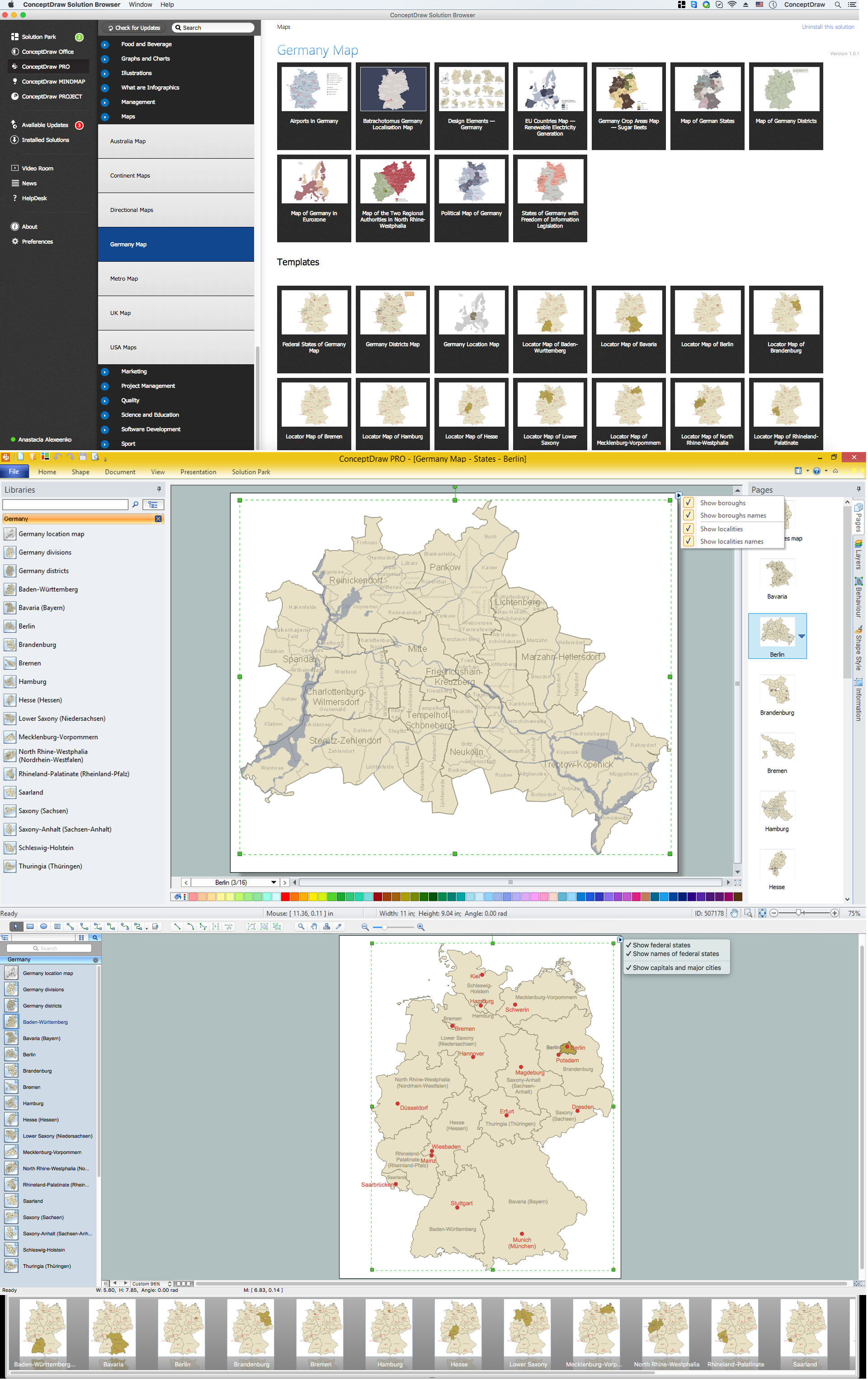
Berlin is the capital of Germany and one of the 16 states of Germany. With a population of 3.5 million people, it is the second most populous city proper and the seventh most populous urban area in the European Union. Despite the fact that the maps surround us everywhere in our life, usually the process of their drawing is sufficienly complex and labor-intensive. But now, thanks to the ConceptDraw DIAGRAM diagramming and vector drawing software extended with Germany Map Solution from the Maps Area of ConceptDraw Solution Park, we have the possibility to make easier this process. Design fast and easy your own pictorial maps of Germany, map of Germany with cities, and thematic Germany maps in ConceptDraw DIAGRAM !This template shows North Rhine-Westphalia location on the Germany federal states map with major cities.
Use it to design Germany political and thematic maps with ConceptDraw PRO software.
You can show or hide federal state borders and names, or capitals and major cities by map selecting and Action menu commands.
The template "Locator map of North Rhine-Westphalia" is included in the Map of Germany solution from the Maps area of ConceptDraw Solution Park.
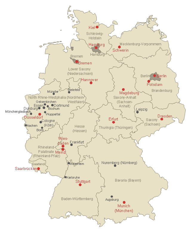
Use this German states map template to design Germany political or thematic maps with ConceptDraw PRO software.
You can show or hide federal state borders or names, or main cities by the map selecting and Action menu commands.
The template "Federal States of Germany map" is included in the Map of Germany solution from the Maps area of ConceptDraw Solution Park.
You can show or hide federal state borders or names, or main cities by the map selecting and Action menu commands.
The template "Federal States of Germany map" is included in the Map of Germany solution from the Maps area of ConceptDraw Solution Park.
- Locator map of Mecklenburg - Vorpommern - Template
- Create Flow Chart on Mac | Map of Germany — Mecklenburg ...
- Map of Germany — Lower Saxony State | Germany crop areas map ...
- Vector Map of Germany | Geo Map - Europe | Geo Map - South ...
- Maps of Germany | How to Create a Map of Germany Using ...
- Federal States of Germany map - Template
- Map of Germany — Saarland State | Germany Map | Map of ...
- Map of Germany — Schleswig-Holstein State | Germany Map | Map ...
- Federal States of Germany map - Template | UML state machine ...
