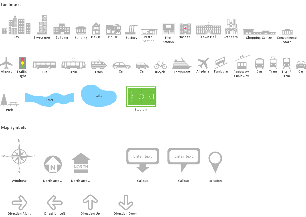
Spatial infographics Design Elements: Location Map

Map Infographic Tool

Map Infographic Design
Brilliant Examples of Infographics Map, Transport, Road

 Network Layout Floor Plans
Network Layout Floor Plans solution extends ConceptDraw DIAGRAM software functionality with powerful tools for quick and efficient documentation the network equipment and displaying its location on the professionally designed Network Layout Floor Plans. Never before creation of Network Layout Floor Plans, Network Communication Plans, Network Topologies Plans and Network Topology Maps was not so easy, convenient and fast as with predesigned templates, samples, examples and comprehensive set of vector design elements included to the Network Layout Floor Plans solution. All listed types of plans will be a good support for the future correct cabling and installation of network equipment.
Spatial infographics Design Elements: Transport Map

Vector Map of Germany

How tо Represent Information Graphically

Spatial infographics Design Elements: Continental Map

HelpDesk
How to Create a Directional Map

- Spatial infographics Design Elements: Location Map | Network ...
- Spatial infographics Design Elements: Location Map | Superb ...
- Directional Maps | Floor Plans | Network Diagram Examples | Free ...
- Spatial infographics Design Elements: Location Map | Network ...
- How to Create a Directional Map Using ConceptDraw PRO ...
- Spatial infographics Design Elements: Location Map | Design ...
- Conference centre location map | Directional Maps | 2D Directional ...
- Spatial infographics Design Elements: Location Map | Brilliant ...
- How To Create A 2d Location Map
- Example Of Vicinity Map Of The House Wityh Landmark