This site uses cookies. By continuing to browse the ConceptDraw site you are agreeing to our Use of Site Cookies.

Map of USA

It is impossible to imagine modern life and science without maps, they surround us anywhere, they are used in geography, history, politics, economics, and many other fields of science. ConceptDraw DIAGRAM diagramming and vector drawing software offers the USA Maps Solution from the Maps Area of ConceptDraw Solution Park with its collection of samples and libraries for easy drawing the Map of USA.

Map of USA States

How to design USA map fast and easy? It is convenient to use special software. ConceptDraw DIAGRAM diagramming and vector drawing software includes the USA Maps Solution which was specially developed to make easier drawing process of USA Maps, Map of USA States, various USA thematic maps and cartograms.

usa map, map of usa, map of usa states, usa map states, usa maps, us map with cities, usa states map, us interstate map, usa map with capitals, printable us map USA Maps

usa map, map of usa, map of usa states, usa map states, usa maps, us map with cities, usa states map, us interstate map, usa map with capitals, printable us map
Use the USA Maps solution to create a map of USA, a US interstate map, printable US maps, US maps with cities and US maps with capitals. Create a complete USA states map.
HelpDesk

How to Draw a Map of USA States

You can find a huge set of geopolitical statistical data regarding America. A common way of visualizing this data is to create maps that connect a particular data in relation to a specific geographical area. Thematic maps are used to depict such data as population density, average rainfall, or political allegiance, representing the data by using visual elements and annotation. Thematic maps always focus on one particular subject matter unlike general reference maps, which display information on different subjects — vegetation, topology, roads, and highways, etc. The United States Mapping Solution for ConceptDraw DIAGRAM includes all of the US States with county outlined borders, from the largest, San Bernardino in California, to the smallest Kalawao County, Hawaii.

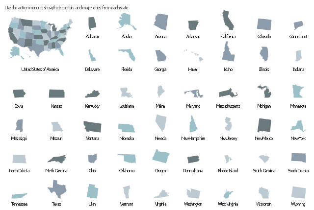
Geo Map — United States of America Map

United States of America (USA) is a federal republic that includes 50 states and a federal district. It is the third largest country by population, fourth by the total area, and one of the most diverse in respect of nationalities and cultures. ConceptDraw DIAGRAM software extended with Continent Maps solution is ideal to draw professional looking Geological map of United States of America, USA map with states, the separate maps of different states of America, thematic maps, geospatial infographics, and varied vector illustrations for your business documents, presentations and websites. Use the pre-designed vector geo map shapes offered by numerous libraries, in particular by the United States of America library that contains 53 United States of America map contours. Each map is scaled, with the option to add the further levels of detail, thus the county borders, their names, capitals, and major cities can be instantly shown or hidden using the Action menu for each state map. ConceptDraw DIAGRAM software gives you a full control over the map size, shading, color fills and alignment.
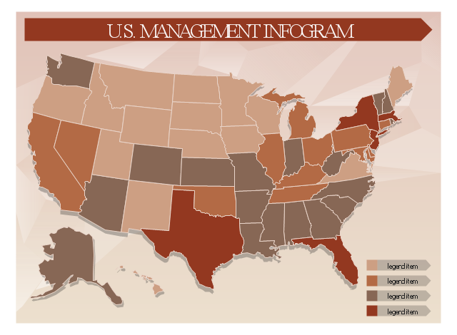
This sample displays United States and 50 states map contours. Use it to design your management infographics.
The infogram shapes example "Design elements - Management map US" was created using the ConceptDraw PRO diagramming and vector drawing software extended with the Management Infographics solition from the area "Business Infographics" in ConceptDraw Solution Park.
USA map contours
USA map contours, Wyoming, Wisconsin, West Virginia, Washington, Virginia, Vermont, Utah, United States, America, USA, Texas, Tennessee, South Dakota, South Carolina, Rhode Island, Pennsylvania, Oregon, Oklahoma, Ohio, North Dakota, North Carolina, New York, New Mexico, New Jersey, New Hampshire, Nevada, Nebraska, Montana, Missouri, Mississippi, Minnesota, Michigan, Massachusetts, Maryland, Maine, Louisiana, Kentucky, Kansas, Iowa, Indiana, Illinois, Idaho, Hawaii, Georgia, Florida, Delaware, Connecticut, Colorado, California, Arkansas, Arizona, Alaska, Alabama,
This United States thematic map template includes 50 states map contours.
Use it to design your management infograms using the ConceptDraw PRO diagramming and vector drawing software.
The template "U.S. management infogram" is included in the Management infographics solution from the Business infographics area of ConceptDraw Solution Park.
U.S. management infographics template
U.S. management infographics template, ribbon arrow callout, management infographics background, arrow text block, Wyoming, Wisconsin, West Virginia, Washington, Virginia, Vermont, Utah, United States, America, USA, Texas, Tennessee, South Dakota, South Carolina, Rhode Island, Pennsylvania, Oregon, Oklahoma, Ohio, North Dakota, North Carolina, New York, New Mexico, New Jersey, New Hampshire, Nevada, Nebraska, Montana, Missouri, Mississippi, Minnesota, Michigan, Massachusetts, Maryland, Maine, Louisiana, Kentucky, Kansas, Iowa, Indiana, Illinois, Idaho, Hawaii, Georgia, Florida, Delaware, Connecticut, Colorado, California, Arkansas, Arizona, Alaska, Alabama,

continent map, maps of continents,map of continents, continents map, 7 continents map, continents and oceans map, world continents map Continent Maps

continent map, maps of continents,map of continents, continents map, 7 continents map, continents and oceans map, world continents map
Continent Maps solution extends ConceptDraw DIAGRAM software with templates, samples and libraries of vector stencils for drawing the thematic maps of continents, state maps of USA and Australia.

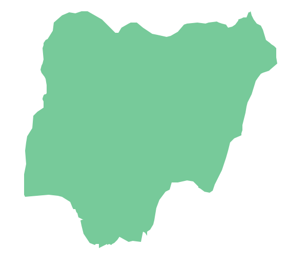
Geo Map - Africa - Nigeria

Nigeria, officially the Federal Republic of Nigeria, is a federal constitutional republic comprising 36 states and its Federal Capital Territory, Abuja. The vector stencils library Nigeria contains contours for ConceptDraw DIAGRAM diagramming and vector drawing software. This library is contained in the Continent Maps solution from Maps area of ConceptDraw Solution Park.

USA Map

Usually designing of maps, including the USA Map is a quite complex, long and labour-intensive process. But now we have an excellent possibility to make it easier with ConceptDraw DIAGRAM diagramming and vector drawing software extended with powerful USA Maps Solution from the Maps Area of ConceptDraw Solution Park.