Use this template for creating the directional maps, location plans, site schemes, transit schemes, road maps, route maps.
"A road map or route map is a map that primarily displays roads and transport links rather than natural geographical information. It is a type of navigational map that commonly includes political boundaries and labels, making it also a type of political map. In addition to roads and boundaries, road maps often include points of interest, such as prominent businesses or buildings, tourism sites, parks and recreational facilities, hotels and restaurants, as well as airports and train stations. A road map may also document non-automotive transit routes, although often these are found only on transit maps." [Road map. Wikipedia]
This template for the ConceptDraw PRO diagramming and vector drawing software is included in the Directional Maps solution from the Maps area of ConceptDraw Solution Park.
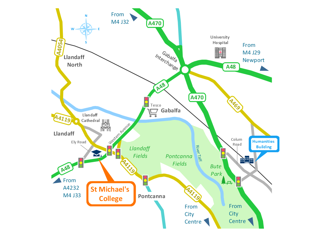
Directional map template

Map Directions
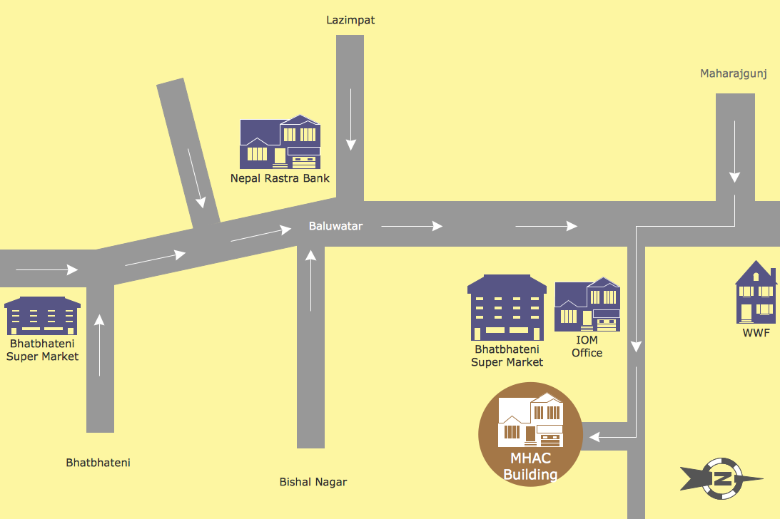
Maps and Directions
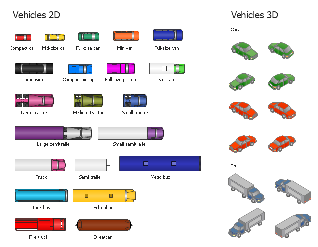
The vector stencils library "Vehicles (2D)" contains 21 icons. The library "Vehicles (3D)" contains 12 icons.
Use these icons for creating the pictorial road and rout maps, directional and locator maps, transit and street maps, road traffic and automotive transport moving diagrams using the ConceptDraw PRO diagramming and vector drawing software.
The example "Design elements - Vehicles 2D, 3D" is included in the Directional Maps solution from the Maps area of ConceptDraw Solution Park.
Vehicle symbols
Directions Map
Directions Maps

 Directional Maps
Directional Maps solution extends ConceptDraw DIAGRAM software with templates, samples and libraries of vector stencils for drawing the directional, location, site, transit, road and route maps, plans and schemes.
Brilliant Examples of Infographics Map, Transport, Road
Spatial infographics Design Elements: Continental Map

"Road maps come in many shapes, sizes and scales. Small, single-page maps may be used to give an overview of a region's major routes and features. ...
Highway maps generally give an overview of major routes within a medium to large region ranging from a few dozen to a few thousand miles or kilometers.
Street maps usually cover an area of a few miles or kilometers (at most) within a single city or extended metropolitan area. City maps are generally a specialized form of street map." [Road map. Wikipedia]
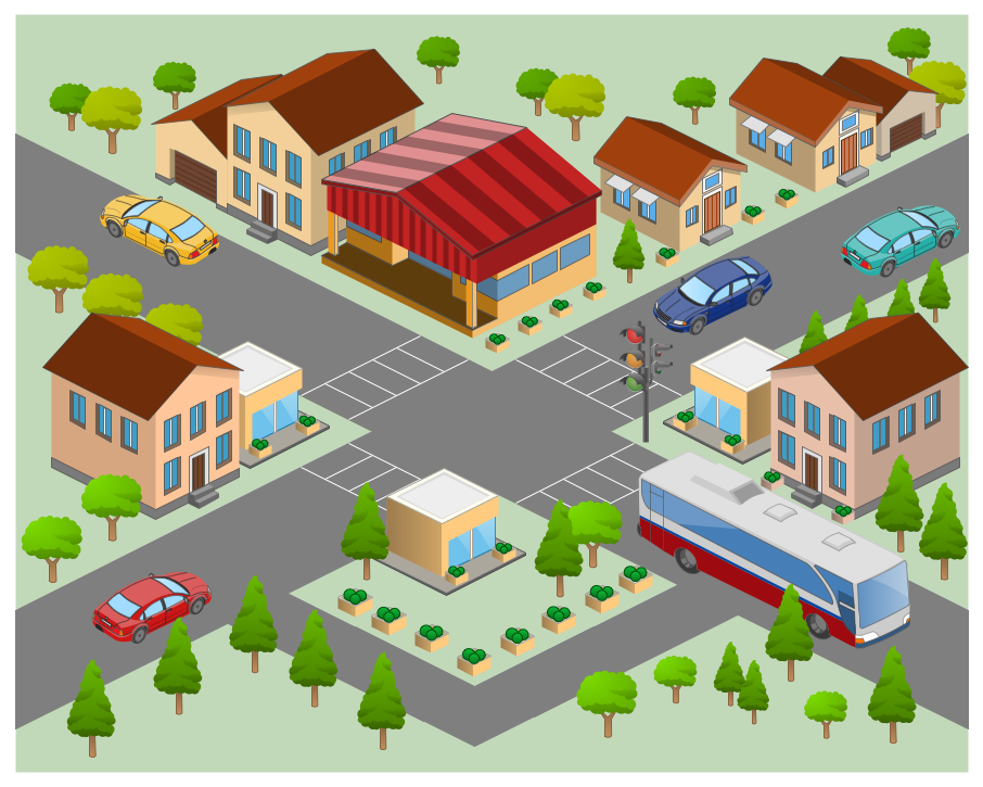
This 3D pictorial road map example was created using the ConceptDraw PRO diagramming and vector drawing software extended with the Directional Maps solution from the Maps area of ConceptDraw Solution Park.
Highway maps generally give an overview of major routes within a medium to large region ranging from a few dozen to a few thousand miles or kilometers.
Street maps usually cover an area of a few miles or kilometers (at most) within a single city or extended metropolitan area. City maps are generally a specialized form of street map." [Road map. Wikipedia]
This 3D pictorial road map example was created using the ConceptDraw PRO diagramming and vector drawing software extended with the Directional Maps solution from the Maps area of ConceptDraw Solution Park.
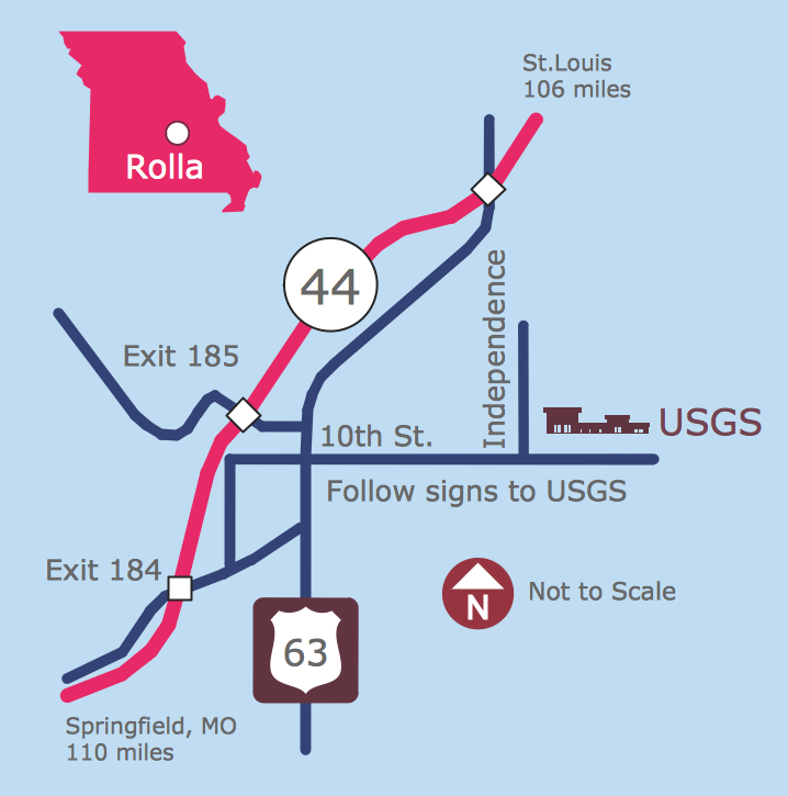
3D Directional map

- Road Map
- 2D Directional map - Template | Map Directions | Directions Map | 2d ...
- Drawing Simple Road Map Software
- Maps Driving Directions | UK Map | 2D Directional map - Template ...
- Directional Maps | Maps Driving Directions | Map Directions ...
- Education Package | Directional Maps | Road transport - Vector ...
- How To Create A 2d Location Map
- Site Plans | Directional Maps | 2d Vehicle Vector Clip Art
- How to Create a Directional Map Using ConceptDraw PRO | 3D ...
- Design elements - Vehicles 2D , 3D | Maps and Directions | 3D ...