The vector stencils library "3D directional maps" contains 40 symbols for creating pictorial maps, street maps, locator maps, transit maps, tourist maps with points of interest (POI), road maps and route maps using the ConceptDraw PRO diagramming and vector drawing software.
"Pictorial maps are a category of maps that are also loosely called illustrated maps, panoramic maps, perspective maps, bird’s-eye view maps and Geopictorial maps amongst others. In contrast to the regular road map, Atlas or topographic cartography, pictorial maps depict a given territory with a more artistic rather than technical style. The cartography can be a sophisticated 3-D perspective landscape or a simple map graphic enlivened with illustrations of buildings, people and animals. They can feature all sorts of varied topics like historical events, legendary figures or local agricultural products and cover anything from an entire continent to a college campus. ...
Pictorial maps usually show an area as if viewed from above at an oblique angle. They are not generally drawn to scale in order to show street patterns, individual buildings, and major landscape features in perspective. While regular maps focus on the accurate rendition of distances, pictorial maps enhance landmarks and often incorporate a complex interplay of different scales into one image in order to give the viewer a more familiar sense of recognition." [Pictorial maps. Wikipedia]
The design elements library "3D directional maps" is included in the Directional Maps solution from the Maps area of ConceptDraw Solution Park.
3D pictorial map symbols

Maps and Directions

Sign Making Software

Sign making software is very useful tool for professional sign-making business. Use ConceptDraw PRO and make sure that now sign making is easier and timesaving than ever!
 Directional Maps
Directional Maps solution extends ConceptDraw PRO software with templates, samples and libraries of vector stencils for drawing the directional, location, site, transit, road and route maps, plans and schemes.
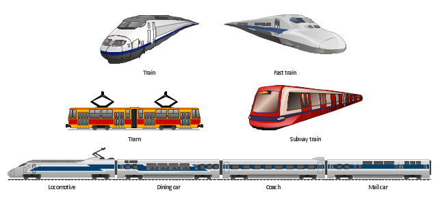
The vector clipart library Rail transport contains 8 images: railway train, fast train, subway train, tram, locomotive, dining car, coach, mail car.
Use the vector stencils library Rail transport to draw train illustrations, presentation slides, infographics and diagrams using the ConceptDraw PRO diagramming and vector drawing software.
"Rail transport is a means of conveyance of passengers and goods, by way of wheeled vehicles running on rails. It is also commonly referred to as train transport. In contrast to road transport, where vehicles merely run on a prepared surface, rail vehicles are also directionally guided by the tracks on which they run. Track usually consists of steel rails installed on sleepers/ ties and ballast, on which the rolling stock, usually fitted with metal wheels, moves. However, other iations are also possible, such as slab track where the rails are fastened to a concrete foundation resting on a prepared subsurface. Rolling stock in railway transport systems generally has lower frictional resistance when compared with highway vehicles and the passenger and freight cars (carriages and wagons) can be coupled into longer trains. The operation is carried out by a railway company, providing transport between train stations or freight customer facilities. Power is provided by locomotives which either draw electrical power from a railway electrification system or produce their own power, usually by diesel engines. Most tracks are accompanied by a signalling system. Railways are a safe land transport system when compared to other forms of transport." [Rail transport. Wikipedia]
The design elements library Rail transport is included in the Aerospace and Transport solution from the Illustration area of ConceptDraw Solution Park.
Vector clip art
Types of Map - Overview

- Road Signs And Symbols Images
- Road Transport - Design Elements | Aerospace and Transport ...
- Picture Graphs | Aerospace and Transport | ConceptDraw Solution ...
- Transport Images
- Illustration | Road Transport - Design Elements | Aerospace and ...
- Aerospace Pictures
- Aerospace and Transport | Aerospace - Design Elements | Aircraft ...
- Design elements - Industrial vehicles | Design elements - Vehicles ...
- Aerospace - Design Elements | Aircraft - Design Elements | Road ...
- Road Transport - Design Elements | UML Class Diagram Example ...
- Basic Flowchart Images . Flowchart Examples | How to Draw a ...
- 3D pictorial road map | 2D Directional map - Template | Maps | Road ...
- Road Map Symbols
- Truck vehicle clipart | Aerospace and Transport | Road Transport ...
- Aerospace and Transport | Rail transport - Design elements | Road ...
- Aerospace and Transport | Industrial transport - Design elements ...
- Design elements - Road signs | Design elements - 3D directional ...
- Aerospace and Transport | Road transport - Vector stencils library ...
- A Small First Aid Rooms For Two Patients Images
- Road Transport - Design Elements | Design elements - Road ...