Vector Map of Germany

Geo Map — South America Continent

Geo Map — United States of America Map

Visual Presentations Made Easy with Diagramming Software

Maps of Germany With Cities

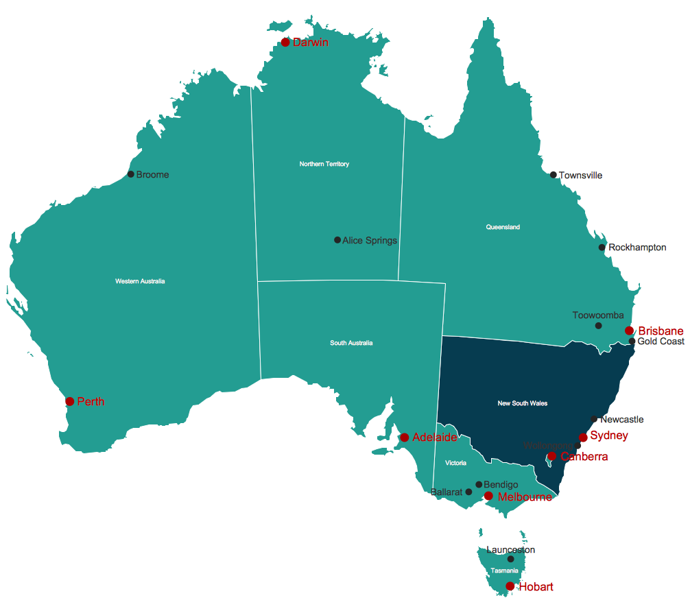
Map Australia
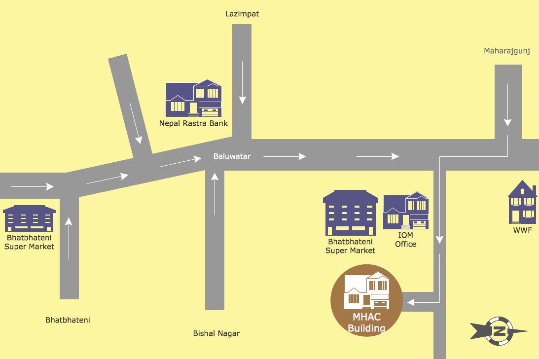
Map Directions
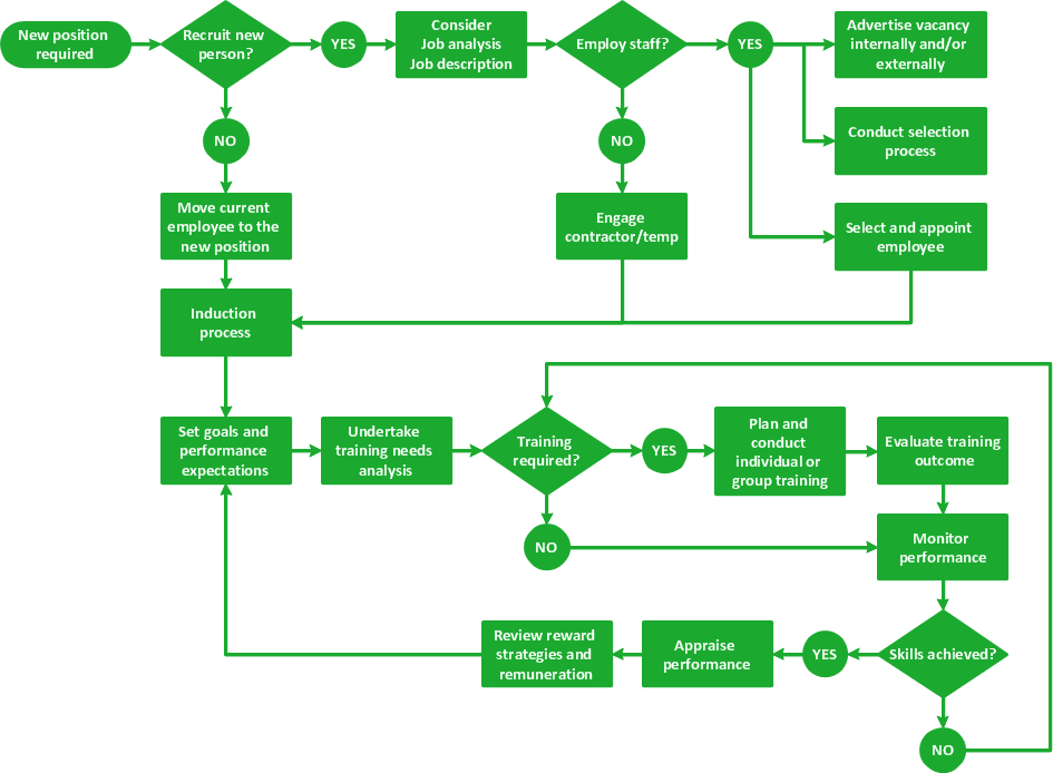
Emergency Plan


Map Software

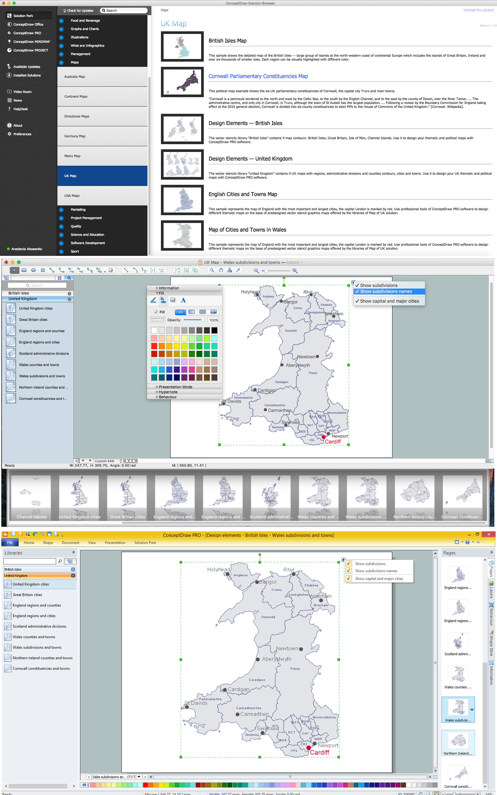
Map of UK — Wales Subdivisions and Towns
Map of USA

UK Map

Geo Map - World

HelpDesk
How to Draw a Map of North America

- Directional Map Drawing Software
- Metro Train Map | Metro Path Map | Metro Maps | Easy Drawing For ...
- Easy To Draw Map Of Europe
- Concept Map Maker | Simple Diagramming | The Best Flowchart ...
- Easy Map Drawing
- Easiest Way To Draw Philippine Map
- Conceptdraw.com: Mind Map Software, Drawing Tools | Project ...
- Population Easy Drawing
- Electrical Drawing Software | Food and Beverage | Site Plan | Easy ...
- How to Draw Maps of Australia Using ConceptDraw PRO | Geo Map ...
- How to draw Metro Map style infographics? (New York) | Subway ...
- Software Drawing Directional Map
- Management Consultant | Directions Maps | Maps Driving Directions ...
- Directions Maps | Maps and Directions | Directions Map | Drawing ...
- Nature Drawings - How to Draw | Geo Map - USA - California | Geo ...
- USA Map States
- Venn Diagram Concept Map
- How To Draw A Easy Geography Picture
- How to Draw a Map of USA States Using ConceptDraw PRO | Map ...
- How to Draw a Map of North America Using ConceptDraw PRO ...