MTA Subway Map
ConceptDraw DIAGRAM diagramming and vector drawing software offers the easiest and time-saving way of drawing the MTA Subway Map. Let's try to make sure this with Metro Map Solution from the Maps Area for ConceptDraw DIAGRAM Solution Park.
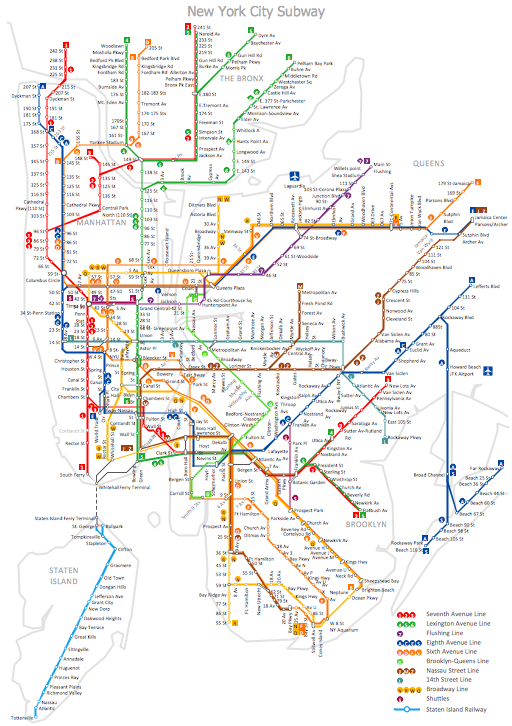
Example 1. MTA Subway Map - New York City Subway
First of all the Metro Map Solution provides the Transport Map library with numerous vector objects that will help you design the MTA Subway Map of any complexity and degree of detailing in a few minutes.

Example 2. Metro Map Solution in ConceptDraw STORE
Observe also collection of predesigned Metro Maps, MTA Subway Map, Metro Train Maps samples in ConceptDraw STORE. Every of them is carefully chosen and well thought-out example designed specially for ConceptDraw DIAGRAM users. You can use any desired of them as is or modificate according to your needs.

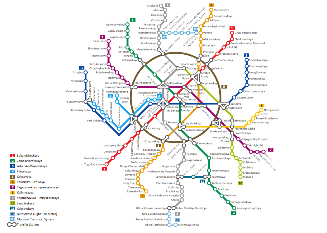
Example 3. MTA Subway Map - London Tube Map
The MTA Subway Map samples you see on this page were created in ConceptDraw DIAGRAM software using the Metro Map solution. Each MTA Subway Map created in ConceptDraw DIAGRAM successfully demonstrates solution's capabilities and professional results you can achieve. An experienced user spent 40-50 minutes creating each of these samples.
Use the Metro Map solution for ConceptDraw DIAGRAM software to create your own Metro Map or MTA Subway Map quick, easy and effective.
All source documents are vector graphic documents. They are available for reviewing, modifying, or converting to a variety of formats (PDF file, MS PowerPoint, MS Visio, and many other graphic formats) from the ConceptDraw STORE. The Metro Map Solution is available for all ConceptDraw DIAGRAM or later users.