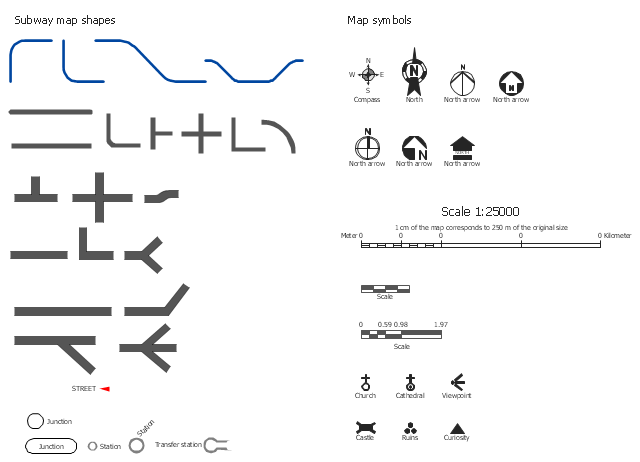
The vector stencils library Map symbols contains 19 icons for labeling the maps using the ConceptDraw PRO diagramming and vector drawing software.
The vector stencils library Subway map contains 41 shapes for creating the subway (tube, metro) maps using the ConceptDraw PRO.
"The various features shown on a map are represented by conventional signs or symbols. For example, colors can be used to indicate a classification of roads. Those signs are usually explained in the margin of the map, or on a separately published characteristic sheet.
Some cartographers prefer to make the map cover practically the entire screen or sheet of paper, leaving no room "outside" the map for information about the map as a whole. These cartographers typically place such information in an otherwise "blank" region "inside" the map -- cartouche, map legend, title, compass rose, bar scale, etc. In particular, some maps contain smaller "sub-maps" in otherwise blank regions—often one at a much smaller scale showing the whole globe and where the whole map fits on that globe, and a few showing "regions of interest" at a larger scale in order to show details that wouldn't otherwise fit." [Map. Wikipedia]
The example "Design elements - Subway map, Map symbols" is included in the Directional Maps solution from the Maps area of ConceptDraw Solution Park.
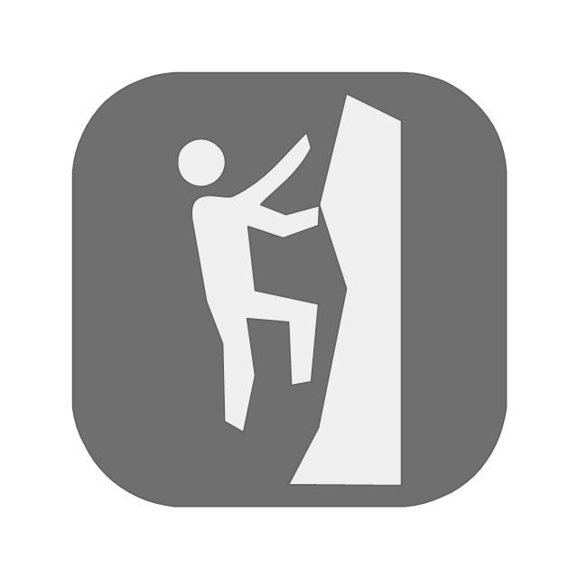
The vector stencils library "Recreation signs" contains 28 pictogram symbols of recreation signs for labeling street and directional maps, locator and tourist maps, road and route maps.
"A tourist sign, often referred to as a brown sign, is a traffic sign whose purpose is to direct visitors to tourist destinations, such as historic buildings, tourist regions, caravan or camp sites, picnic areas, sporting facilities and cultural places such as museums. By international convention, brown signs with white lettering and white pictograms are often used for this purpose. ...
Basically these tourist signs have 3 main applications:
(1) Information signs and signposts that point to important tourist destinations or places of interest in the local area, for example within a village or town.
(2) Standard signs that are used to mark routes with special themes, i.e. so-called tourist or holiday routes.
(3) Tourist signs that herald the presence of nearby landscapes, towns and regions, usually on long distance routes such as motorways. They are not used as direction signs." [Tourist sign. Wikipedia]
The pictograms example "Recreation signs - Vector stencils library" was created using the ConceptDraw PRO diagramming and vector drawing software extended with the Directional Maps solution from the Maps area of ConceptDraw Solution Park.
www.conceptdraw.com/ solution-park/ maps-directional
Garrett IA Diagrams with ConceptDraw PRO
Garrett IA diagrams are used at development of Internet-resources, in particulars at projecting of interactions of web-resource elements. The diagram of information architecture of the web resource which is constructed correctly with necessary details presents to developers the resource in comprehensible and visual way.- Directional Maps | Road signs - Vector stencils library | Directions ...
- Draw Road Signs
- Conventional Signs And Symbols Of Engineering Drawings And
- Basic Flowchart Symbols and Meaning | Map Directions | Maps and ...
- Signs And Symbols Used In Landscaping
- Images Of Road Conventional Signs
- Map symbols - Vector stencils library | How to Create a Directional ...
- Mechanical Drawings Signs And Symbols
- Building Planning And Design Conventional Signs Symbols
- Road signs - Vector stencils library | Design elements - Road signs ...
- Signs And Symbols Of Mechanical Drawing
- Conventional Signs And Symbols Used In Technical Drawing
- Directional Maps | Map Directions | Design elements - 3D directional ...
- Basic Flowchart Symbols and Meaning | Garrett IA Diagrams with ...
- Topographic Map Conventional Signs And Symbols
- Diagram Of A Topographic Map Conventional Signs And Symbols
- Details Of Conventional Signs And Symbols In Technical Drawing
- Images Of Conventional Signs And Symbols
- Conventional Signs And Symbols In Technical Drawing
- Architectural Symbols Evacuation Signs
