Geo Map — United States of America Map
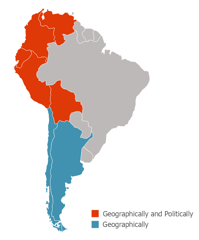
United States of America (USA) is a federal republic that includes 50 states and a federal district. It is the third largest country by population, fourth by the total area, and one of the most diverse in respect of nationalities and cultures. ConceptDraw DIAGRAM software extended with Continent Maps solution is ideal to draw professional looking Geological map of United States of America, USA map with states, the separate maps of different states of America, thematic maps, geospatial infographics, and varied vector illustrations for your business documents, presentations and websites. Use the pre-designed vector geo map shapes offered by numerous libraries, in particular by the United States of America library that contains 53 United States of America map contours. Each map is scaled, with the option to add the further levels of detail, thus the county borders, their names, capitals, and major cities can be instantly shown or hidden using the Action menu for each state map. ConceptDraw DIAGRAM software gives you a full control over the map size, shading, color fills and alignment."The Andean States are a group of nations in South America that are defined by sharing a common geography (Andes mountain range) or culture such as the Quechua language and Andean cuisine which was primarily spread during the times of the Inca Empire, but also before and after it. ...
The Andes occupy the western part of South America, stretching through the following countries: Colombia, Venezuela, Ecuador, Peru, Bolivia, Argentina (not considered to be -geopolitically- an Andean State), Chile (not considered to be -geopolitically- an Andean State)." [Andean states. Wikipedia]
This Andean states map was redesigned from Wikipedia file Andean States1.PNG.
[en.wikipedia.org/ wiki/ File:Andean_ States1.PNG]
This file is licensed under the Creative Commons Attribution-Share Alike 3.0 Unported license. [creativecommons.org/ licenses/ by-sa/ 3.0/ deed.en]
This Andean states political map example was drawn using the ConceptDraw PRO diagramming and vector drawing software extended with the design elements library South America. This example is included in the Continent Maps solution from the Maps area of ConceptDraw Solution Park.
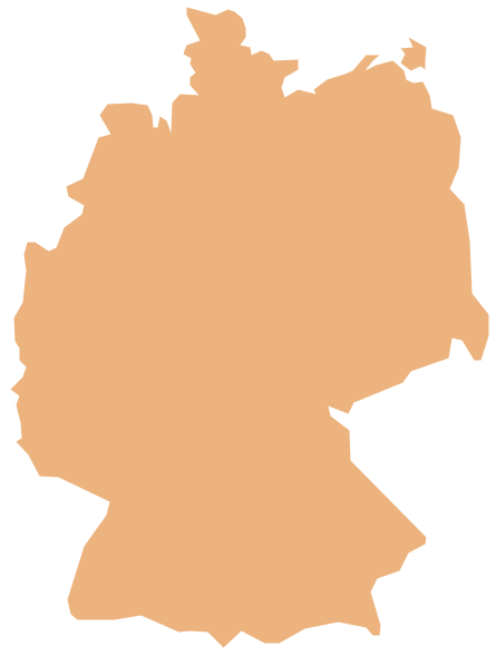
Geo Map — Europe — Germany
The vector stencils library Germany contains contours for ConceptDraw DIAGRAM diagramming and vector drawing software. This library is contained in the Continent Maps solution from Maps area of ConceptDraw Solution Park.
 Continent Maps
Continent Maps solution extends ConceptDraw DIAGRAM software with templates, samples and libraries of vector stencils for drawing the thematic maps of continents, state maps of USA and Australia.
USA Maps
ConceptDraw DIAGRAM diagramming and vector drawing software enhanced with USA Maps Solution from the Maps Area of ConceptDraw Solution Park is the best for drawing various kinds of USA Maps, thematic maps of any detailing, pictorial map of USA states.- Geo Map - America | Geo Map - America - United States | Geo Map ...
- Map Of America States
- Geo Map - United States of America Map | USA Maps | Map of USA ...
- Geo Map - America - United States | Map of USA with state names ...
- Geo Map - America - United States
- Geo Map - United States of America Map | Map of USA with state ...
- Andean states - Political map
- Geo Map - America - United States | Geo Map - America | Geo Map ...
- Geo Map - United States of America Map | How to Draw a Map of ...
- Geo Map - United States of America Map
- Map Of States In America
- Geo Map - United States of America Map | Geo Map - USA ...
- Map of USA with state names
- Map of USA with state names | Geo Map - United States of America ...
- USA Maps | Geo Map - USA - Tennesse | How to Draw a Map of ...
- Languages of South America - Thematic map | Languages of South ...
- Geo Map - United States of America Map | Geo Map - USA - Alaska ...
- Geo Map - South America - Argentina | Argentina in South America ...
- USA Maps | How to Draw a Map of North America Using ...
- Geo Map - USA - Mexico | Map of USA with state names | Geo Map ...


