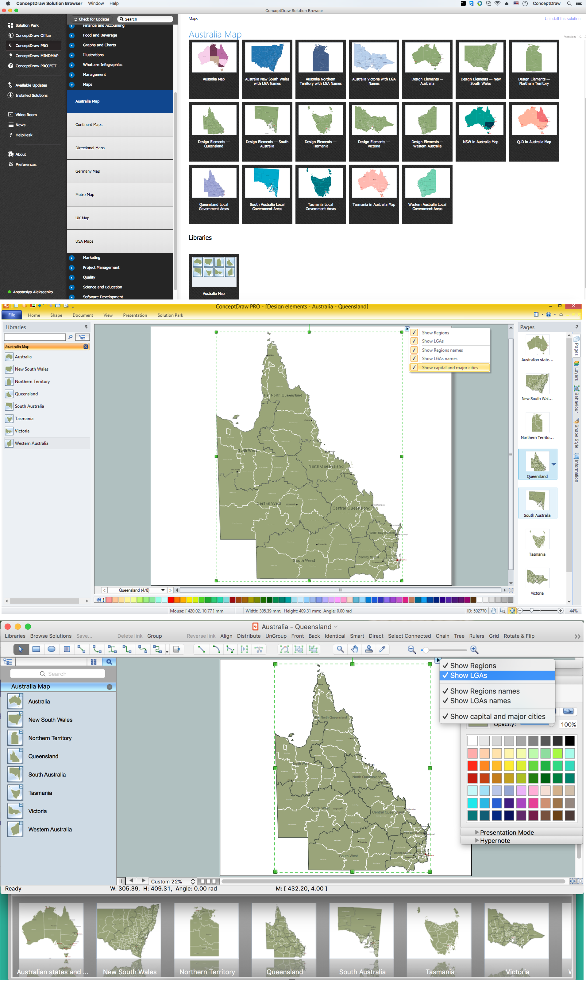
Australia Map — Queensland
“Queensland (abbreviated as Qld) is the second-largest and third-most-populous state in Australia. Situated in the north-east of the country, it is bordered by the Northern Territory, South Australia and New South Wales to the west, south-west and south respectively. To the east, Queensland is bordered by the Coral Sea and Pacific Ocean. Queensland has a population of 4,750,500, concentrated along the coast and particularly in the state's South East. The state is the world's sixth largest sub-national entity, with an area of 1,852,642 km2. The capital and largest city in the state is Brisbane, Australia's third largest city. Often referred to as the "Sunshine State", Queensland is home to 10 of Australia's 30 largest cities and is the nation's third largest economy.“
Regions
- Central Queensland
- Central West
- Darling Downs
- Far North Queensland
- North Queensland
- North West
- South East Queensland
- South West
- Wide Bay-Burnett
Local Government Areas
- Barcaldine Region
- Blackall-Tambo Region
- Bundaberg Region
- Burdekin Shire
- Cairns Region
- Cassowary Coast Region
- Central Highlands Region
- Charters Towers Region
- City of Brisbane
- City of Ipswich
- City of Mount Isa
- City of Townsville
- Fraser Coast Region
- Gladstone Region
- Goondiwindi Region
- Gympie Region
- Hopevale
- Isaac Region
- Lockyer Valley Region
- Logan City
- Longreach Region
- Mackay Region
- Maranoa Region
- Moreton Bay Region
- Napranum Shire
- North Burnett Region
- Rockhampton Region
- Scenic Rim Region
- Shire of Aurukun
- Shire of Balonne
- Shire of Banana
- Shire of Barcoo
- Shire of Boulia
- Shire of Bulloo
- Shire of Burke
- Shire of Carpentaria
- Shire of Cloncurry
- Shire of Cook
- Shire of Croydon
- Shire of Diamantina
- Shire of Etheridge
- Shire of Flinders
- Shire of Hinchinbrook
- Shire of Kowanyama
- Shire of Lockhart River
- Shire of McKinlay
- Shire of Murweh
- Shire of Paroo
- Shire of Pormpuraaw
- Shire of Quilpie
- Shire of Richmond
- Shire of Winton
- Somerset Region
- South Burnett Region
- Southern Downs Region
- Sunshine Coast Region
- Tablelands Region
- Toowoomba Region
- Western Downs Region
- Whitsunday Region