Made with
ConceptDraw
DIAGRAM 18

Map of Germany — Berlin

Berlin is the capital of Germany and one of the 16 states of Germany. With a population of 3.5 million people, it is the second most populous city proper and the seventh most populous urban area in the European Union. Located in northeastern Germany on the banks of Rivers Spree and Havel, it is the centre of the Berlin-Brandenburg Metropolitan Region, which has about six million residents from over 180 nations. Due to its location in the European Plain, Berlin is influenced by a temperate seasonal climate. Around one-third of the city's area is composed of forests, parks, gardens, rivers and lakes.“
[from Wikipedia]

Boroughs

  • Charlottenburg-Wilmersdorf
  • Friedrichshain-Kreuzberg
  • Lichtenberg
  • Marzahn-Hellersdorf
  • Mitte
  • Neukölln
  • Pankow
  • Reinickendorf
  • Spandau
  • Steglitz-Zehlendorf
  • Tempelhof-Schöneberg
  • Treptow-Köpenick

Localities

  •  Mitte
  •  Tiergarten
  •  Wedding
  •  Moabit
  •  Hansaviertel
  •  Gesundbrunnen                                
  •  Friedrichshain                                  
  •  Kreuzberg
  •  Prenzlauer Berg
  •  Weißensee
  •  Blankenburg
  •  Heinersdorf
  •  Karow
  •  Stadtrandsiedlung Malchow            
  •  Pankow
  •  Blankenfelde
  •  Buch
  •  Französisch Buchholz
  •  Niederschönhausen
  •  Rosenthal
  •  Wilhelmsruh
  •  Charlottenburg
  •  Wilmersdorf
  •  Schmargendorf
  •  Grunewald
  •  Westend
  •  Charlottenburg-Nord                        
  •  Halensee
  •  Spandau
  •  Haselhorst
  •  Siemensstadt
  •  Staaken
  •  Gatow
  •  Kladow
  •  Hakenfelde
  •  Falkenhagener Feld                        
  •  Wilhelmstadt
  •  Steglitz
  •  Lichterfelde                                      
  •  Lankwitz
  •  Zehlendorf
  •  Dahlem
  •  Nikolassee
  •  Wannsee
  •  Schöneberg                                      
  •  Friedenau
  •  Tempelhof
  •  Mariendorf
  •  Marienfelde
  •  Lichtenrade
  •  Neukölln
  •  Britz
  •  Buckow
  •  Rudow
  •  Gropiusstadt                                      
  •  Alt-Treptow
  •  Plänterwald
  •  Baumschulenweg
  •  Johannisthal
  •  Niederschöneweide                          
  •  Altglienicke
  •  Adlershof
  •  Bohnsdorf
  •  Oberschöneweide
  •  Köpenick
  •  Friedrichshagen
  •  Rahnsdorf
  •  Grünau
  •  Müggelheim
  •  Schmöckwitz
  •  Marzahn
  •  Biesdorf
  •  Kaulsdorf
  •  Mahlsdorf
  •  Hellersdorf                                        
  •  Friedrichsfelde
  •  Karlshorst
  •  Lichtenberg
  •  Falkenberg
  •  Malchow
  •  Wartenberg
  •  Neu-Hohenschönhausen                  
  •  Alt-Hohenschönhausen
  •  Fennpfuhl
  •  Rummelsburg
  •  Reinickendorf
  •  Tegel
  •  Konradshöhe
  •  Heiligensee
  •  Frohnau
  •  Hermsdorf
  •  Waidmannslust
  •  Lübars
  •  Wittenau
  •  Märkisches Viertel                            
  •  Borsigwalde                            

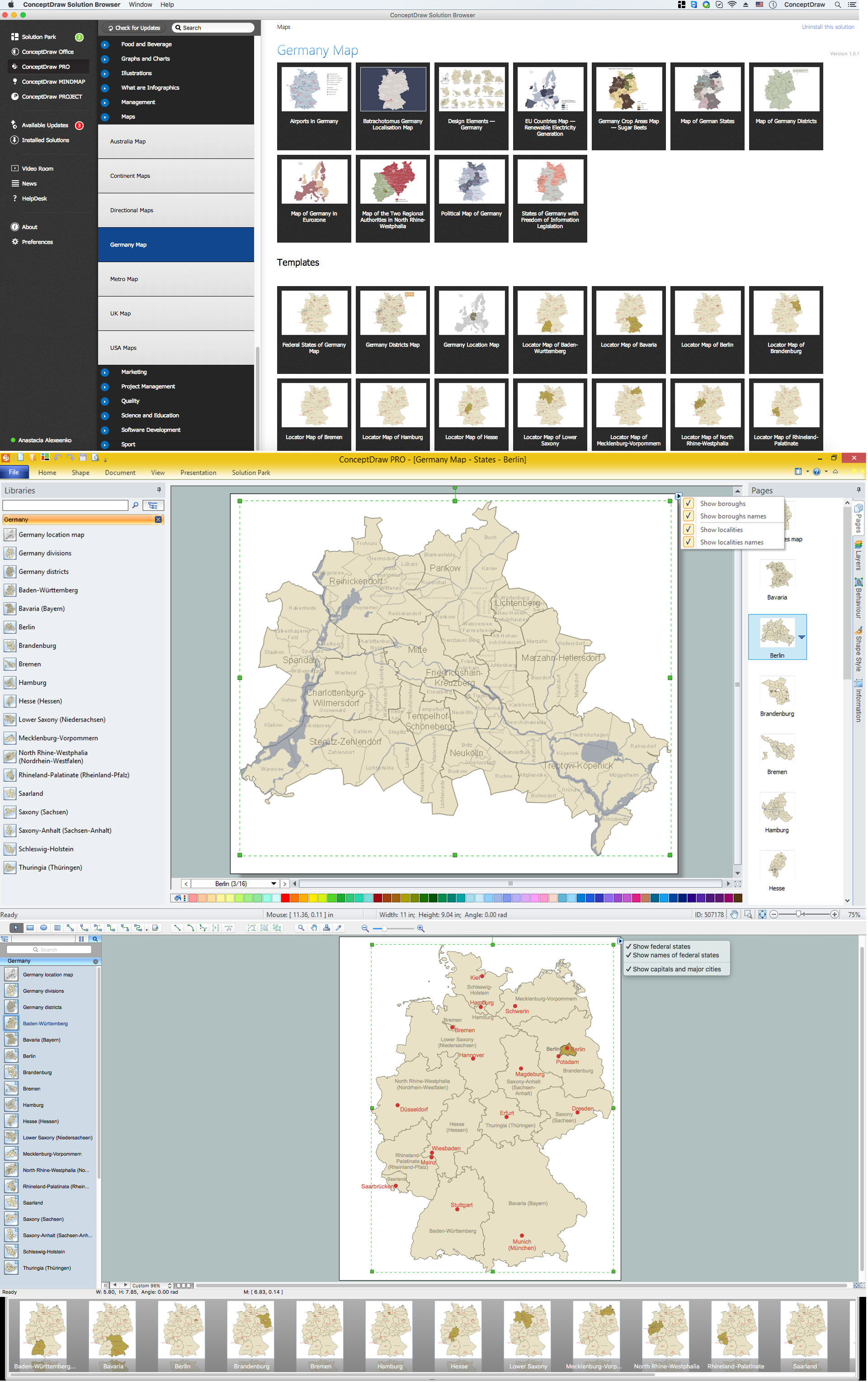
Despite the fact that the maps surround us everywhere in our life, usually the process of their drawing is sufficienly complex and labor-intensive. But now, thanks to the ConceptDraw DIAGRAM diagramming and vector drawing software extended with Germany Map Solution from the Maps Area of ConceptDraw Solution Park, we have the possibility to make easier this process. Design fast and easy your own pictorial maps of Germany, map of Germany with cities, and thematic Germany maps in ConceptDraw DIAGRAM

Map of Germany — Berlin *

Example 1. Germany Map Solution — Berlin (Mac OS X, Windows)

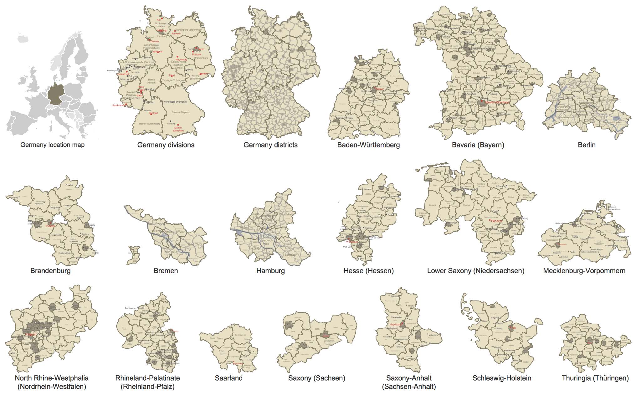
Use of ready objects is a fastest way of drawing vivid and attractive maps and cartograms, and Germany maps are not exception. The Germany Map Solution offers for ConceptDraw DIAGRAM users wide variety of ready-to-use vector map objects, which compose the Germany library.

Germany Library Design Elements

Example 2. Germany Library Design Elements

These objects allow easy design many kinds of Germany maps, among them geographic, topography, political map of Germany, detailed map of Germany with cities, various thematic Germany maps that are used for visually illustration important information and statistical data, and many other useful maps.

All source documents are vector graphic documents. They are available for reviewing, modifying, or converting to a variety of formats (PDF file, MS PowerPoint, MS Visio, and many other graphic formats) from the ConceptDraw STORE. The Germany Map Solution is available for all ConceptDraw DIAGRAM users.


THREE RELATED HOW TO's:
The HR Management Software is an incredibly powerful tool for those who need to analyze or present human resource process flows in a visually effective manner.HR Management Software
Picture: HR Management Software
Related Solution:
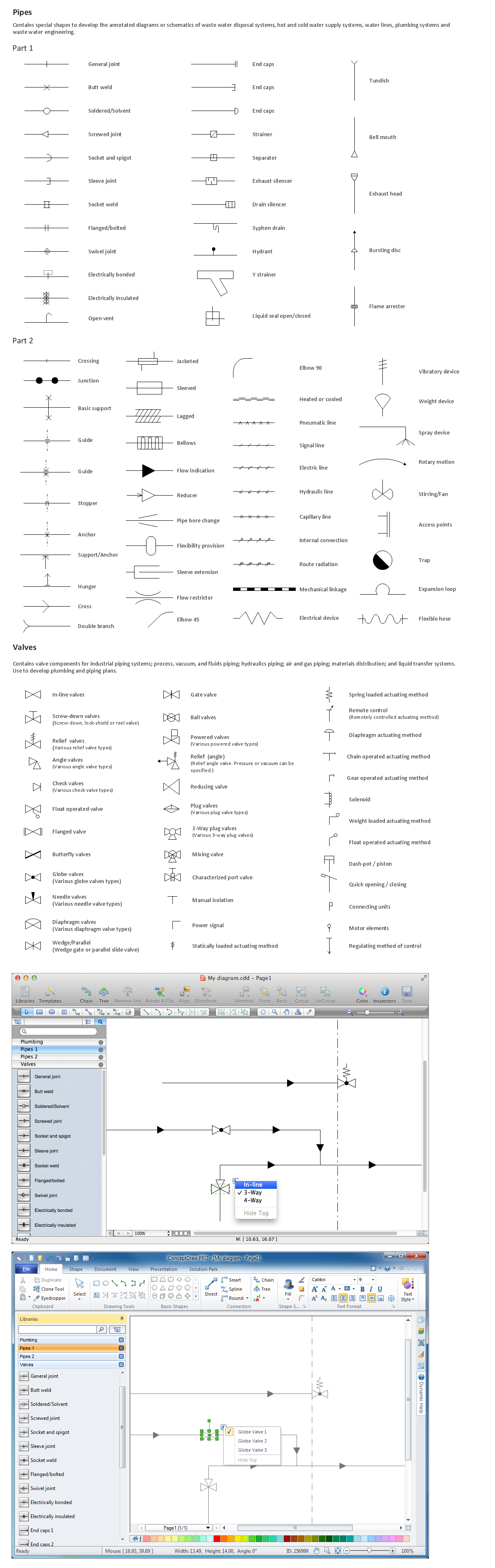
Use building drawing software to develop the annotated diagrams or schematics of waste water disposal systems, hot and cold water supply systems, water lines and waste water engineering.Building Drawing Software for Design Piping Plan *
Picture: Building Drawing Software for Design Piping Plan
Related Solution:
Germany is a federal parliamentary republic in West-Central Europe which consists of 16 constituent states. It is a part of Schengen area and the most populous member state in the European Union. ConceptDraw DIAGRAM diagramming and vector drawing software offers the unique Germany Map Solution from the Maps Area of ConceptDraw Solution Park, developed specially for easy drawing the maps of Germany of different levels of complexity and detailing.Maps of Germany *
Picture: Maps of Germany
Related Solution:
ConceptDraw
DIAGRAM 18