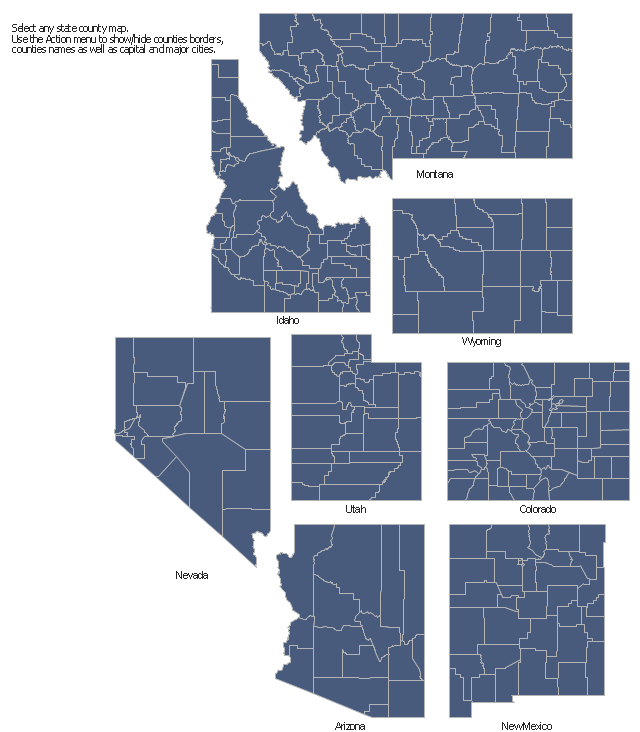
The vector stencils library "Map of US Mountain" contains 8 state maps of Arizona, Colorado, Idaho, Montana, Nevada, New Mexico, Utah, Wyoming with main cities and borders of counties.
Use it to design your U.S. thematic maps using the ConceptDraw PRO diagramming and vector drawing software.
The county map example "Design elements - Map of US Mountain" is included in the USA Maps solution from the Maps area of ConceptDraw Solution Park.
Use it to design your U.S. thematic maps using the ConceptDraw PRO diagramming and vector drawing software.
The county map example "Design elements - Map of US Mountain" is included in the USA Maps solution from the Maps area of ConceptDraw Solution Park.
County maps of Mountain states
HelpDesk
How to Draw a Map of USA States Using ConceptDraw PRO

"A state of the United States of America is one of the 50 constituent political entities that shares its sovereignty with the United States federal government."
[U.S. state. Wikipedia]
This political map example was redesigned from the Wikimedia Commons file: Map of USA with state names 2.svg.
[commons.wikimedia.org/ wiki/ File:Map_ of_ USA_ with_ state_ names_ 2.svg]
This file is licensed under the Creative Commons Attribution-Share Alike 3.0 Unported license. [creativecommons.org/ licenses/ by-sa/ 3.0/ deed.en]
The example "Map of USA with state names" was created using the ConceptDraw PRO diagramming and vector drawing software extended with the Continent Map solution from the Maps area of ConceptDraw Solution Park.
Political map - USA

A color-coded map showing US state-by-state status of Benefit Corporation legislation.
"A thematic map is a type of map or chart especially designed to show a particular theme connected with a specific geographic area. These maps "can portray physical, social, political, cultural, economic, sociological, agricultural, or any other aspects of a city, state, region, nation, or continent"." [Thematic map. Wikipedia]
This U.S.A. thematic map was redesigned from Wikipedia file: Benefit Corporation Map 2012 05 16.svg. [commons.wikimedia.org/ wiki/ File:Benefit_ Corporation_ Map_ 2012_ 05_ 16.svg]
This file is licensed under the Creative Commons Attribution-Share Alike 3.0 Unported license.
[creativecommons.org/ licenses/ by-sa/ 3.0/ deed.en]
This U.S. thematic map example was created using the ConceptDraw PRO diagramming and vector drawing software extended with the Continent Maps solution from the Maps area of ConceptDraw Solution Park.
Thematic map of U.S.
- Design elements - Map of US Mountain | Geography - Vector ...
- Map of USA with state names | Benefit Corporation legislation ...
- Benefit Corporation legislation - Thematic map | USA Map | Map of ...
- Design elements - Map of US Mountain
- How to Draw a Map of USA States Using ConceptDraw PRO | Geo ...
- Geo Map - United States of America Map | Map of USA States | How ...
- Geo Map - United States of America Map | Map of USA States | Map ...
- Map of USA | USA Map States | Maps of Germany With Cities | Us ...
- Geo Map — United States of America Map | Map of USA States ...