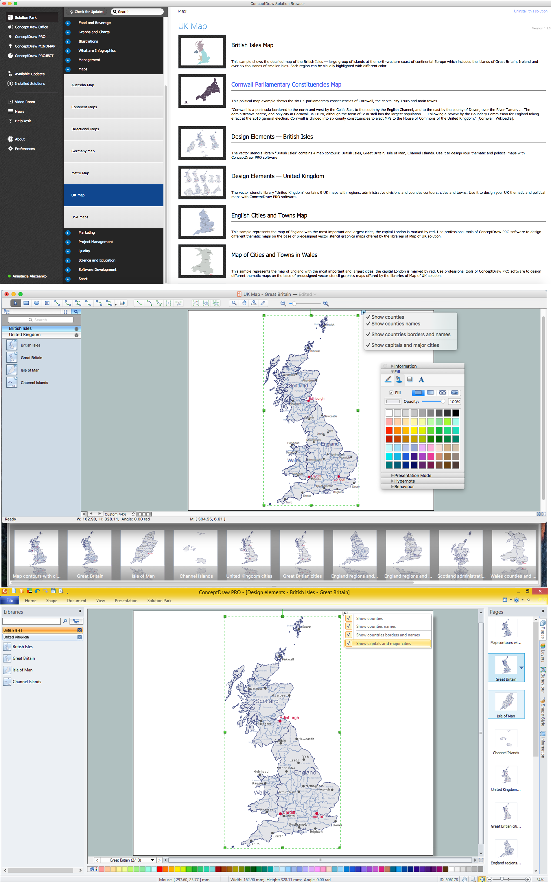
Map of UK — Great Britain
“Great Britain, also known as Britain, is an island in the North Atlantic off the north-west coast of continental Europe. With an area of 209,331 km2 (80,823 sq mi), it is the largest island in Europe and the ninth-largest in the world. In 2011 the island had a population of about 61 million people, making it the third-most populous island in the world, after Java in Indonesia and Honshu in Japan. It accounts for the majority of the British Isles archipelago, along with over 1,000 smaller surrounding islands, including the island of Ireland to its west.
The island is part of the United Kingdom of Great Britain and Northern Ireland, constituting most of its territory: most of England, Scotland, and Wales are on the island, with their respective capital cities, London, Edinburgh, and Cardiff. Politically, the term Great Britain usually extends to include surrounding islands that form part of England, Scotland, and Wales. The island is dominated by an oceanic climate with quite narrow temperature differences between seasons.”
Regions
- East Midlands
- East of England
- Greater London
- North East England
- North West England
- South East England
- South West England
- West Midlands
- Yorkshire and the Humber
Counties
- Aberdeenshire
- Anglesey
- Angus
- Argyllshire
- Ayrshire
- Banffshire
- Beds
- Berkshire
- Berwickshire
- Brecknockshire
- Bucks
- Buteshire
- Caernarfonshire
- Caithness
- Cambs
- Cardiganshire
- Carmarthenshire
- Cheshire
- Clacks
- Cornwall
- Cromartyshire
- Cumberland
- Denbighshire
- Derbyshire
- Devon
- Dorset
- Dumfriesshire
- Durham
- East Lothian
- Essex
- Fife
- Flintshire
- Glamorgan
- Gloucestershire
- Hampshire
- Herefs
- Herts
- Hunts
- Inverness-shire
- Isle of Wight
- Kent
- Kincardineshire
- Kinross-shire
- Kirkcudbrightshire
- Lanarkshire
- Lancashire
- Leics
- Lincolnshire
- Merionethshire
- Middx
- Midlothian
- Monmouthshire
- Montgomeryshire
- Moray
- Nairnshire
- Norfolk
- Northants
- Northumberland
- Notts
- Orkney
- Oxon
- Peeblesshire
- Pembrokeshire
- Perthshire
- Radnorshire
- Renfrewshire
- Ross-shire
- Roxburghshire
- Rutland
- Selkirkshire
- Shetland
- Shropshire
- Somerset
- Staffordshire
- Stirlingshire
- Suffolk
- Surrey
- Sussex
- Sutherland
- Warwicks
- West Lothian
- Westmorland
- Wigtownshire
- Wiltshire
- Worcs
- Yorkshire