Map of UK — Isle of Man
“TheIsle of Man, also known simply as Mann, is a self-governing Crown dependency in the Irish Sea between Great Britain and Ireland. The head of state is Queen Elizabeth II, who holds the title of Lord of Mann. The Lord of Mann is represented by a Lieutenant Governor. Foreign relations and defence are the responsibility of the British Government.”
[from Wikipedia]
Countries
- Ayre
- Garff
- Middle
- Rushen
- Glenfaba
- Michael
Counties
- Andreas
- Arbory
- Ballaugh
- Braddan
- Bride
- Castletown
- Douglas
- German
- Jurby
- Laxey
- Lezayre
- Lonan
- Malew
- Marown
- Maughold
- Michael
- Onchan
- Patrick
- Peel
- Port Erin
- Port St Mary
- Ramsey
- Rushen
- Santon
Cities
- Andreas
- Baldrine
- Ballamodha
- Ballaragh
- Ballasalla
- Barregarrow
- Churchtown
- Colby
- Corrany
- Cranstal
- Crosby
- Dalby
- Douglas
- Glen Helen
- Glen Maye
- Kirk Michael
- Knocksharry
- Newton
- Onchan
- Patrick
- Port Erin
- Regaby
- St. Marks
- Sulby
- The Cronk
- The Lhen
- West Jurby
How to design the Map of UK fast and easy? It is incredibly convenient to use special software. ConceptDraw DIAGRAM diagramming and vector drawing software offers the Map of UK Solution from the Maps Area of ConceptDraw Solution Park specially developed to make easier drawing the maps of UK counties, various UK related thematic maps and cartograms on their base.
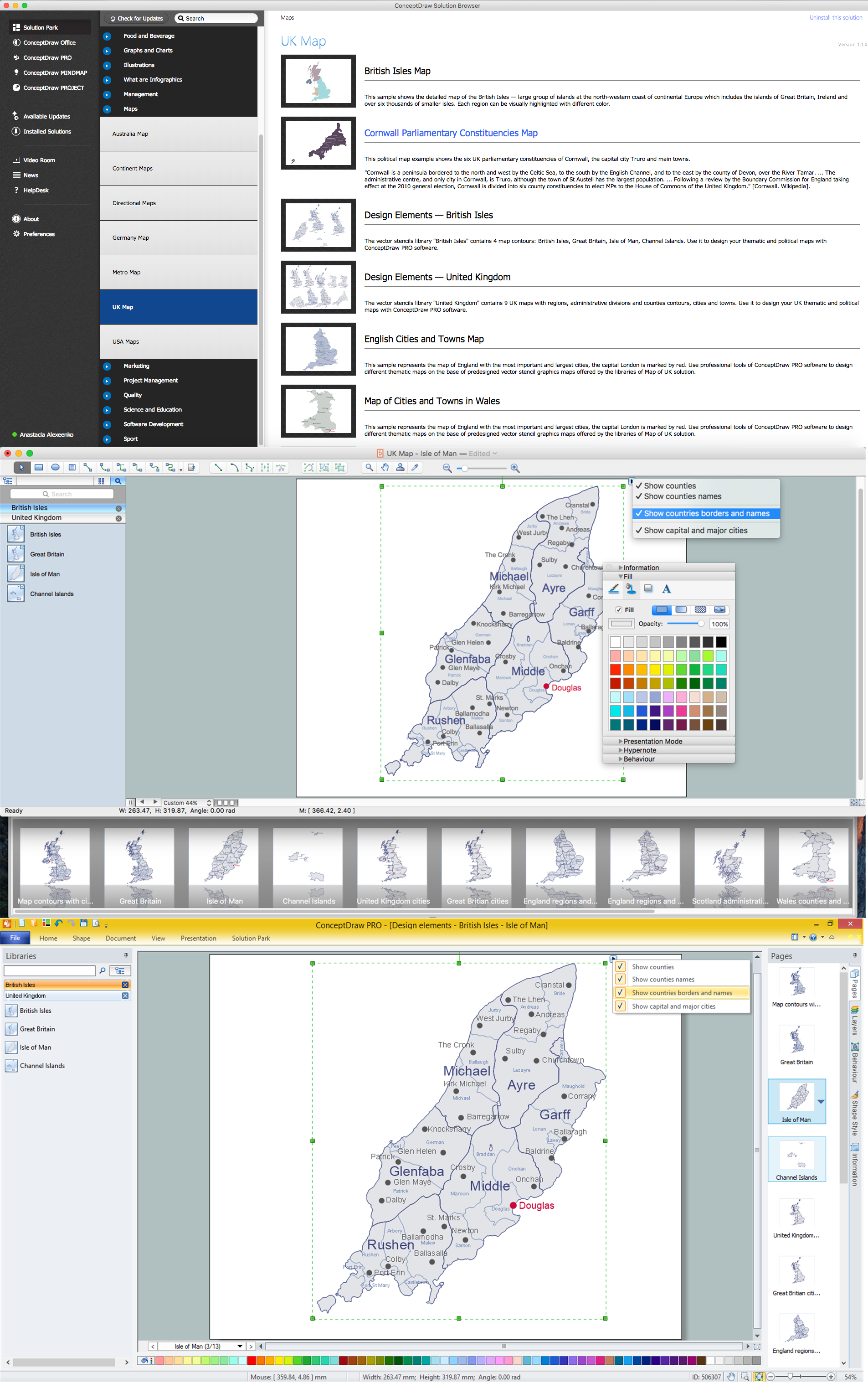
Example 1. UK Map Solution — Isle of Man
Map of UK Solution provides wide collection of predesigned maps of UK countries, islands and counties, and 2 libraries with 12 ready-to-use vector maps objects which lie at the base of included samples.

Example 2. British Isles Library Design Elements

Example 3. United Kingdom Library Design Elements
Thanks to all these tools, now design of UK Map and thematic maps for the countries included to UK is very simple process. All that you need is follow the next steps:
- create new ConceptDraw document,
- drag the needed objects from the libraries of Map of UK Solution,
- make changes in color style and apply the commands from the object's action menu to make your map colorful and successful.

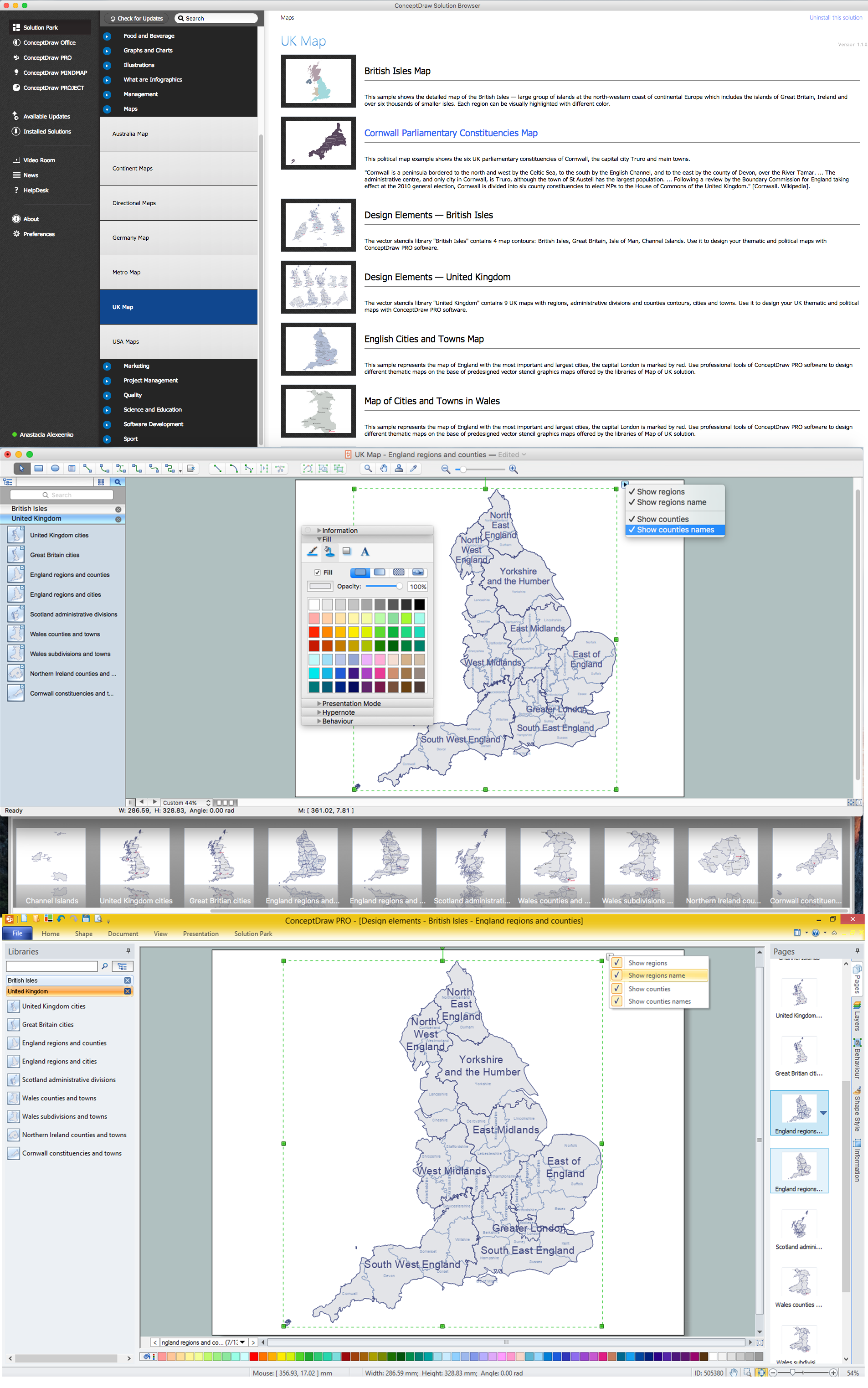
Example 4. Map of UK — British Isles Counties
The maps, geospatial infographics and especially thematic maps which are the popular visual way of studying different points of interest and geographical data, all they are incredibly useful in various scientific fields. Design them easy in ConceptDraw DIAGRAM
Use the Map of UK solution for ConceptDraw DIAGRAM software to design your own Map of UK quick, easy and effective, and then successfully use it in your life or work activity.
All source documents are vector graphic documents. They are available for reviewing, modifying, or converting to a variety of formats (PDF file, MS PowerPoint, MS Visio, and many other graphic formats) from the ConceptDraw STORE. The Map of UK Solution is available for all ConceptDraw DIAGRAM users.
.png)