


Geo Map - Canada - Newfoundland and Labrador
Geo Map - Canada - Newfoundland and Labrador


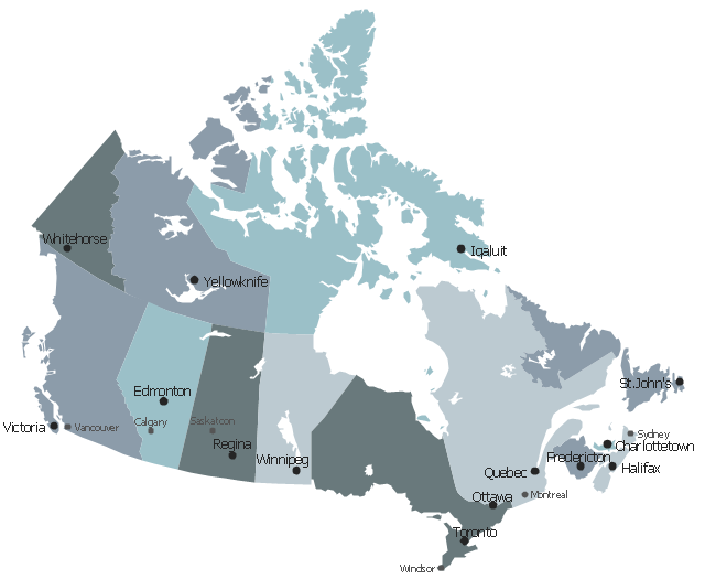
This political map of Canada exhibits its ten provinces and three territories, and
their capitals. " Canada is a country in North America consisting of 10 provinces


The three territories are Northwest Territories, Nunavut, and Yukon." [Provinces
and territories of Canada . Wikipedia] This political map was redesigned from
Wikipedia] This political map was redesigned from Wikipedia file: Canada
regions map .svg. [commons.wikimedia.org/wiki/File:Canada_regions_map.svg]
The
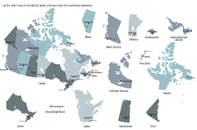
This sample displays state map contours with capitals and major cities of Canada
provinces and territories. Use it to design your management infographics.
The vector stencils library "Management map Canada " contains 14 state map
contours of Canada . Use it to create your management infogram in the
- Geo Map - Canada
- Canada political map | Canada - Vector stencils library | Canada ...
- Geo Map - Canada - British Columbia | Geo Map - Canada - Prince ...
- Alberta Canada Map New Brunswick
- Canada Thematic Map
- Vector Map Of Canada's 10 Provinces And 3 Territories
- Map Of Canada Black And White
- Geo Map - Canada - Ontario
- Geo Map - Canada
- Canada - Vector stencils library | Management map Canada - Vector ...
- Geo Map - Canada - Prince Edward Island
- Map Provinces Canada
- Canada - Vector stencils library | Geo Map - Canada - Prince ...
- Geo Map - Canada - Yukon
- Management map Canada - Vector stencils library | Management ...
- Canada regions - Political map | Geo Map - Canada - Northwest ...
- Geo Map - Canada - Nunavut
- Geo Map - Canada - Saskatchewan
- Canada regions - Political map | Geo Map - Canada - British ...
- Canada political map
- ERD | Entity Relationship Diagrams, ERD Software for Mac and Win
- Flowchart | Basic Flowchart Symbols and Meaning
- Flowchart | Flowchart Design - Symbols, Shapes, Stencils and Icons
- Flowchart | Flow Chart Symbols
- Electrical | Electrical Drawing - Wiring and Circuits Schematics
- Flowchart | Common Flowchart Symbols
- Flowchart | Common Flowchart Symbols