Maps Driving Directions
 UK Map
The Map of UK solution contains collection of professionally designed samples and scalable vector stencil graphics maps, representing the United Kingdom counties, regions and cities. Use the Map of UK solution from ConceptDraw Solution Park as the base fo
Use this template for creating the directional maps, location plans, site schemes, transit schemes, road maps, route maps.
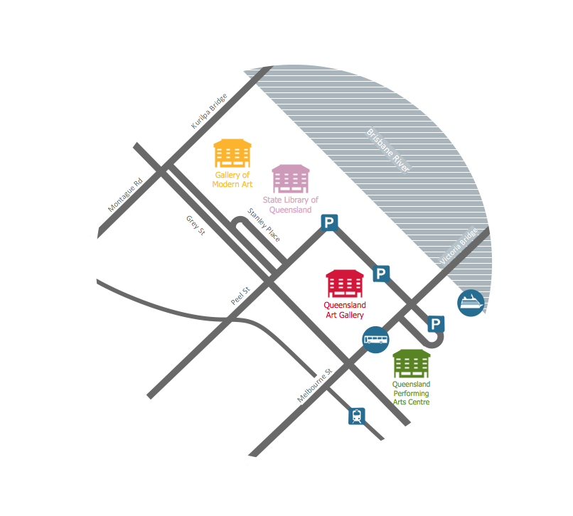
"A road map or route map is a map that primarily displays roads and transport links rather than natural geographical information. It is a type of navigational map that commonly includes political boundaries and labels, making it also a type of political map. In addition to roads and boundaries, road maps often include points of interest, such as prominent businesses or buildings, tourism sites, parks and recreational facilities, hotels and restaurants, as well as airports and train stations. A road map may also document non-automotive transit routes, although often these are found only on transit maps." [Road map. Wikipedia]
This template for the ConceptDraw PRO diagramming and vector drawing software is included in the Directional Maps solution from the Maps area of ConceptDraw Solution Park.
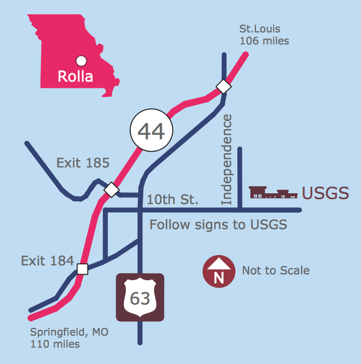
Directional map template

Geo Map — Asia

There are 116 vector shapes illustrating the Asia countries flags in colours as they are and you can always use some of them or all of them.
Maps and Directions
Geo Map — USA — Oklahoma

The vector stencils library Oklahoma contains contours for ConceptDraw DIAGRAM diagramming and vector drawing software. This library is contained in the Continent Maps solution from Maps area of ConceptDraw Solution Park.
Continents Map

Geo Map — USA — Florida

The vector stencils library Florida contains contours for ConceptDraw DIAGRAM diagramming and vector drawing software. This library is contained in the Continent Maps solution from Maps area of ConceptDraw Solution Park.
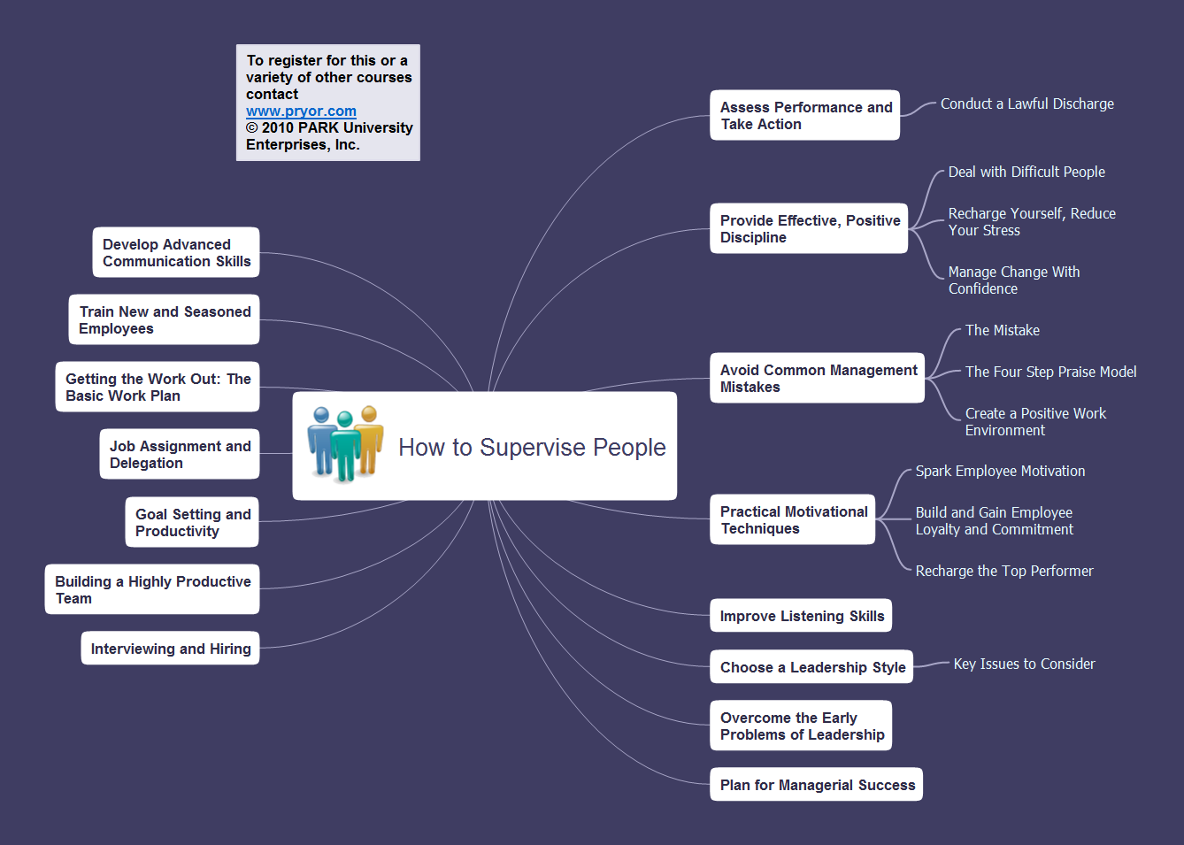
Mind Mapping in the Quality Management
How to Make SWOT Analysis in a Word Document
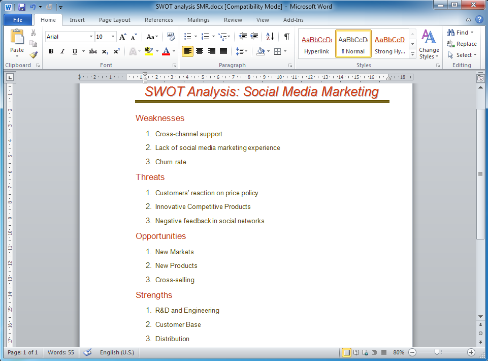
ConceptDraw products across any platform, meaning you never have to worry about compatibility again. ConceptDraw MINDMAP allows you to make SWOT analysis on PC or macOS operating systems.
How to draw Metro Map style infographics? Moscow, New York, Los Angeles, London

Presentation Preparation using Mind Maps
Geo Map — USA — Mississippi

The vector stencils library Mississippi contains contours for ConceptDraw DIAGRAM diagramming and vector drawing software. This library is contained in the Continent Maps solution from Maps area of ConceptDraw Solution Park.
Australia Map — Northern Territory
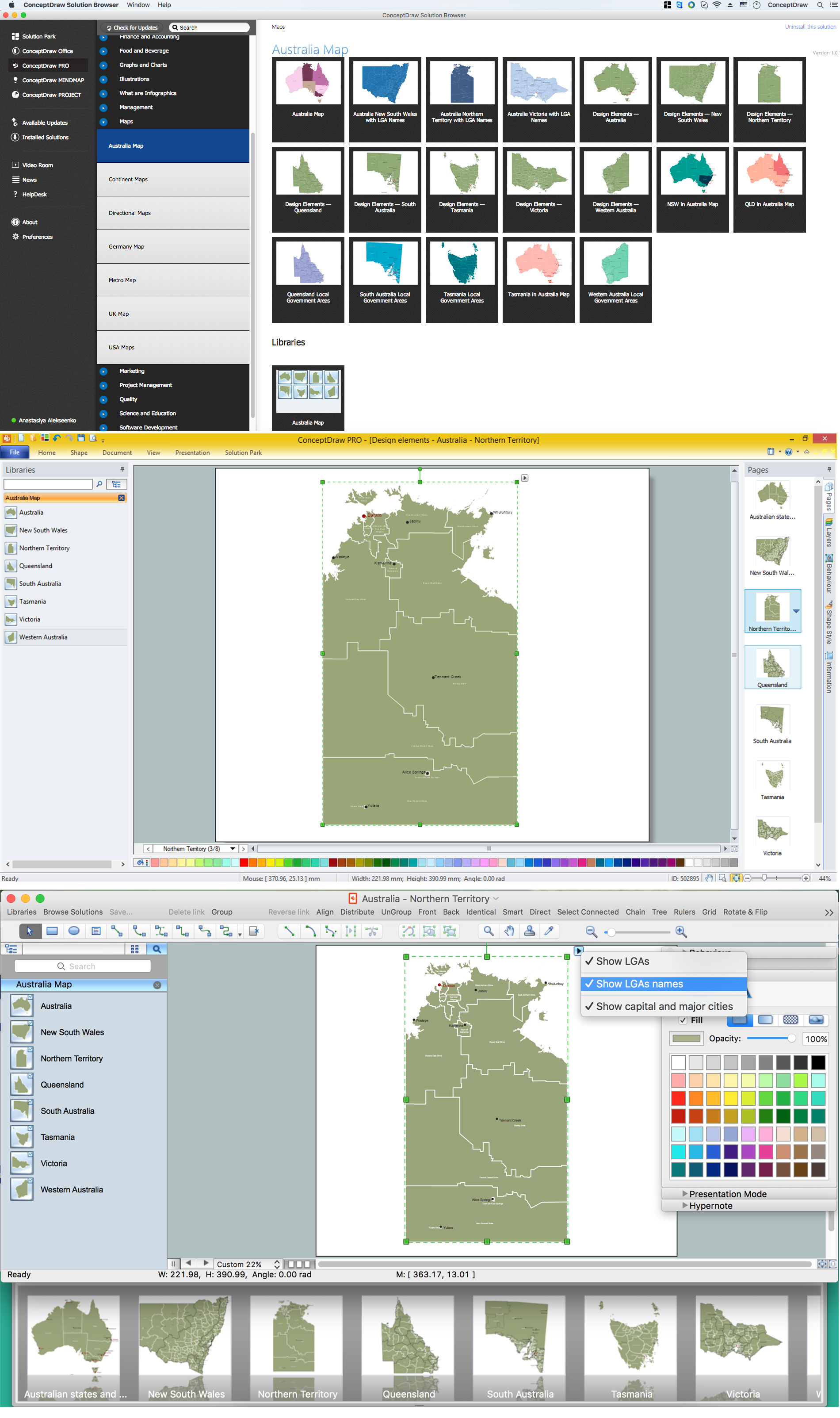
Maps surround us everywhere in our life, study, work, traveling, they are widely used in geography, history, politics, economics, and many other fields of science and life activity. But designing of maps is usually complex and labor-intensive process. Now we have the possibility to make easier this process - ConceptDraw DIAGRAM diagramming and vector drawing software extended with Australia Map Solution from the Maps Area of ConceptDraw Solution Park will help us in easy drawing detailed Australia map.
Metro Map
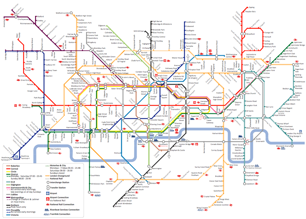
The Metro Map Solution from the Maps Area uses two ConceptDraw techniques: Replicating Objects and Switching Objects. And the result is a vector graphic document.
- Town Map Template
- Free Town Map Template
- 2D Directional map - Template | 2d Town With Road
- 2D Directional map - Template | Landmarks - Vector stencils library ...
- 2D Directional map - Template | Directional Maps | Map Directions ...
- Directional Maps | How to Create a Directional Map Using ...
- Fire Exit Plan. Building Plan Examples | How to draw Metro Map ...
- 2D Directional map - Template | Map Directions | Maps and ...
- Directional Maps | Maps | Map Directions | Road Maps
- How to Create a Directional Map Using ConceptDraw PRO | 3D ...
- Transit map template | Landmarks - Vector stencils library | How to ...
- Road Map Suburbs And Houses Drawing
- Line graph - Template
- Isometric Town Map
- 2D Directional map - Template | Location of the Migration Health ...
- Directional Maps | Directions Maps | Spatial infographics Design ...
- Free Concept Map Templates
- 3D pictorial road map | How to draw Metro Map style infographics ...
- Maps and Directions | Continents Map | Vector Town 3d Png
- Concept Mapping Template Free
- ERD | Entity Relationship Diagrams, ERD Software for Mac and Win
- Flowchart | Basic Flowchart Symbols and Meaning
- Flowchart | Flowchart Design - Symbols, Shapes, Stencils and Icons
- Flowchart | Flow Chart Symbols
- Electrical | Electrical Drawing - Wiring and Circuits Schematics
- Flowchart | Common Flowchart Symbols
- Flowchart | Common Flowchart Symbols