 Continent Maps
Continent Maps solution extends ConceptDraw PRO software with templates, samples and libraries of vector stencils for drawing the thematic maps of continents, state maps of USA and Australia.
World Continents Map

Geo Map - Canada - Nunavut

The vector stencils library Nunavut contains contours for ConceptDraw PRO diagramming and vector drawing software. This library is contained in the Continent Maps solution from Maps area of ConceptDraw Solution Park.
"Central America ... is the central geographic region of the Americas. It is the southernmost, isthmian portion of the North American continent, which connects with South America on the southeast. When considered part of the unified continental model, it is considered a subcontinent. Central America consists of seven countries: Belize, Costa Rica, El Salvador, Guatemala, Honduras, Nicaragua, and Panama. Central America is part of the Mesoamerican biodiversity hotspot, which extends from northern Guatemala through central Panama. It is bordered by Mexico to the north, the Caribbean Sea to the east, the North Pacific Ocean to the west, and Colombia to the south-east, which is also the most southern point of North America." [Central America. Wikipedia]
This example Political map of Central America was redesigned from Wikimedia Commons file: Map of Central America.png. [commons.wikimedia.org/ wiki/ File:Map_ of_ Central_ America.png]
This file is licensed under the Creative Commons Attribution-Share Alike 3.0 Unported license. [creativecommons.org/ licenses/ by-sa/ 3.0/ deed.en]
The example "Political map of Central America" was created using the ConceptDraw PRO diagramming and vector drawing software extended with the Continent Maps solution from the Maps area of ConceptDraw Solution Park.
Political map - Central America

Map of Continents

 Australia Map
For graphic artists creating accurate maps of Australia. The Australia Map solution - allows designers to map Australia for their needs, offers a collection of scalable graphics representing the political geography of Australia, split into distinct state
Geo Map - Asia - China

The vector stencils library China contains contours for ConceptDraw PRO diagramming and vector drawing software. This library is contained in the Continent Maps solution from Maps area of ConceptDraw Solution Park.
"A state of the United States of America is one of the 50 constituent political entities that shares its sovereignty with the United States federal government."
[U.S. state. Wikipedia]
This political map example was redesigned from the Wikimedia Commons file: Map of USA with state names 2.svg.
[commons.wikimedia.org/ wiki/ File:Map_ of_ USA_ with_ state_ names_ 2.svg]
This file is licensed under the Creative Commons Attribution-Share Alike 3.0 Unported license. [creativecommons.org/ licenses/ by-sa/ 3.0/ deed.en]
The example "Map of USA with state names" was created using the ConceptDraw PRO diagramming and vector drawing software extended with the Continent Map solution from the Maps area of ConceptDraw Solution Park.
Political map - USA

Geo Map - Asia - Mongolia

The vector stencils library Mongolia contains contours for ConceptDraw PRO diagramming and vector drawing software. This library is contained in the Continent Maps solution from Maps area of ConceptDraw Solution Park.
Geo Map - Europe - Germany

Geo Map - USA - Louisiana

The vector stencils library Louisiana contains contours for ConceptDraw PRO diagramming and vector drawing software. This library is contained in the Continent Maps solution from Maps area of ConceptDraw Solution Park.
Geo Map - USA - Virginia

The vector stencils library Virginia contains contours for ConceptDraw PRO diagramming and vector drawing software. This library is contained in the Continent Maps solution from Maps area of ConceptDraw Solution Park.
Geo Map - USA - Kansas

The vector stencils library Kansas contains contours for ConceptDraw PRO diagramming and vector drawing software. This library is contained in the Continent Maps solution from Maps area of ConceptDraw Solution Park.
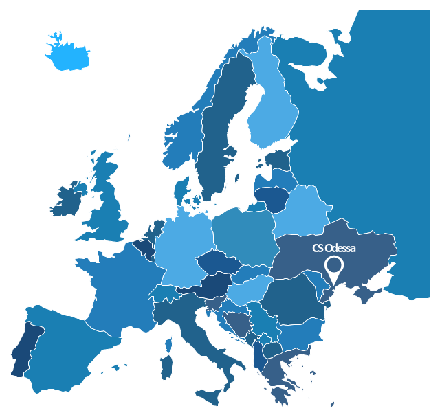
"A thematic map is a map that focuses on a specific theme or subject area, whereas in a general map the variety of phenomena - geological, geographical, political - regularly appear together. The contrast between them lies in the fact that thematic maps use the base data, such as coastlines, boundaries and places, only as points of reference for the phenomenon being mapped. General maps portray the base data, such as landforms, lines of transportation, settlements, and political boundaries, for their own sake." [Thematic map. Wikipedia]
The template "Europe thematic map" for the ConceptDraw PRO diagramming and vector drawing software is included in the Spatial Infographics solution from the area "What is Infographics" of ConceptDraw Solution Park.
The template "Europe thematic map" for the ConceptDraw PRO diagramming and vector drawing software is included in the Spatial Infographics solution from the area "What is Infographics" of ConceptDraw Solution Park.
Europe contour map
Venn Diagram Examples for Problem Solving. Environmental Social Science. Human Sustainability Confluence

Create your Venn diagrams for problem solving in environmental social science using the ConceptDraw PRO diagramming and vector drawing software extended with the Venn Diagrams solution from the area "What is a Diagram" of ConceptDraw Solution Park.
- Political map of Central America | Political map of Asia | Central Asia ...
- Percentage Spider Chart | Asia flags - Stencils library | South Asia ...
- Central Asia political map | Political map of Central America ...
- Southeast Asia - Political map | Geo Map - Asia | Asia - Vector ...
- Political map of Europe | Which Continent San Marino Flag In
- Draw About Political Map
- Middle East - Political map | Geo Map - Asia | Continent Maps ...
- Political map of Europe
- Benefit Corporation legislation - Thematic map | Continent Maps ...
- Geo Map - Europe - Russia
- 2D Directional map template
- Design elements - Geography | Geography - Vector stencils library ...
- Maps | Design elements - Thematic maps | Benefit Corporation ...
- How to Draw a Computer Network Diagrams
- Political map of Europe | Geo Map - Europe - Russia | Geo Map ...
- The 100th Tour de France - Route map | 2D Directional map ...
- Design elements - Europe | Spatial infographics Design Elements ...
- Political map of Europe | Tools to Create Your Own Infographics ...
- Building Drawing Software for Design Site Plan | Business diagrams ...
- Geo Map - Asia - India | Asia - Vector stencils library | South Asia ...
- ERD | Entity Relationship Diagrams, ERD Software for Mac and Win
- Flowchart | Basic Flowchart Symbols and Meaning
- Flowchart | Flowchart Design - Symbols, Shapes, Stencils and Icons
- Flowchart | Flow Chart Symbols
- Electrical | Electrical Drawing - Wiring and Circuits Schematics
- Flowchart | Common Flowchart Symbols
- Flowchart | Common Flowchart Symbols