Brilliant Examples of Infographics Map, Transport, Road

 Directional Maps
Directional Maps solution extends ConceptDraw DIAGRAM software with templates, samples and libraries of vector stencils for drawing the directional, location, site, transit, road and route maps, plans and schemes.
This location map sample was created on the base on the map "Location of the Migration Health Assessment Center (MHAC)" from the website of the U.S. Embassy in Nepal. "Applicants for U.S. immigrant visas and transportation letters are required to have medical examinations performed by IOM (International Organization for Migration) Embassy panel physicians. ... Health assessments for the immigrants to the US are conducted by the International Organization for Migration (IOM) at the Migration Health Assessment Center."
[nepal.usembassy.gov/ visas/ immigrant-visas/ medical-exams.html]
The location map example "Location of the Migration Health Assessment Center (MHAC)" was created using the ConceptDraw PRO diagramming and vector drawing software extended with the Directional Maps solution from the Maps area of ConceptDraw Solution Park.
Location map
.png--diagram-flowchart-example.png)
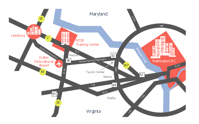
This location map sample was created on the base of the location map from the website of the NTSB Training Center.
"The NTSB Training Center is the training facility for the National Transportation Safety Board, an independent federal agency that investigates all civil aviation accidents in the United States and selected accidents in other modes of transportation.
The Training Center provides training for NTSB investigators and others from the transportation community to improve their practice of accident investigation techniques. The curriculum promotes independent, objective, and technically advanced accident investigations that will enhance the safety of all modes of transportation. ... Located on the Virginia campus of The George Washington University in Ashburn, the Training Center is ten miles from Washington Dulles Airport and 30 miles from Washington, D.C. Driving directions, maps, and a link to the virtual tour of our facility are available on the Campus page." [ntsb.gov/ trainingcenter/ about.htm]
The location map example "NTSB Training Center location" was created using the ConceptDraw PRO diagramming and vector drawing software extended with the Directional Maps solution from the Maps area of ConceptDraw Solution Park.
Location map
Spatial infographics Design Elements: Location Map

Sign Making Software

Sign making software is very useful tool for professional sign-making business. Use ConceptDraw DIAGRAM and make sure that now sign making is easier and timesaving than ever!
 ConceptDraw Solution Park
ConceptDraw Solution Park collects graphic extensions, examples and learning materials
Map Infographic Design
Map Infographic Tool
How tо Represent Information Graphically

 Spatial Infographics
Spatial infographics solution extends ConceptDraw DIAGRAM software with infographic samples, map templates and vector stencils libraries with design elements for drawing spatial information graphics.
 Maps
Maps
This solution extends ConceptDraw DIAGRAM.4 with the specific tools necessary to help you draw continental, directional, road, or transit maps, to represent international, business, or professional information visually.
Directions Maps

Building Drawing. Design Element Site Plan
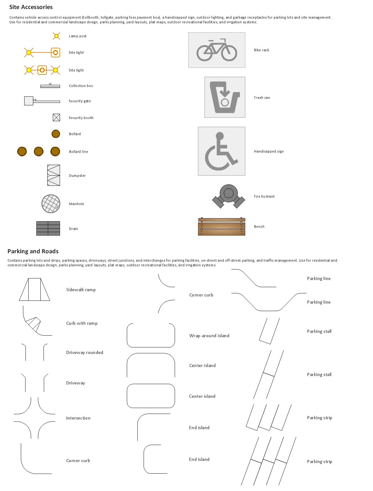
Use Site Plan symbols to draw your own residential and commercial landscape design, parks planning, yard layouts, plat maps, outdoor recreational facilities, and irrigation systems.

- Brilliant Examples of Infographics Map, Transport, Road | Maps ...
- Directions Map | How to Create a Directional Map Using ...
- Road Maps Location
- Spatial infographics Design Elements: Location Map | Directional ...
- Brilliant Examples of Infographics Map, Transport, Road | Map ...
- Directional Maps | How to Create a Directional Map Using ...
- Road Plan
- Example Of Road Transportation
- 3D pictorial road map | 2D Directional map - Template | Maps | Road ...
- Spatial infographics Design Elements: Location Map | Design ...
- Location Map Template
- 3D pictorial street map | Design elements - 3D directional maps ...
- Samples Of ER Model Diagram For Road
- Directional Map Software Examples
- Directional Map Software
- How To Create A 2d Location Map
- Road Transport - Design Elements | Aerospace and Transport ...
- Examples Of Road Transportation
- Design elements - Location map | Design elements - Location map ...
- Maps | Types of Map - Overview | Brilliant Examples of Infographics ...
- ERD | Entity Relationship Diagrams, ERD Software for Mac and Win
- Flowchart | Basic Flowchart Symbols and Meaning
- Flowchart | Flowchart Design - Symbols, Shapes, Stencils and Icons
- Flowchart | Flow Chart Symbols
- Electrical | Electrical Drawing - Wiring and Circuits Schematics
- Flowchart | Common Flowchart Symbols
- Flowchart | Common Flowchart Symbols