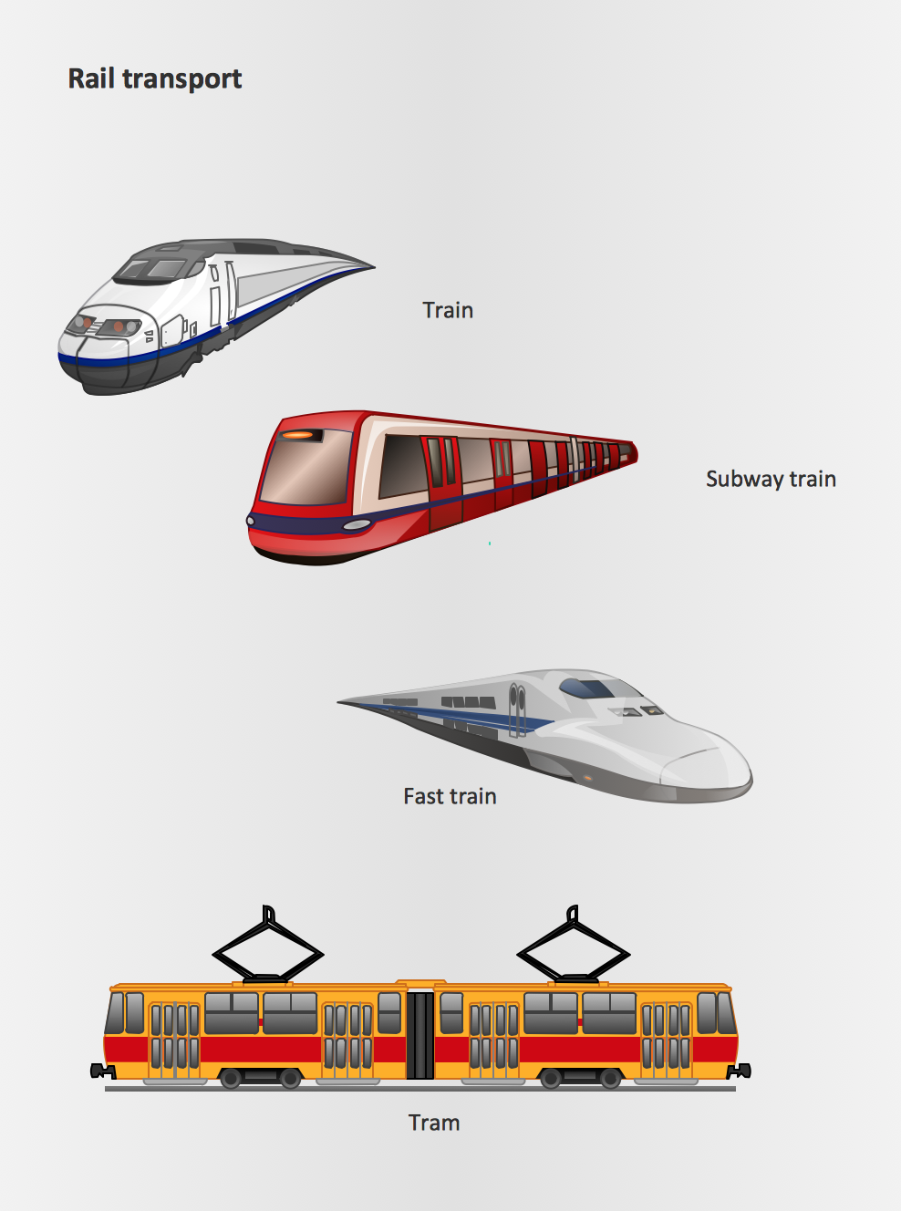
Rail transport - Design elements
The vector stencils library Rail transport contains clipart of railway transport for ConceptDraw PRO diagramming and vector drawing software.Use it to draw illustrations of trains and transportation of passengers and goods by railroads.
Geo Map of Americas
The Americas are the combined continental landmasses of North America and South America, in the Western Hemisphere. There are 35 sovereign states in the Americas.ConceptDraw is idea to draw the geological maps of America from the pre-designed vector geo map shapes and vector images map of america.
Use Continent Maps solution from the Maps area of ConceptDraw Solution Park to draw thematic maps, geospatial infographics and vector illustrations for your business documents, presentations and websites.
 Aerospace and Transport
This solution extends ConceptDraw PRO software with templates, samples and library of vector clipart for drawing the Aerospace and Transport Illustrations. It contains clipart of aerospace objects and transportation vehicles, office buildings and anci
How To Create Restaurant Floor Plan in Minutes
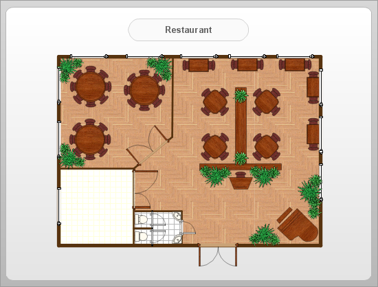
Restaurant Floor Plans solution for ConceptDraw PRO has 49 extensive restaurant symbol libraries that contains 1495 objects of building plan elements; many examples and templates for drawing floor plans and restaurant layouts.It helps make a layout for a restaurant — restaurant floor plans, cafe floor plans, bar area, floor plan of a fast food restaurant, restaurant furniture layout, etc.
ConceptDraw PRO — great restaurant floor planner. You do not need to be an artist to create great-looking restaurant floor plans in minutes.

How to draw Metro Map style infographics? Moscow, New York, Los Angeles, London
The solution handles designs of any complexity, and the comprehensive library covers all key aspects of a transportation system. To further enhance your map design, there is the option to embed links, that can display station images or other relevant, important information. We have also included a set of samples in the solution, that show the possible real-world application — complex tube systems including the London Tube and New York City Subway show the level of detail possible when using the Metro Map Solution.Planogram
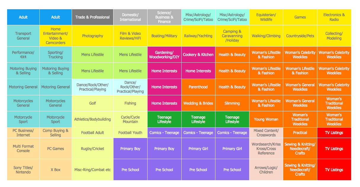
This example shows the planogram for magazines.This example was created in ConceptDraw PRO diagramming and vector drawing software using the Basic Diagramming Solution from the Universal Diagramming area of ConceptDraw Solution Park.
- Rail transport - Design elements | Metro Train Image Illustrator
- People Transport Illustrator Vector
- Rail transport - Design elements | How to draw Metro Map style ...
- Subway Train Map | How to draw Metro Map style infographics ...
- Industrial transport - Vector stencils library | Rail transport - Vector ...
- Transportation Infographics | Rail transport - Design elements ...
- Metro Train Map | Metro Map | How to draw Metro Map style ...
- Road Transport - Design Elements | Aerospace - Design Elements ...
- Illustrator Free Download
- Illustrator Software Download
- Illustrator Floor Plan Elements
- Vector Free Download Illustrator
- Business Process Illustrator Templates
- How to draw Metro Map style infographics? (London) | How to draw ...
- Stars and planets - Vector stencils library | Professions - Vector ...
- Design elements - Road transport | Telecom - Vector stencils library ...
- Metropolitan area networks (MAN). Computer and Network ...
- Plumbing and Piping Plans | Design elements - Bathroom | Design ...
- Infographic design elements, software tools Subway and Metro style ...
- https://www.conceptdraw.com/examples/uuo-element daily 0.56 http ...
- ERD | Entity Relationship Diagrams, ERD Software for Mac and Win
- Flowchart | Basic Flowchart Symbols and Meaning
- Flowchart | Flowchart Design - Symbols, Shapes, Stencils and Icons
- Flowchart | Flow Chart Symbols
- Electrical | Electrical Drawing - Wiring and Circuits Schematics
- Flowchart | Common Flowchart Symbols
- Flowchart | Common Flowchart Symbols


