HelpDesk
How to Draw Maps of Australia

Geo Map - Australia - Victoria

Geo Map — South America Continent

ConceptDraw DIAGRAM is idea to draw the geological maps of South America continent from the pre-designed vector geo map shapes.
Use Continent Maps solution from the Maps area of ConceptDraw Solution Park to draw thematic maps, geospatial infographics and vector illustrations for your business documents, presentations and websites.
Geo Map - Australia - South Australia

Geo Map — Australia — New Zealand

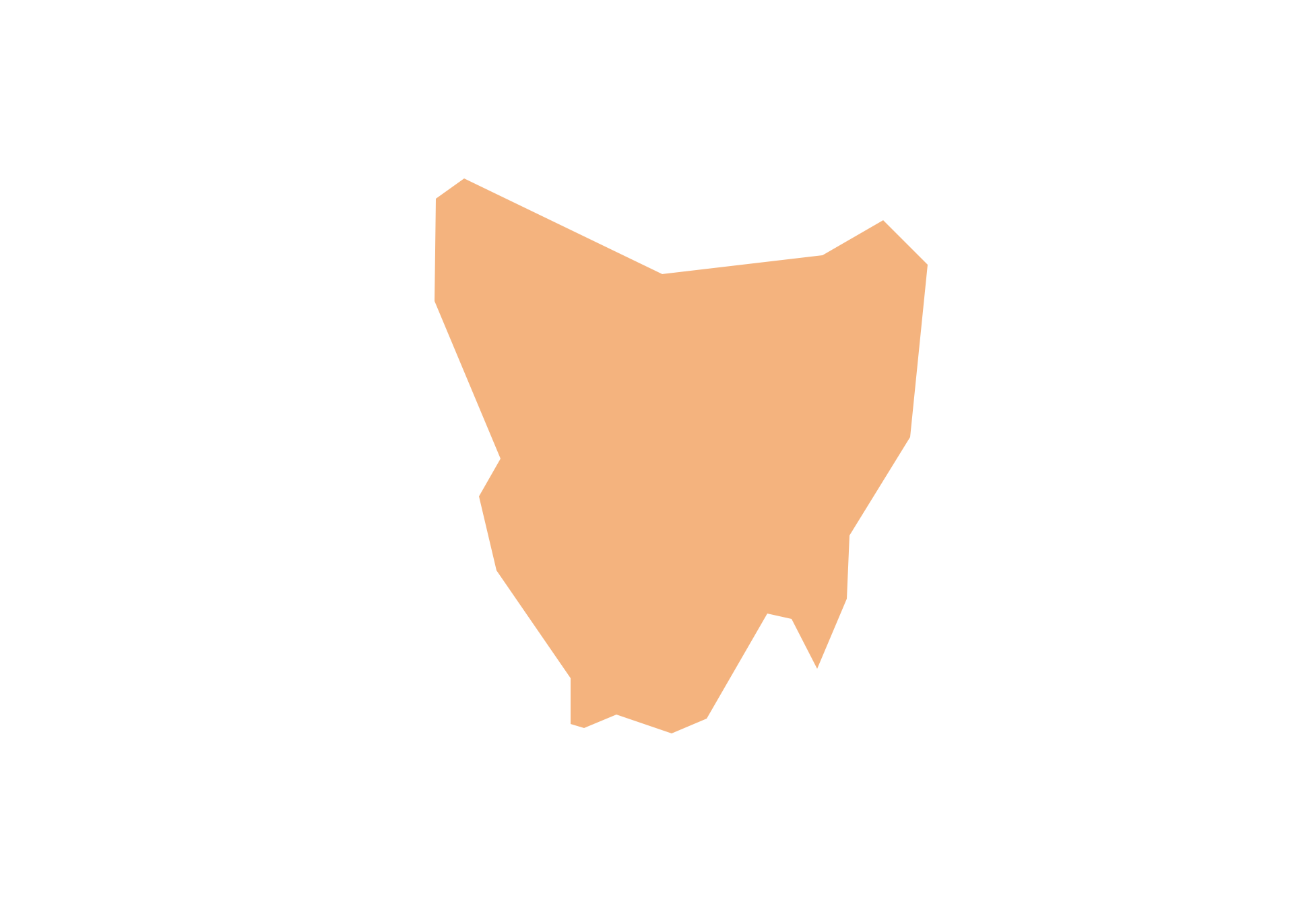
Geo Map - Australia - Tasmania
Geo Map - Australia - New South Wales

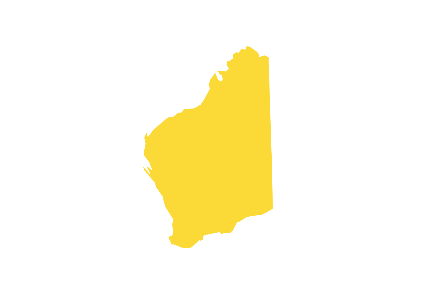
Geo Map - Australia - Western Australia
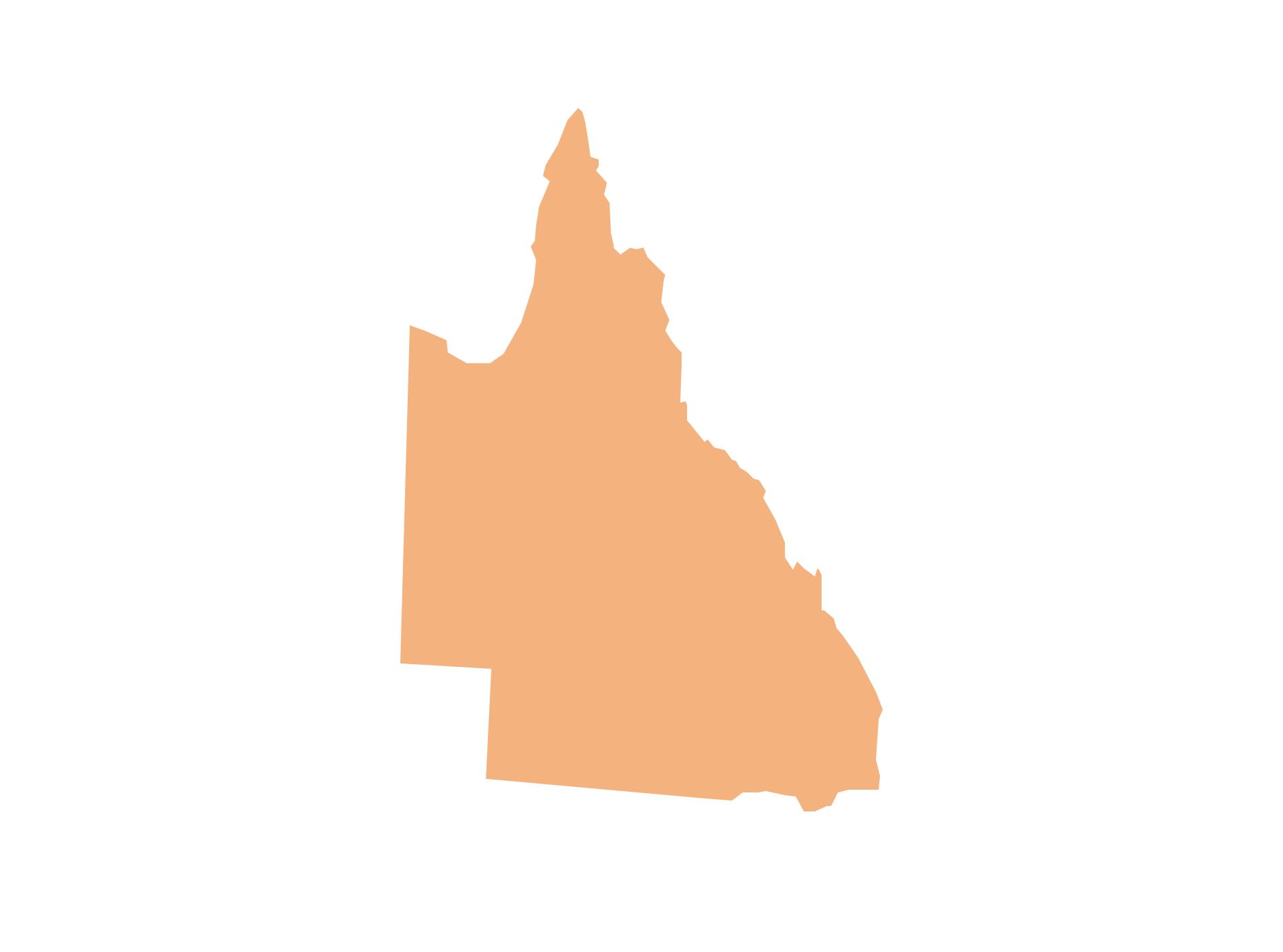
Geo Map - Australia - Queensland
 Australia Map
For graphic artists creating accurate maps of Australia. The Australia Map solution - allows designers to map Australia for their needs, offers a collection of scalable graphics representing the political geography of Australia, split into distinct state
HelpDesk
How to Create a Map of Germany

Geo Map - Australia - Nothern Territory

Geo Map — United States of America Map

ConceptDraw is idea to draw the geological map of the United States of America from the pre-designed vector geo map shapes.
Each map is scaled, with the option to add further levels of detail - county borders, their names, capitals and major cities can be shown or hidden using the action menu for each state map. ConceptDraw DIAGRAM gives you full control over map size, shading, color fills and alignment.
Use the Continent Maps solution for easy drawing professional looking geological maps, thematic maps, geospatial infographics and vector illustrations for your business documents, presentations and websites.
Map of Germany — Saarland State

Despite the fact that the maps surround us everywhere in our life, usually the process of their drawing is sufficienly complex and labor-intensive. But now, thanks to the ConceptDraw DIAGRAM diagramming and vector drawing software extended with Germany Map Solution from the Maps Area of ConceptDraw Solution Park, we have the possibility to make easier this process. Design fast and easy your own pictorial maps of Germany, map of Germany with cities, and thematic Germany maps in ConceptDraw DIAGRAM!
Geo Map - Australia

 Continent Maps
Continent Maps solution extends ConceptDraw DIAGRAM software with templates, samples and libraries of vector stencils for drawing the thematic maps of continents, state maps of USA and Australia.
Map of Germany — Saxony State
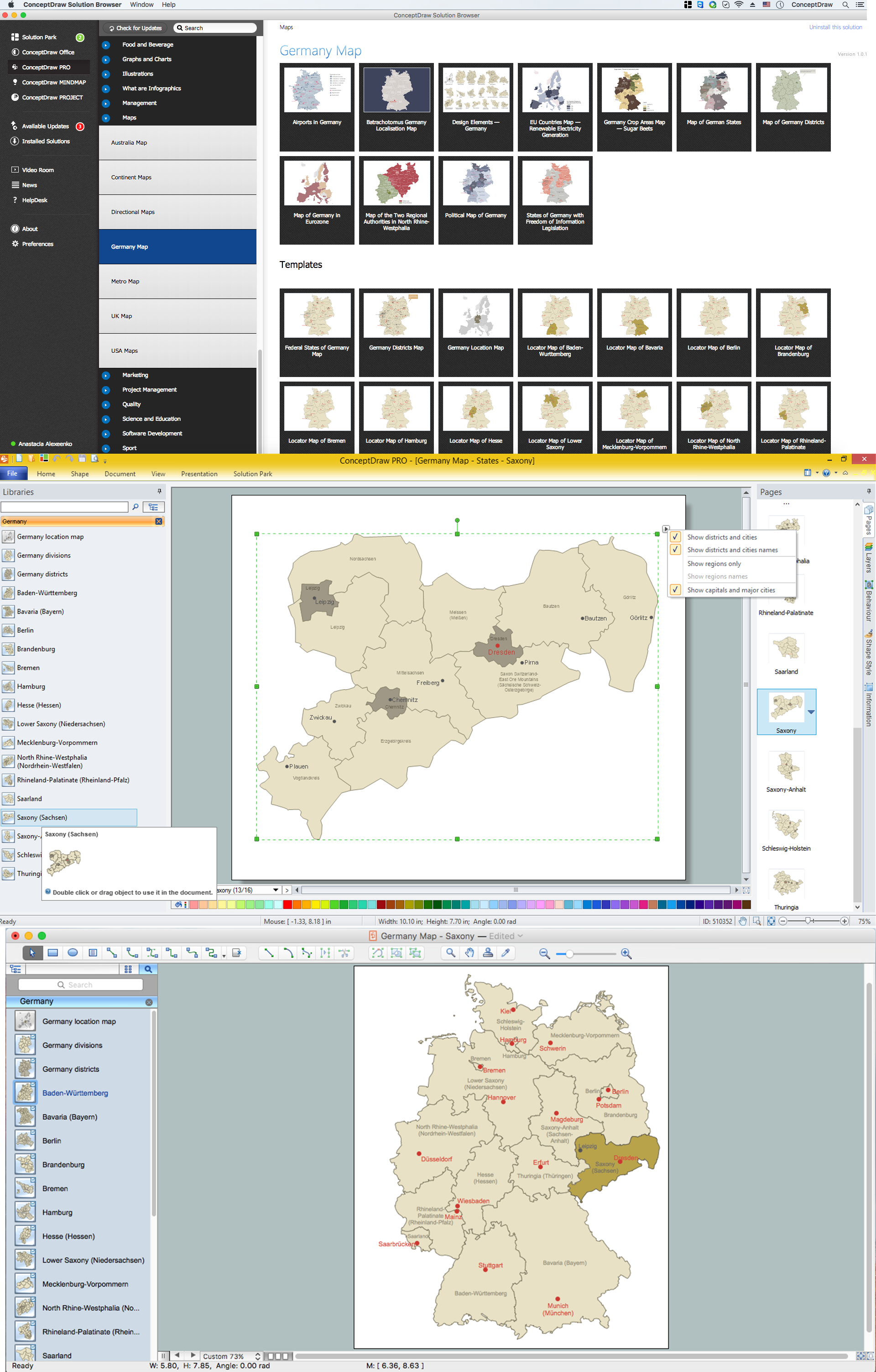
Despite the fact that the maps surround us everywhere in our life, usually the process of their drawing is sufficienly complex and labor-intensive. But now, thanks to the ConceptDraw DIAGRAM diagramming and vector drawing software extended with Germany Map Solution from the Maps Area of ConceptDraw Solution Park, we have the possibility to make easier this process. Design fast and easy your own pictorial maps of Germany, map of Germany with cities, and thematic Germany maps in ConceptDraw DIAGRAM!
Map of Germany — Hesse State
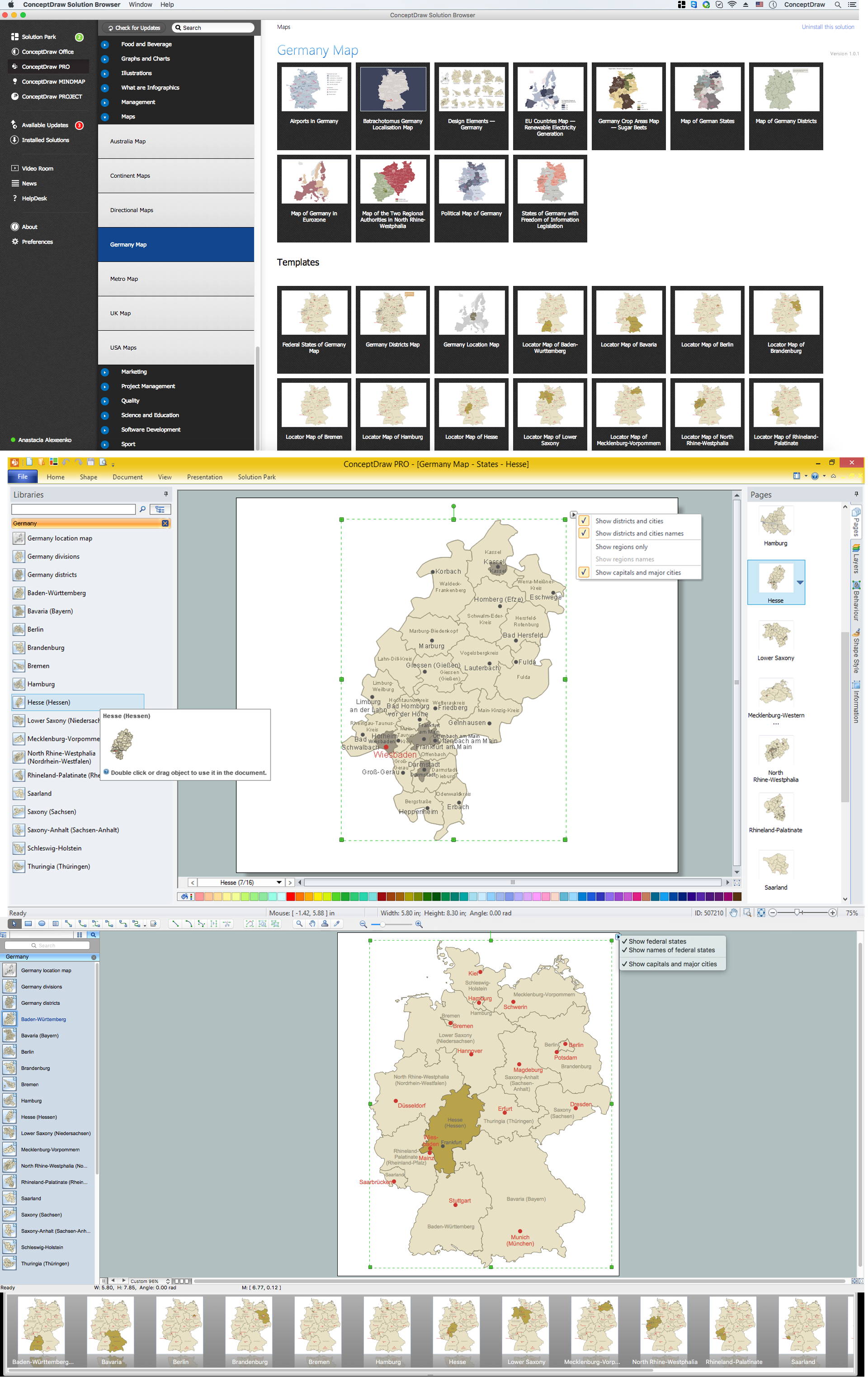
Despite the fact that the maps surround us everywhere in our life, usually the process of their drawing is sufficienly complex and labor-intensive. But now, thanks to the ConceptDraw DIAGRAM diagramming and vector drawing software extended with Germany Map Solution from the Maps Area of ConceptDraw Solution Park, we have the possibility to make easier this process. Design fast and easy your own pictorial maps of Germany, map of Germany with cities, and thematic Germany maps in ConceptDraw DIAGRAM!
Map of Germany — Saxony-Anhalt State
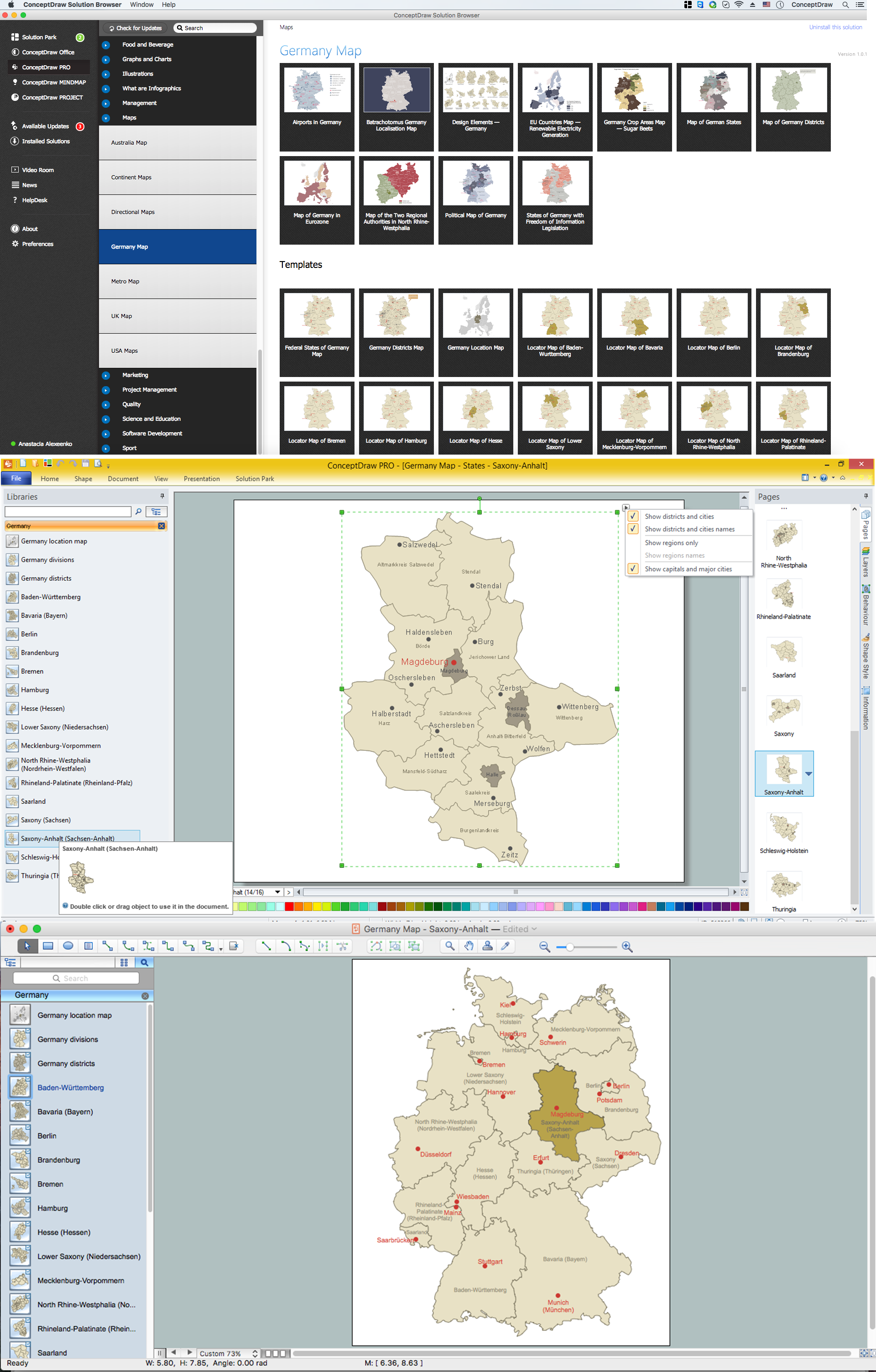
Despite the fact that the maps surround us everywhere in our life, usually the process of their drawing is sufficienly complex and labor-intensive. But now, thanks to the ConceptDraw DIAGRAM diagramming and vector drawing software extended with Germany Map Solution from the Maps Area of ConceptDraw Solution Park, we have the possibility to make easier this process. Design fast and easy your own pictorial maps of Germany, map of Germany with cities, and thematic Germany maps in ConceptDraw DIAGRAM!
Geo Map — Europe — Germany

- Australia Map | How to Draw Maps of Australia Using ConceptDraw ...
- Australia states time zones - Thematic map | How to Draw Maps of ...
- Continent Map Australia
- Australia Map Example
- How to Draw a Map of USA States Using ConceptDraw PRO | Geo ...
- How to Draw Maps of Australia Using ConceptDraw PRO | Geo Map ...
- Australia Map Clip Art
- Map of USA with state names | Geo Map - United States of America ...
- Benefit Corporation legislation - Thematic map | Ranks US states by ...
- Geo Map - Australia - New Zealand
- Geo Map - Australia - New Zealand
- Continents Map | Continent Maps | How to Draw a Map of North ...
- Geo Map - United States of America Map | Continent Maps | Map of ...
- How to Draw a Map of North America Using ConceptDraw PRO ...
- How to Draw a Map of North America Using ConceptDraw PRO ...
- Australia map - Template | Australia management infogram ...
- Continent Map
- How to Draw a Map of North America Using ConceptDraw PRO ...
- Design elements - Thematic maps | How to Create a Map Depicting ...
- Organizational chart - United States Department of Labor | Bar ...
- ERD | Entity Relationship Diagrams, ERD Software for Mac and Win
- Flowchart | Basic Flowchart Symbols and Meaning
- Flowchart | Flowchart Design - Symbols, Shapes, Stencils and Icons
- Flowchart | Flow Chart Symbols
- Electrical | Electrical Drawing - Wiring and Circuits Schematics
- Flowchart | Common Flowchart Symbols
- Flowchart | Common Flowchart Symbols