Geo Map — South America Continent

ConceptDraw DIAGRAM is idea to draw the geological maps of South America continent from the pre-designed vector geo map shapes.
Use Continent Maps solution from the Maps area of ConceptDraw Solution Park to draw thematic maps, geospatial infographics and vector illustrations for your business documents, presentations and websites.
Geo Map — Asia

There are 116 vector shapes illustrating the Asia countries flags in colours as they are and you can always use some of them or all of them.
Geo Map — United States of America Map

ConceptDraw is idea to draw the geological map of the United States of America from the pre-designed vector geo map shapes.
Each map is scaled, with the option to add further levels of detail - county borders, their names, capitals and major cities can be shown or hidden using the action menu for each state map. ConceptDraw DIAGRAM gives you full control over map size, shading, color fills and alignment.
Use the Continent Maps solution for easy drawing professional looking geological maps, thematic maps, geospatial infographics and vector illustrations for your business documents, presentations and websites.
Geo Map Software

Geo Map — Europe — Greece

The vector stencils library Greece contains contours for ConceptDraw DIAGRAM diagramming and vector drawing software. This library is contained in the Continent Maps solution from Maps area of ConceptDraw Solution Park.
Geo Map of Americas

ConceptDraw is idea to draw the geological maps of America from the pre-designed vector geo map shapes and vector images map of america.
Use Continent Maps solution from the Maps area of ConceptDraw Solution Park to draw thematic maps, geospatial infographics and vector illustrations for your business documents, presentations and websites.
Map of Continents

World Continents Map

Geo Map - Africa

Vector design elements library Africa contains country map contours, geographical maps, cartograms and thematic maps for ConceptDraw DIAGRAM diagramming and vector drawing software. To help visualize the business and thematic information connected with geographic areas, locations or customs.
All ConceptDraw DIAGRAM documents are vector graphic files and are available for reviewing, modifying, and converting to a variety of formats: image, HTML, PDF file, MS PowerPoint Presentation, Adobe Flash, MS Visio (.VDX,.VSDX).
Continents Map

Geo Map - South America - Cuba

The vector stencils library Cuba contains contours for ConceptDraw DIAGRAM diagramming and vector drawing software. This library is contained in the Continent Maps solution from Maps area of ConceptDraw Solution Park.
Geo Map - Australia

Geo Map - South America - Paraguay

The vector stencils library Paraguay contains contours for ConceptDraw DIAGRAM diagramming and vector drawing software. This library is contained in the Continent Maps solution from Maps area of ConceptDraw Solution Park.
Geo Map — Europe — Germany

Geo Map - Canada - Manitoba
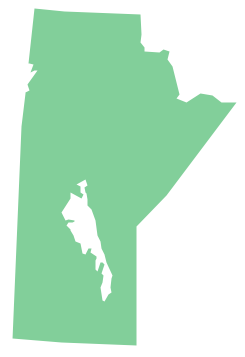
The vector stencils library Manitoba contains contours for ConceptDraw DIAGRAM diagramming and vector drawing software. This library is contained in the Continent Maps solution from Maps area of ConceptDraw Solution Park.
Geo Map - South America - Jamaica

The vector stencils library Jamaica contains contours for ConceptDraw DIAGRAM diagramming and vector drawing software. This library is contained in the Continent Maps solution from Maps area of ConceptDraw Solution Park.
Geo Map - Europe - Croatia

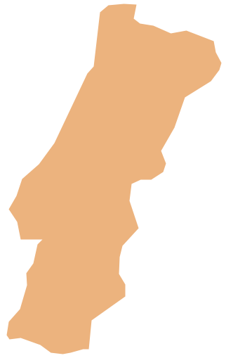
Geo Map - Europe - Portugal
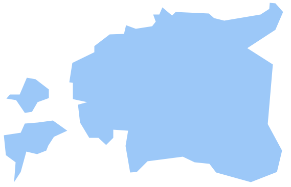
Geo Map - Europe - Estonia
Geo Map — Europe

- Continent Maps | Geo Map - South America Continent | Geo ...
- Continent Maps | Geo Map - South America Continent | Continent ...
- Maps | Continent Maps | Geo Map - Africa | Drawing Of Map Of The ...
- Geo Map - United States of America Map | Continent Maps | Map of ...
- Geo Map - Australia | Continent Maps | Map of median household ...
- Geo Map - South America Continent | Geo Map Software | Geo Map ...
- Continent Maps | Geo Map - Europe - Germany | Design elements ...
- Geo Map of America | Geo Map - South America Continent | Geo ...
- Geo Map - Asia | Continent Maps | Continents Map | Asia Continent ...
- Geo Map
- Continent Maps | How to Draw a Geographical Map Quickly | Geo ...
- Geo Map - South America Continent | How to Draw a Map of North ...
- Geo Mapping Software Examples - World Map Outline | World ...
- Maps Of The Continents
- Geo Map - South America Continent | Continent Maps | Geo Map of
- Geo Mapping Software Examples - World Map Outline | Geo Map ...
- Design elements - Asia | Geo Map - Asia | Continent Maps | Asian ...
- Continent Maps | Geo Map - Europe - Germany | Geo Map - Europe ...
- Geo Map - World | Geo Map Software | Types of Map - Overview ...
- Continent Maps | Geo Map Software | Design elements - South ...
- ERD | Entity Relationship Diagrams, ERD Software for Mac and Win
- Flowchart | Basic Flowchart Symbols and Meaning
- Flowchart | Flowchart Design - Symbols, Shapes, Stencils and Icons
- Flowchart | Flow Chart Symbols
- Electrical | Electrical Drawing - Wiring and Circuits Schematics
- Flowchart | Common Flowchart Symbols
- Flowchart | Common Flowchart Symbols