HelpDesk
How to Plan Projects Effectively Using Solutions

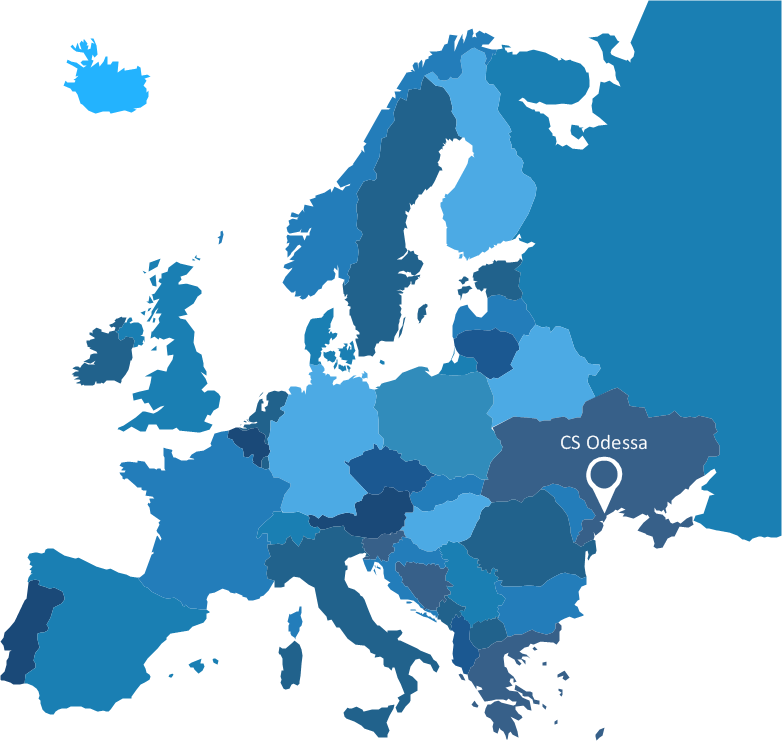
Geo Map — United States of America Map

ConceptDraw is idea to draw the geological map of the United States of America from the pre-designed vector geo map shapes.
Each map is scaled, with the option to add further levels of detail - county borders, their names, capitals and major cities can be shown or hidden using the action menu for each state map. ConceptDraw DIAGRAM gives you full control over map size, shading, color fills and alignment.
Use the Continent Maps solution for easy drawing professional looking geological maps, thematic maps, geospatial infographics and vector illustrations for your business documents, presentations and websites.
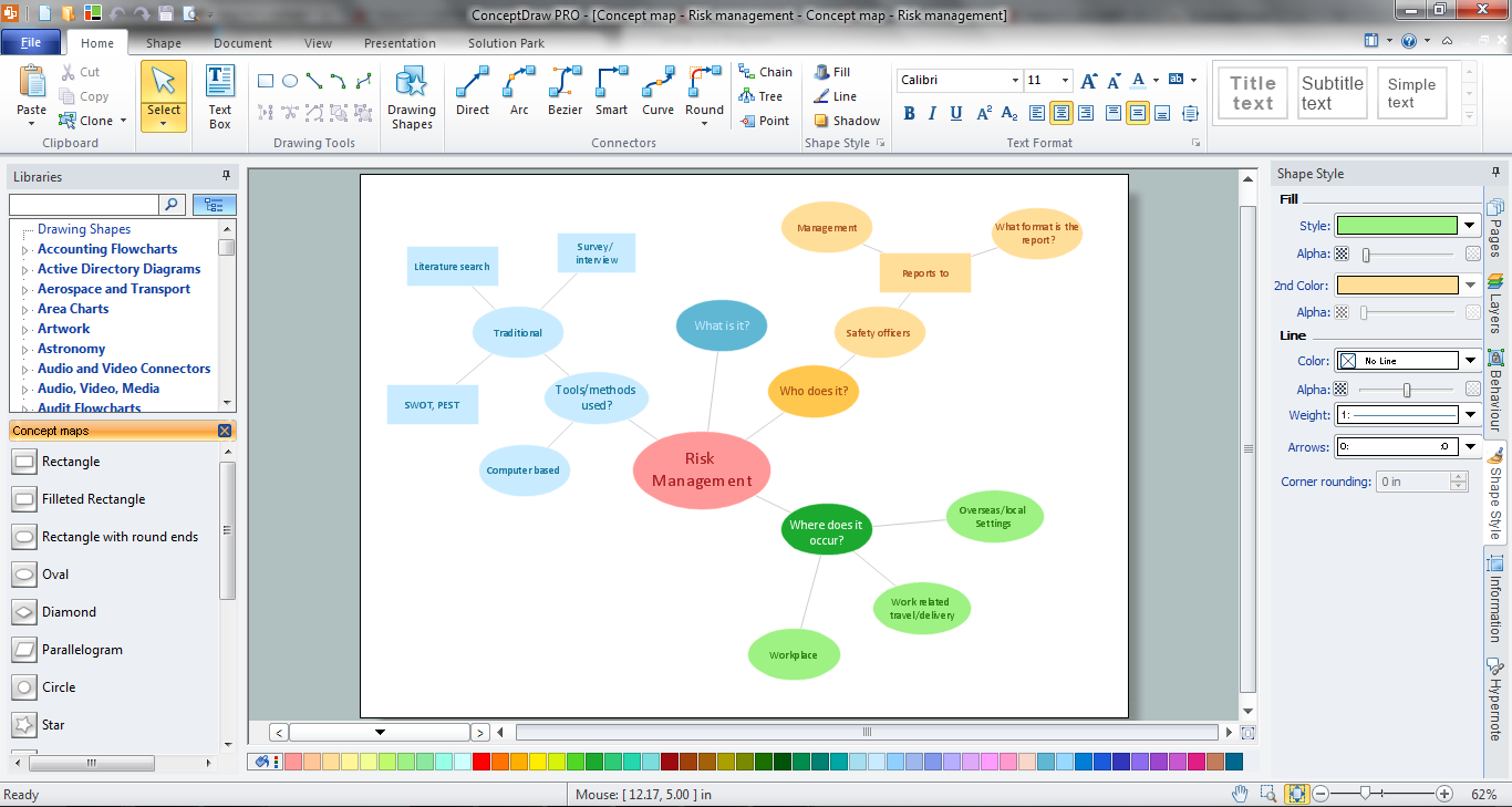
How To Make a Concept Map
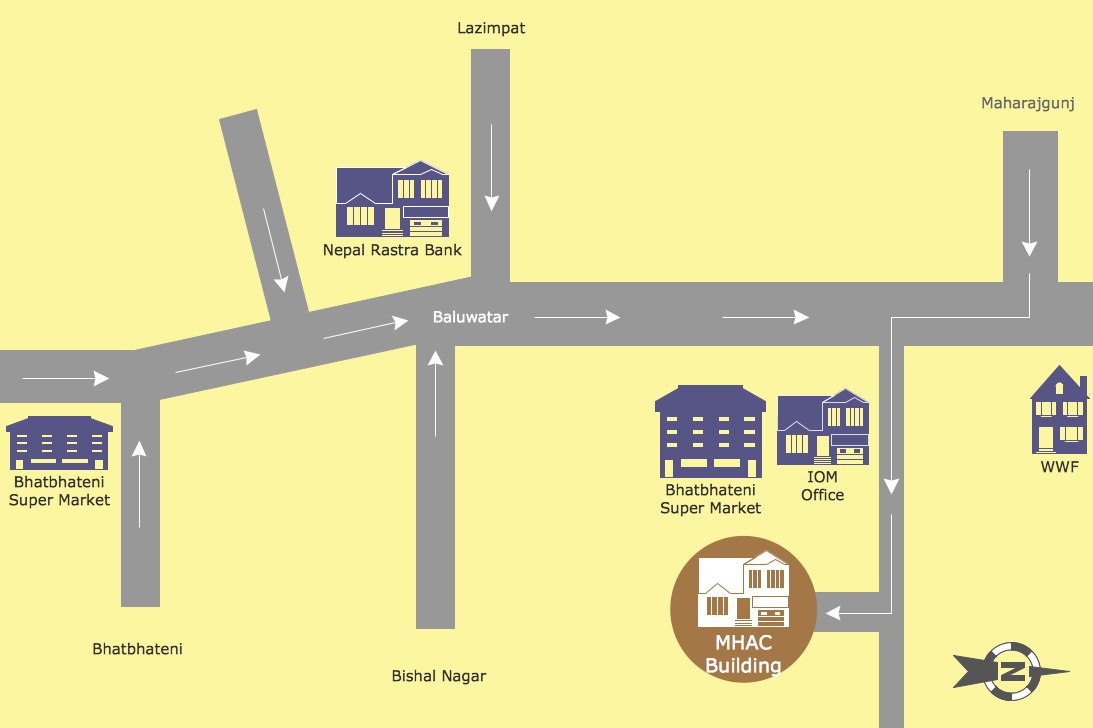
Map Directions
Map of Germany

Maps of Germany With Cities

UK Map

ConceptDraw DIAGRAM diagramming and vector drawing software offers the unique Map of UK Solution from the Maps Area of ConceptDraw Solution Park that is indispensable for easy drawing professional looking map of UK, UK counties map, UK map with cities, map of Scotland, map of England, map of Wales, Northern Ireland map.
 PM Easy
PM Easy solution extends the ConceptDraw PROJECT functionality with an ability to support neutral methodology of project management and to quickly start a project by listing the task relationships and dependencies, that makes the iterative planning much easier. The project management tool and available visual tools, such as mind mapping, increase the effectiveness of tracking and analysis your project tasks. PM Easy solution from ConceptDraw Solution Park is mainly targeted at project managers in small or medium-sized companies, allowing them to make the project plan and execute projects using mind mapping technique, to implement planning using mind mapping, and to track tasks using ConceptDraw PROJECT application.
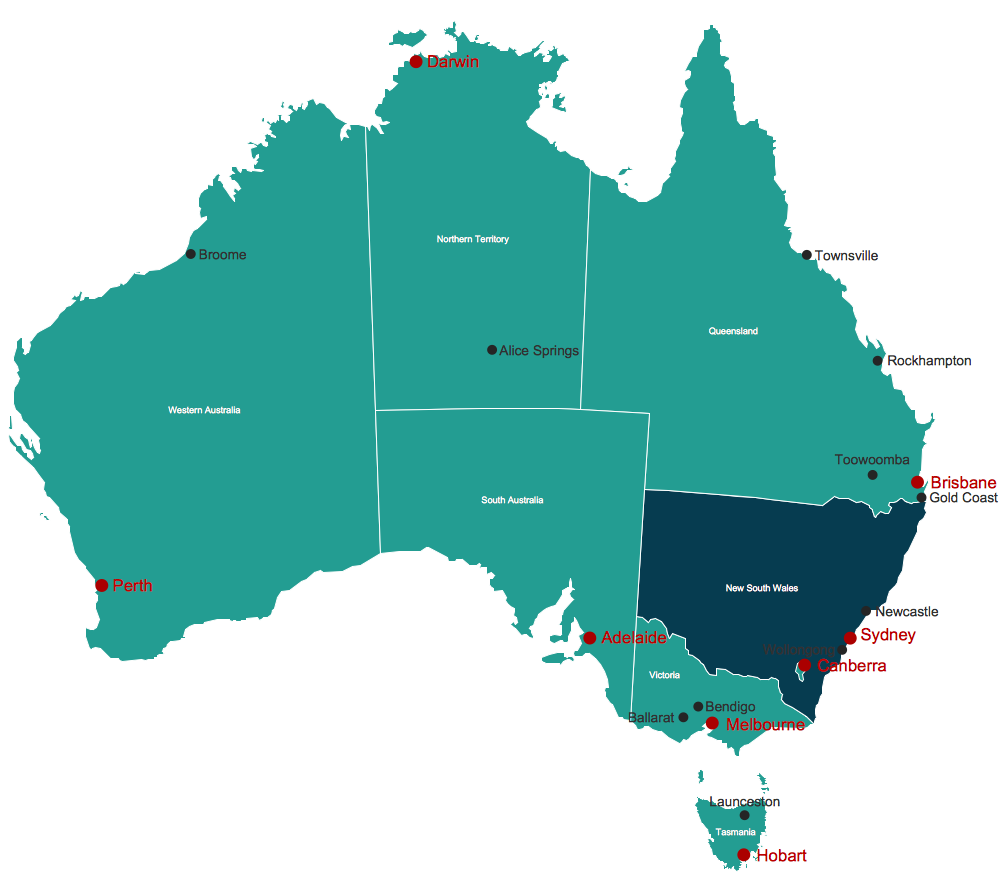
Map Australia
Vector Map of Germany

Map of Germany — Schleswig-Holstein State
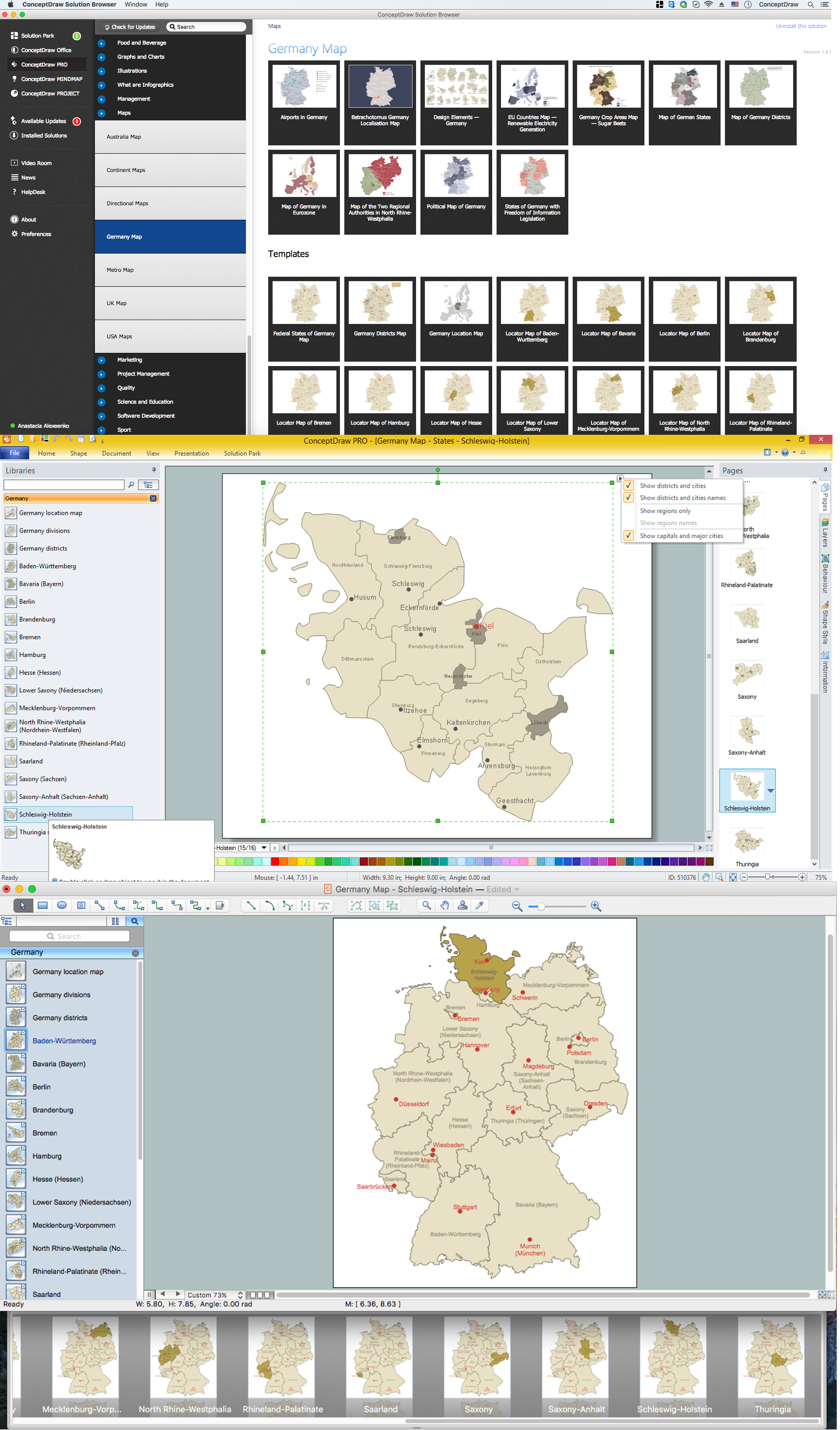
Despite the fact that the maps surround us everywhere in our life, usually the process of their drawing is sufficienly complex and labor-intensive. But now, thanks to the ConceptDraw DIAGRAM diagramming and vector drawing software extended with Germany Map Solution from the Maps Area of ConceptDraw Solution Park, we have the possibility to make easier this process. Design fast and easy your own pictorial maps of Germany, map of Germany with cities, and thematic Germany maps in ConceptDraw DIAGRAM!
Map of USA

Map of UK

How to design the Map of UK fast and easy? It is incredibly convenient to use special software. ConceptDraw DIAGRAM diagramming and vector drawing software offers the Map of UK Solution from the Maps Area of ConceptDraw Solution Park specially developed to make easier drawing the maps of UK counties, various UK related thematic maps and cartograms on their base.
Visualization Spatial Data Using Thematic Maps Combined with Infographics
Nice and simple, but the features it have are power-packed!
Concept Map
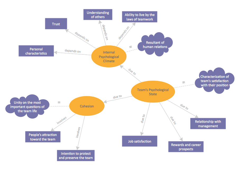
How to draw a Concept Map quick, easy and effective? ConceptDraw DIAGRAM offers the unique Concept Maps Solution from the "Diagrams" Area that will help you!
- Easy Map Drawing
- Easy Map Of Uk
- Map of Germany | Geo Map Software | Maps of Germany | Easy Map ...
- Easy To Draw Map Of Europe
- Metro Train Map | Metro Path Map | Metro Map | Easy Drawing For ...
- Continents and Oceans Map | Continent Maps | AWS | Easy ...
- Fishbone Diagram | PM Easy | Metro Map | How To Construct A ...
- Metro Map | PM Easy | Seven Management and Planning Tools ...
- How to Report on Project Milestones Using a Mind Map | PM Easy ...
- eLearning - Easy English on Skype | Recruitment | Geo Map - South ...
- How to Plan Projects Effectively Using Mind Maps and PM Easy ...
- Gantt chart examples | PM Easy | How to Draw a Mind Map on Mac ...
- Geo Map - United States of America Map | USA Maps | Map of USA ...
- Easy To Draw Renewable Resource
- Launch Projects Exchanging Mind Maps with Evernote | PM Easy ...
- Continent Maps | Geo Map - Asia | Continents Map | Easy To Draw ...
- MTA Subway Map
- Maps and Directions | Metro Map | Easy To Draw Subway Map
- PM Presentations | PM Easy | Communication Tool for Remote ...
- eLearning - Easy English on Skype | eLearning: Speaking English ...
- ERD | Entity Relationship Diagrams, ERD Software for Mac and Win
- Flowchart | Basic Flowchart Symbols and Meaning
- Flowchart | Flowchart Design - Symbols, Shapes, Stencils and Icons
- Flowchart | Flow Chart Symbols
- Electrical | Electrical Drawing - Wiring and Circuits Schematics
- Flowchart | Common Flowchart Symbols
- Flowchart | Common Flowchart Symbols