Basic Diagramming


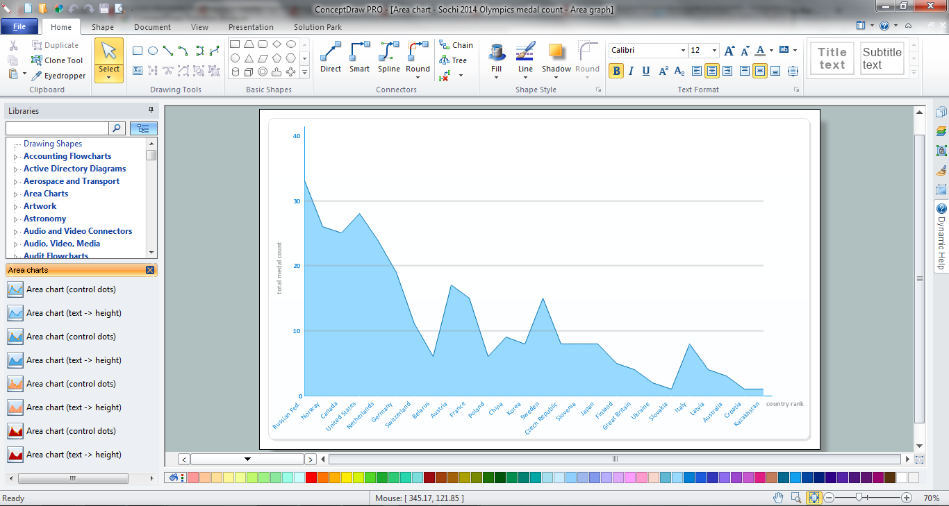
Area Chart
Map of Germany — Saarland State

Despite the fact that the maps surround us everywhere in our life, usually the process of their drawing is sufficienly complex and labor-intensive. But now, thanks to the ConceptDraw DIAGRAM diagramming and vector drawing software extended with Germany Map Solution from the Maps Area of ConceptDraw Solution Park, we have the possibility to make easier this process. Design fast and easy your own pictorial maps of Germany, map of Germany with cities, and thematic Germany maps in ConceptDraw DIAGRAM!
Infographic Maker

Geo Map - Australia - Victoria

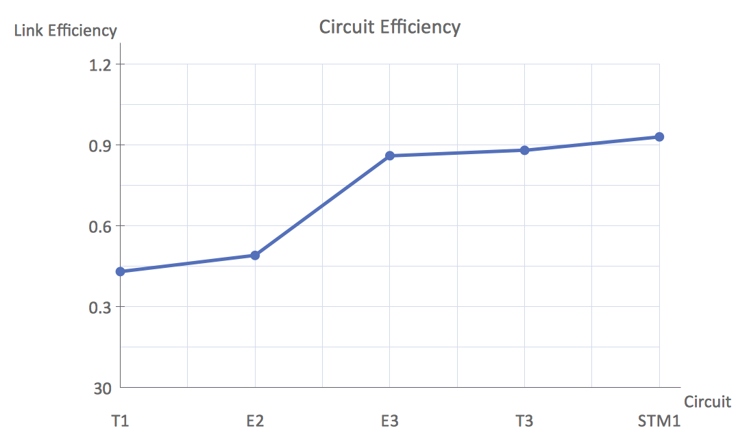
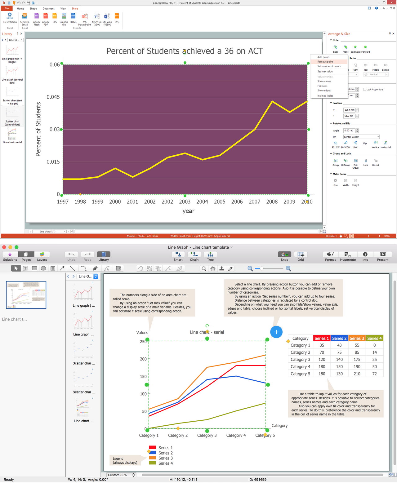
Line Chart Examples
What Is a Line Chart
Australia Map — New South Wales
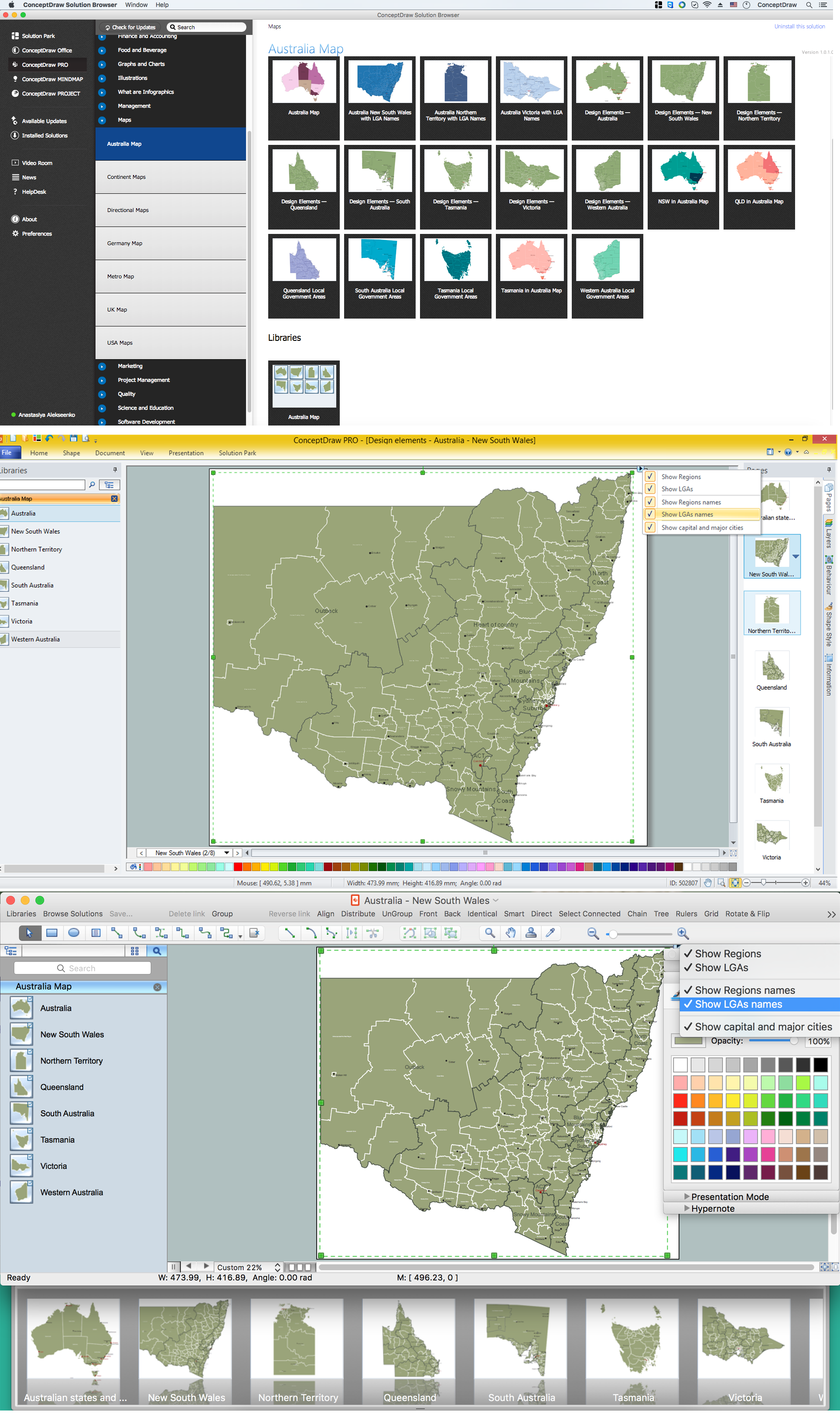
Maps surround us everywhere in our life, study, work, traveling, they are widely used in geography, history, politics, economics, and many other fields of science and life activity. But designing of maps is usually complex and labor-intensive process. Now we have the possibility to make easier this process - ConceptDraw DIAGRAM diagramming and vector drawing software extended with Australia Map Solution from the Maps Area of ConceptDraw Solution Park will help us in easy drawing detailed Australia map.
Geo Map — United States of America Map

ConceptDraw is idea to draw the geological map of the United States of America from the pre-designed vector geo map shapes.
Each map is scaled, with the option to add further levels of detail - county borders, their names, capitals and major cities can be shown or hidden using the action menu for each state map. ConceptDraw DIAGRAM gives you full control over map size, shading, color fills and alignment.
Use the Continent Maps solution for easy drawing professional looking geological maps, thematic maps, geospatial infographics and vector illustrations for your business documents, presentations and websites.
Geo Map - Europe - United Kingdom

Line Graph
Map of UK — Wales Subdivisions and Towns
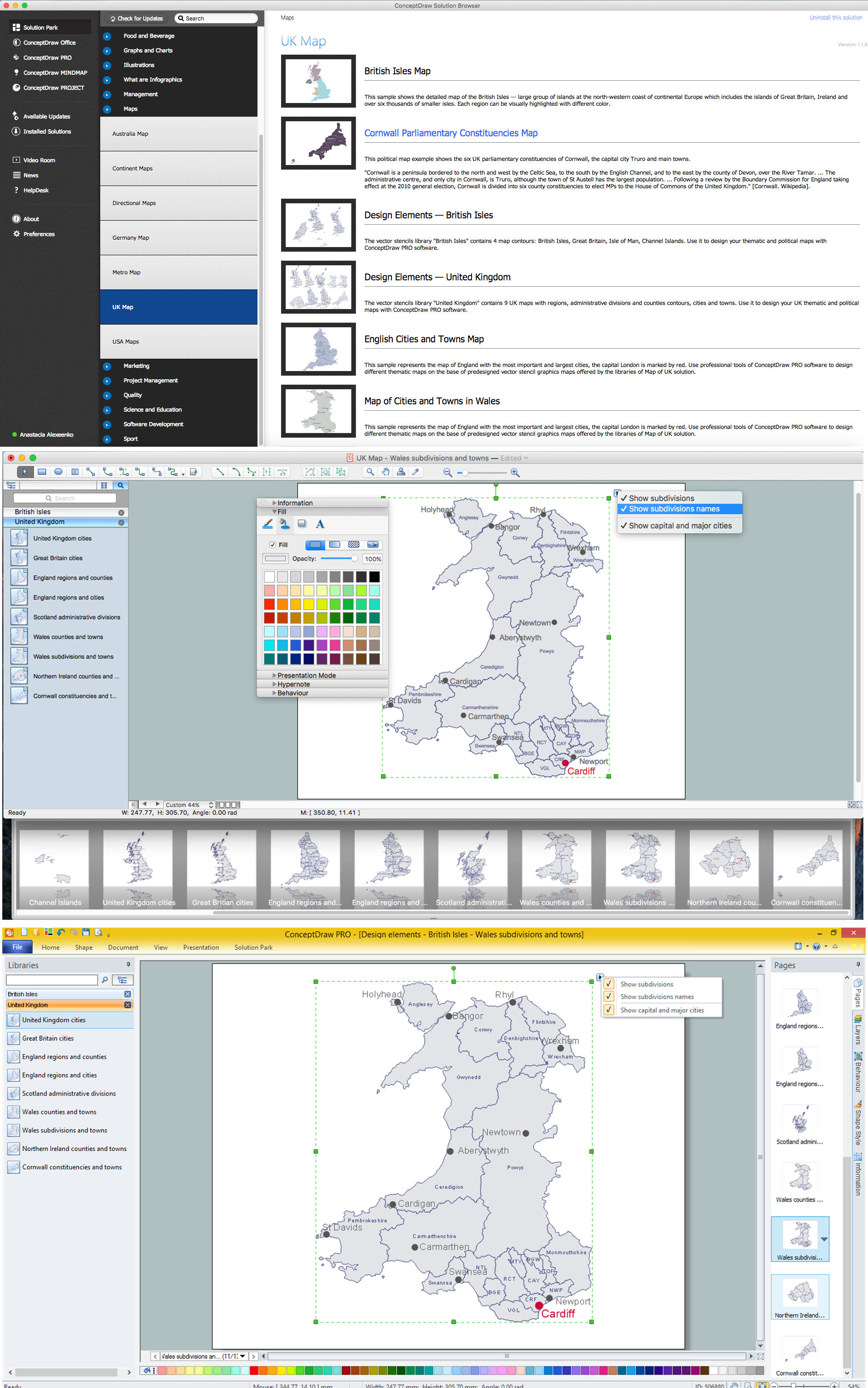
How to design the Map of UK fast and easy? It is incredibly convenient to use special software. ConceptDraw DIAGRAM diagramming and vector drawing software offers the Map of UK Solution from the Maps Area of ConceptDraw Solution Park specially developed to make easier drawing the maps of UK counties, various UK related thematic maps and cartograms on their base.
Sample Pictorial Chart. Sample Infographics

Use Pictorial Infographics solution to draw your own design pictorial infographics documents quick and easy.
Australia Map — Northern Territory
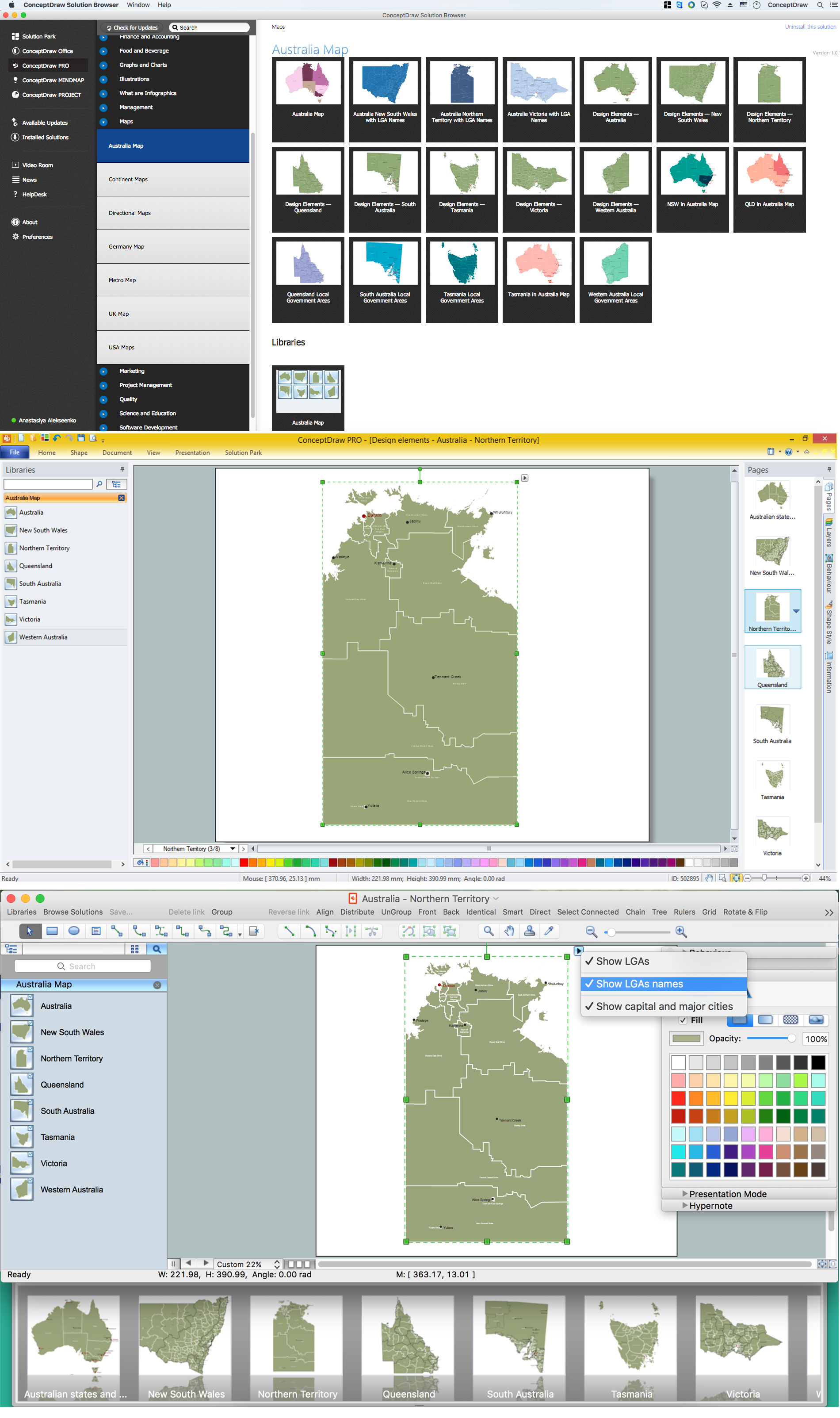
Maps surround us everywhere in our life, study, work, traveling, they are widely used in geography, history, politics, economics, and many other fields of science and life activity. But designing of maps is usually complex and labor-intensive process. Now we have the possibility to make easier this process - ConceptDraw DIAGRAM diagramming and vector drawing software extended with Australia Map Solution from the Maps Area of ConceptDraw Solution Park will help us in easy drawing detailed Australia map.
Maps of Germany With Cities

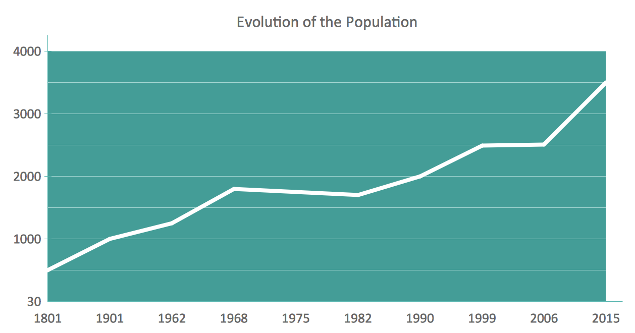
- Easy Drawing Of Population
- An Easy Diagram Of Population
- World Population Chart Drawing
- Easy Chart On Population
- Easy Graph Of Population
- Population Easy
- Solution For Population Explosion In Drawing
- Basic Diagramming | Area Chart | Line Chart Examples | Population ...
- Population Education Pictures Chart Making
- Easy Drawing On Population
- Population Chart Drawing
- Drawing On World Population
- Chart On World Population For Drawing
- World Population Growth Presentation
- Population growth by continent | Infographic Maker | Sample ...
- World Population Draw Diagram
- Populations Explosion Drawing
- Population Graph In Graphics Documentation Free Download
- Basic Diagramming | Regional population growth from 2010 to 2016 ...
- Picture Graph | Pictures of Graphs | Basic Diagramming | Population ...
- ERD | Entity Relationship Diagrams, ERD Software for Mac and Win
- Flowchart | Basic Flowchart Symbols and Meaning
- Flowchart | Flowchart Design - Symbols, Shapes, Stencils and Icons
- Flowchart | Flow Chart Symbols
- Electrical | Electrical Drawing - Wiring and Circuits Schematics
- Flowchart | Common Flowchart Symbols
- Flowchart | Common Flowchart Symbols