Types of Map - Overview

Tools to Create Your Own Infographics

Spatial infographics Design Elements: Transport Map

Basic Diagramming

Use Basic Diagramming solution to draw you own diagrams, charts and graphs for graphic communication, explanation of business and personal ideas and concepts, simple visual presentation of numerical data, complex structures, logical relations, step-by-step flows of actions or operations.

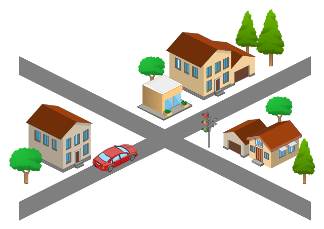
Use this template for creating the 3D pictorial road maps, directional maps, location plans, site plans, transit maps, route maps.
"Road maps can ... vary in complexity, from a simple schematic map used to show how to get to a single specific destination (such as a business), to a complex electronic map, which may layer together many different types of maps and information" [Road map. Wikipedia]
This template for the ConceptDraw PRO diagramming and vector drawing software is included in the Directional Maps solution from the Maps area of ConceptDraw Solution Park.
3D pictorial road map template
The vector stencils library "3D directional maps" contains 40 symbols for creating pictorial maps, street maps, locator maps, transit maps, tourist maps with points of interest (POI), road maps and route maps using the ConceptDraw PRO diagramming and vector drawing software.
"Pictorial maps are a category of maps that are also loosely called illustrated maps, panoramic maps, perspective maps, bird’s-eye view maps and Geopictorial maps amongst others. In contrast to the regular road map, Atlas or topographic cartography, pictorial maps depict a given territory with a more artistic rather than technical style. The cartography can be a sophisticated 3-D perspective landscape or a simple map graphic enlivened with illustrations of buildings, people and animals. They can feature all sorts of varied topics like historical events, legendary figures or local agricultural products and cover anything from an entire continent to a college campus. ...
Pictorial maps usually show an area as if viewed from above at an oblique angle. They are not generally drawn to scale in order to show street patterns, individual buildings, and major landscape features in perspective. While regular maps focus on the accurate rendition of distances, pictorial maps enhance landmarks and often incorporate a complex interplay of different scales into one image in order to give the viewer a more familiar sense of recognition." [Pictorial maps. Wikipedia]
The design elements library "3D directional maps" is included in the Directional Maps solution from the Maps area of ConceptDraw Solution Park.
3D pictorial map symbols

How tо Represent Information Graphically

Brilliant Examples of Infographics Map, Transport, Road

UK Map

ConceptDraw DIAGRAM diagramming and vector drawing software offers the unique Map of UK Solution from the Maps Area of ConceptDraw Solution Park that is indispensable for easy drawing professional looking map of UK, UK counties map, UK map with cities, map of Scotland, map of England, map of Wales, Northern Ireland map.
Excellent Examples of Infographic Maps

 Metro Map
Metro Map solution extends ConceptDraw DIAGRAM software with templates, samples and library of vector stencils for drawing the metro maps, route maps, bus and other transport schemes, or design tube-style infographics.
Map Infographic Maker

Map Directions

Superb Examples of Infographic Maps

Map Infographic Design

Maps and Directions

 Directional Maps
Directional Maps solution extends ConceptDraw DIAGRAM software with templates, samples and libraries of vector stencils for drawing the directional, location, site, transit, road and route maps, plans and schemes.
Map Infographic Creator

Road Transport - Design Elements

Spatial infographics Design Elements: Continental Map

- Drawing Simple Road Map Software
- Directional Maps | Maps Driving Directions | Map Directions ...
- Software To Draw Plan And Road Map
- Simple Way To Draw Road Map
- Brilliant Examples of Infographics Map , Transport, Road | Map ...
- Road Maps
- 2D Directional map - Template
- Software Drawing Directional Map
- Road Map Drawing
- Map Directions | Brilliant Examples of Infographics Map , Transport ...
- Road Map Symbols
- Navigation Road Map Clipart
- Hotel locator map | How to Create a Directional Map Using ...
- Directions Map | How to draw Metro Map style infographics ...
- Map Software | Geo Mapping Software Examples - World Map ...
- How To Draw Building Plans | Fire Exit Plan. Building Plan ...
- Maps | How tо Represent Information Graphically | Map Directions ...
- Example Of Simple Vicinity Map
- How to Draw Maps of Australia | Geo Map — South America ...
- Sport Field Plans | Design elements - 3D directional maps | Site ...
- ERD | Entity Relationship Diagrams, ERD Software for Mac and Win
- Flowchart | Basic Flowchart Symbols and Meaning
- Flowchart | Flowchart Design - Symbols, Shapes, Stencils and Icons
- Flowchart | Flow Chart Symbols
- Electrical | Electrical Drawing - Wiring and Circuits Schematics
- Flowchart | Common Flowchart Symbols
- Flowchart | Common Flowchart Symbols