Spatial infographics Design Elements: Continental Map
ConceptDraw PRO is a software for making infographics illustrations. You can work with various components to build really impressive and easy-to-understand infographics design.Spatial infographics Design Elements: Location Map
Infographic Design Elements for visually present various geographically distributed information.Subway infographic design elements - software tools
Subway infographic design elements of MetroMap and ConceptDraw software tools.Map of Germany
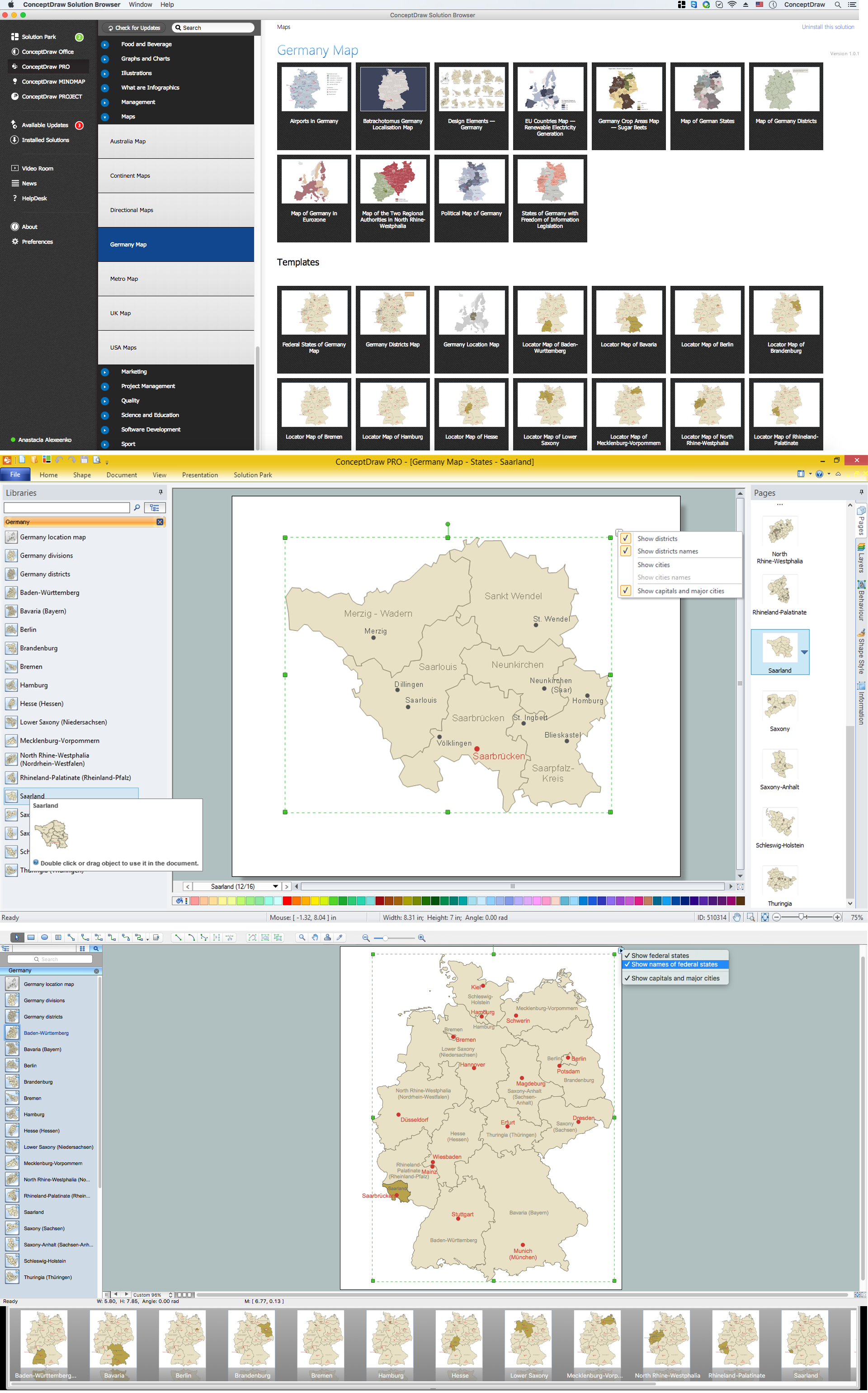
Germany, officially the Federal Republic of Germany, is a federal parliamentary republic in West-Central Europe. You need design the map of Germany or detailed map of Germany with cities fast and easy? We reccomend you to use the indispensable ConceptDraw PRO diagramming and vector drawing software extended with unique Germany Map Solution from the Maps Area of ConceptDraw Solution Park.Map Infographic Design
ConceptDraw collection of vector elements for infographics design.Infographic design elements, software tools Subway and Metro style
Subway infographic design elements for ConceptDraw PRO (mac and pc).How To Make a Concept Map
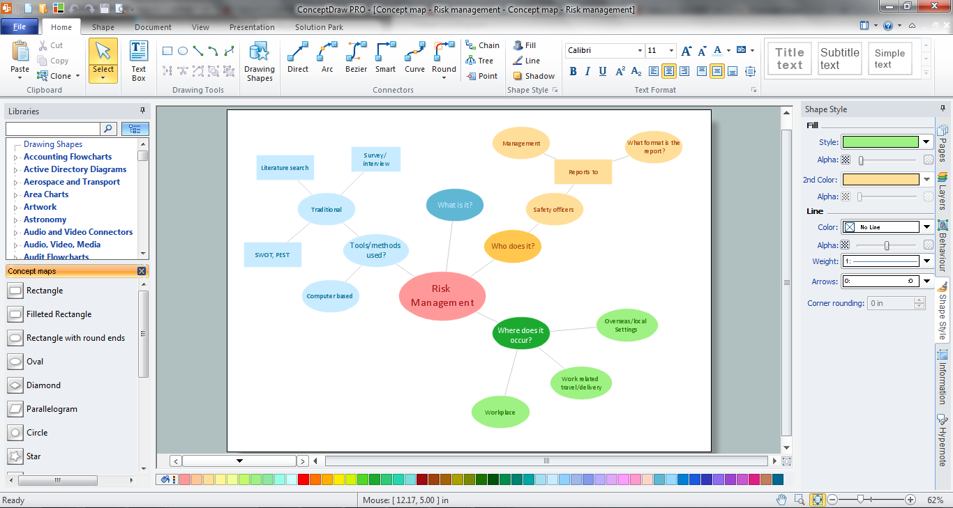
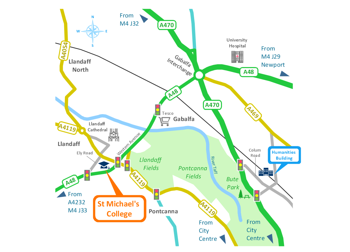
How to make a Concept Map fast and easy? ConceptDraw PRO diagramming and vector drawing software extended with Concept Maps Solution from the "Diagrams" Area is the best choice for those who want design professional looking Concept Map in minutes.Spatial infographics Design Elements: Transport Map
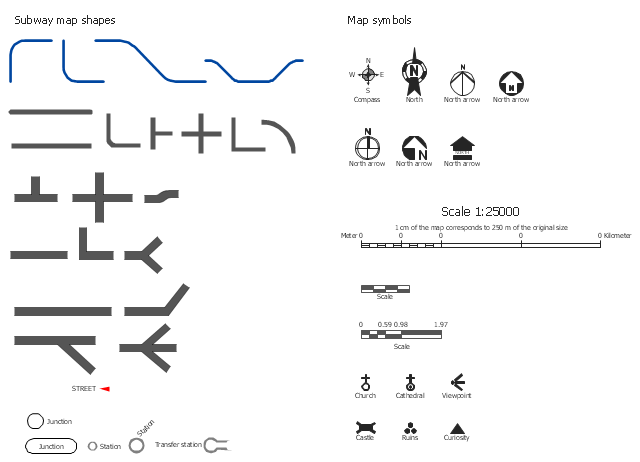
Do you like infographics and data visualization? Creating infographics is super-easy with ConceptDraw.The vector stencils library Map symbols contains 19 icons for labeling the maps using the ConceptDraw PRO diagramming and vector drawing software.
The vector stencils library Subway map contains 41 shapes for creating the subway (tube, metro) maps using the ConceptDraw PRO.
"The various features shown on a map are represented by conventional signs or symbols. For example, colors can be used to indicate a classification of roads. Those signs are usually explained in the margin of the map, or on a separately published characteristic sheet.
Some cartographers prefer to make the map cover practically the entire screen or sheet of paper, leaving no room "outside" the map for information about the map as a whole. These cartographers typically place such information in an otherwise "blank" region "inside" the map -- cartouche, map legend, title, compass rose, bar scale, etc. In particular, some maps contain smaller "sub-maps" in otherwise blank regions—often one at a much smaller scale showing the whole globe and where the whole map fits on that globe, and a few showing "regions of interest" at a larger scale in order to show details that wouldn't otherwise fit." [Map. Wikipedia]
The example "Design elements - Subway map, Map symbols" is included in the Directional Maps solution from the Maps area of ConceptDraw Solution Park.
Geo Map — Europe
Europe is a continent that comprises the westernmost part of Eurasia.ConceptDraw PRO is idea to draw the geological maps of Europe from the pre-designed vector geo map shapes.
Use it to draw thematic maps, geospatial infographics and vector illustrations for your business documents, presentations and websites.
Maps of Germany With Cities
Despite the fact that the maps surround us everywhere in our life, usually the process of their drawing is sufficienly complex and labor-intensive. But now, thanks to the ConceptDraw PRO diagramming and vector drawing software extended with Germany Map Solution from the Maps Area of ConceptDraw Solution Park, we have the possibility to make easier this process. Design fast and easy your own pictorial maps of Germany, map of Germany with cities, and thematic Germany maps in ConceptDraw PRO!Map of Germany — Saarland State
The Saarland is one of the sixteen federal states (or Bundesländer) of Germany. The capital city is Saarbrücken.Despite the fact that the maps surround us everywhere in our life, usually the process of their drawing is sufficienly complex and labor-intensive. But now, thanks to the ConceptDraw PRO diagramming and vector drawing software extended with Germany Map Solution from the Maps Area of ConceptDraw Solution Park, we have the possibility to make easier this process. Design fast and easy your own pictorial maps of Germany, map of Germany with cities, and thematic Germany maps in ConceptDraw PRO!
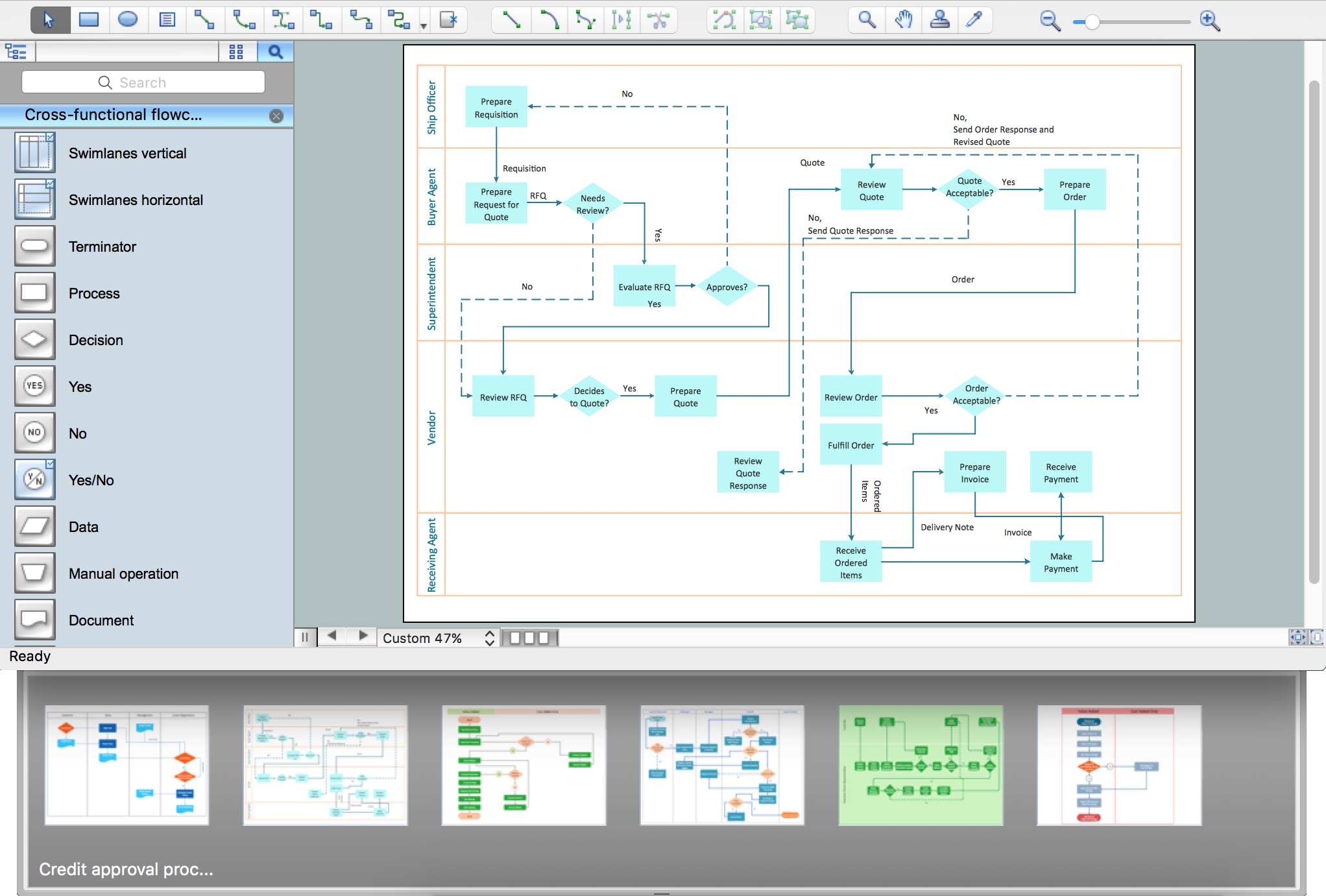
Process Flowchart
ConceptDraw is Professional business process mapping software for making process flow diagram, workflow diagram, general flowcharts and technical illustrations for business documents. It is includes rich examples, templates, process flowchart symbols. ConceptDraw flowchart maker allows you to easier create a process flowchart. Use a variety of drawing tools, smart connectors, flowchart symbols and shape libraries to create flowcharts of complex processes, process flow diagrams, procedures and information exchange.
Geo Map — Asia
ConceptDraw is idea to draw the geological maps of Asia from the pre-designed vector geo map shapes.Use Geo Map Asia to draw thematic maps, geospatial infographics and vector illustrations for your business documents, presentations and websites.
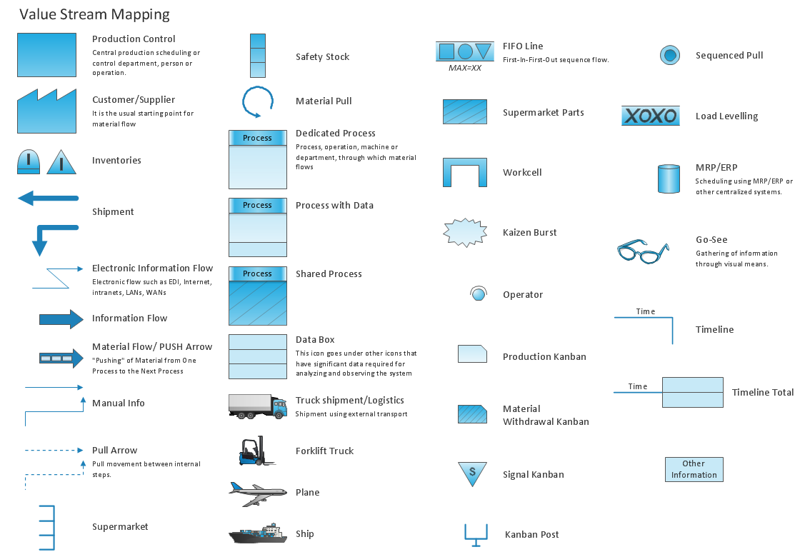
Value Stream Mapping - Design Elements
ConceptDraw PRO is a software for making Value Stream Mapping diagram with more than 10 library objects that are scalable vector images.- Design Map
- Design elements - 3D directional maps | Directions Map | Map ...
- Map of Germany | Subway infographic design elements - software ...
- Design Map Europa
- Transit map template | Transport map - Template | Design elements ...
- Map Europe Design
- Directions Map | Maps and Directions | Spatial infographics Design ...
- Design elements - Subway map , Map symbols | MTA Subway Map ...
- Landscape Design Map
- Design elements - Thematic maps | Name Three Primary Purposes ...
- Map Infographic Creator | Spatial infographics Design Elements ...
- How to draw Metro Map style infographics? (London) | Infographic ...
- Spatial infographics Design Elements: Location Map
- How To Draw Building Plans | Building Drawing Software for Design ...
- Asian Map Designs
- Design elements - Transport map | Subway Train Map | Metro Maps ...
- Geo Map - Europe | Spatial infographics Design Elements ...
- Design Value Stream Map
- Continent Maps | Spatial infographics Design Elements: Continental ...
- Brilliant Examples of Infographics Map , Transport, Road | Spatial ...
- ERD | Entity Relationship Diagrams, ERD Software for Mac and Win
- Flowchart | Basic Flowchart Symbols and Meaning
- Flowchart | Flowchart Design - Symbols, Shapes, Stencils and Icons
- Flowchart | Flow Chart Symbols
- Electrical | Electrical Drawing - Wiring and Circuits Schematics
- Flowchart | Common Flowchart Symbols
- Flowchart | Common Flowchart Symbols


