Continents Map

Spatial infographics Design Elements: Continental Map

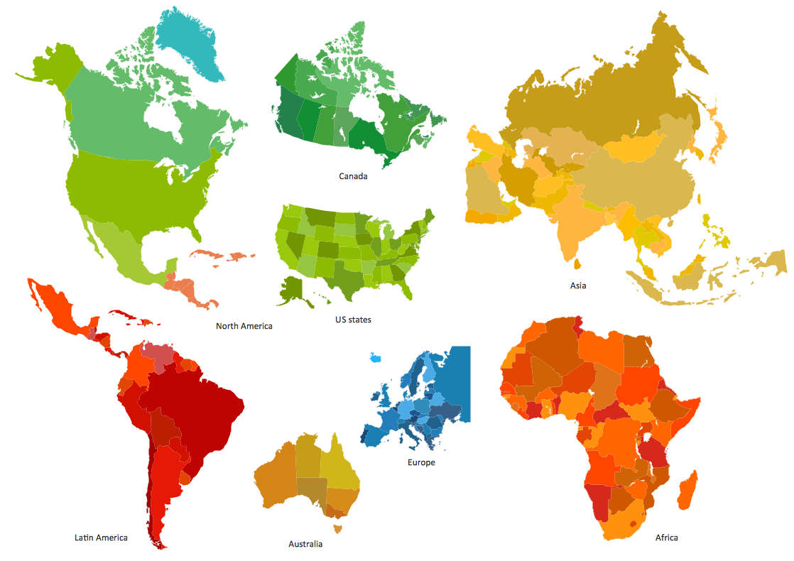
 Continent Maps
Continent Maps solution extends ConceptDraw DIAGRAM software with templates, samples and libraries of vector stencils for drawing the thematic maps of continents, state maps of USA and Australia.
Continents and Oceans Map

HelpDesk
How to Draw a Map of North America

7 Continents Map

Continent Map
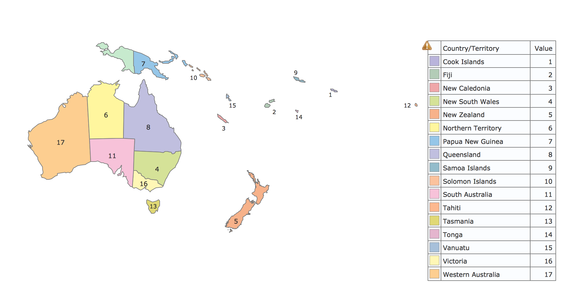
Geo Map - Oceania
Geo Map — South America Continent

ConceptDraw DIAGRAM is idea to draw the geological maps of South America continent from the pre-designed vector geo map shapes.
Use Continent Maps solution from the Maps area of ConceptDraw Solution Park to draw thematic maps, geospatial infographics and vector illustrations for your business documents, presentations and websites.
Best Tool for Infographic Construction
- The Seven Continents Templates
- Australia map - Template | Maps | Continent Maps | Australia Map ...
- North America map with capitals - Template | Continents Map ...
- Continent Template
- Cafe and Restaurant Floor Plans | Continent Maps | Line Graphs ...
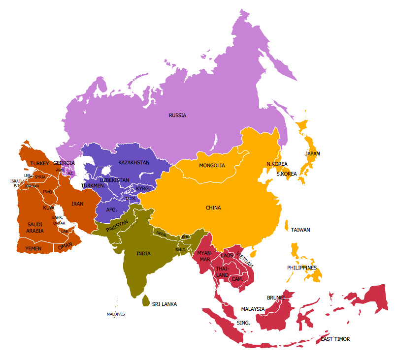
- Geo Map - Asia - India | Asia map with capitals - Template ...
- North America map with capitals - Template | Continents Map | Geo ...
- Europe Continent Map Template
- Continents Map | Asia map with capitals - Template | Geo Map - Asia ...
- Europe map with capitals - Template | Continents Map | Geo Map ...
- ERD | Entity Relationship Diagrams, ERD Software for Mac and Win
- Flowchart | Basic Flowchart Symbols and Meaning
- Flowchart | Flowchart Design - Symbols, Shapes, Stencils and Icons
- Flowchart | Flow Chart Symbols
- Electrical | Electrical Drawing - Wiring and Circuits Schematics
- Flowchart | Common Flowchart Symbols
- Flowchart | Common Flowchart Symbols