"A locator map, sometimes referred to simply as a locator, is typically a simple map used in cartography to show the location of a particular geographic area within its larger and presumably more familiar context. Depending on the needs of the cartographer, this type of map can be used on its own or as an inset or addition to a larger map. ...
Direct marketing.
The widespread distribution of sophisticated Geographic Information System (GIS) mapping techniques has allowed the development of large-scale customized locator maps that can be tailored to individual consumers in direct marketing campaigns. This sophistication allows a variety of customized locator maps to be produced in a relatively short period of time. Major types of direct marketing locator maps are:
Single Location: A single business location is shown with major street and road connections. While this type of map can be efficiently constructed using GIS with existing street databases and customized map templates, special software is not required because the map does not change for each direct mailing." [Locator map. Wikipedia]
This example was created using the ConceptDraw PRO diagramming and vector drawing software extended with the Directional Maps solution from the Maps area of ConceptDraw Solution Park.
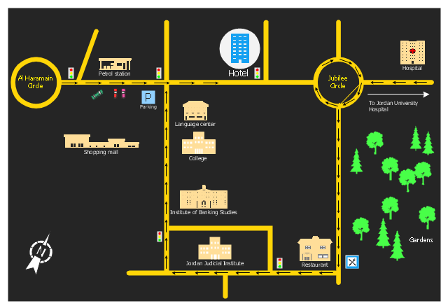
Hotel location map
 Directional Maps
Directional Maps solution extends ConceptDraw PRO software with templates, samples and libraries of vector stencils for drawing the directional, location, site, transit, road and route maps, plans and schemes.
 Maps
Maps
This solution extends ConceptDraw PRO v9.4 with the specific tools necessary to help you draw continental, directional, road, or transit maps, to represent international, business, or professional information visually.
 Germany Map
The Germany Map solution contains collection of samples, templates and scalable vector stencil graphic maps, representing map of Germany and all 16 states of Germany. Use the Germany Map solution from ConceptDraw Solution Park as the base for various them
 USA Maps
Use the USA Maps solution to create a map of USA, a US interstate map, printable US maps, US maps with cities and US maps with capitals. Create a complete USA states map.
Map of USA States

Maps Driving Directions

USA Maps

Sign Making Software

Sign making software is very useful tool for professional sign-making business. Use ConceptDraw PRO and make sure that now sign making is easier and timesaving than ever!
Maps and Directions

UML Use Case Diagram Example - Taxi Service

This sample shows the work of the taxi service and is used by taxi stations, by airports, in the tourism field and delivery service.
- Rolla USGS Center locator map | Mind Maps for Business - SWOT ...
- Locator map
- Types of Map - Overview | Hotel locator map | UML Diagram Types ...
- Hotel locator map | Rolla USGS Center locator map | Maps | Locator ...
- Hotel locator map
- Spatial infographics Design Elements: Location Map | Conference ...
- Www Example Of Geographical Location
- Directional Maps | How to Create a Directional Map Using ...
- Landmarks - Vector stencils library | Hotel locator map | Mac OS X ...
- Location Map Template
- 4 Level pyramid model diagram - Information systems types ...
- Hotel Network Topology Diagram | Hotel Plan. Hotel Plan Examples ...
- Map Infographic Design | Map Directions | Brilliant Examples of ...
- Maps | Map Directions | 2D Directional map - Template | Road Maps
- Rolla USGS Center locator map | Examples Of Opportunities And ...
- Road Maps Location
- Brilliant Examples of Infographics Map , Transport, Road | Maps ...
- Sales Process Map | SWOT Sample in Computers | Cross Functional ...
- Languages of South America - Thematic map | Europe thematic map ...
- Brilliant Examples of Infographics Map , Transport, Road | Design ...
- ERD | Entity Relationship Diagrams, ERD Software for Mac and Win
- Flowchart | Basic Flowchart Symbols and Meaning
- Flowchart | Flowchart Design - Symbols, Shapes, Stencils and Icons
- Flowchart | Flow Chart Symbols
- Electrical | Electrical Drawing - Wiring and Circuits Schematics
- Flowchart | Common Flowchart Symbols
- Flowchart | Common Flowchart Symbols