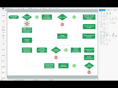
Flow chart Example. Warehouse Flowchart

Standard warehousing process flow diagram and standard workflow diagram used for process identification for further evaluating effectiveness and profitability of overall business process. Use the ConceptDraw PRO diagramming and vector drawing software extended with the Flowcharts solution from the Diagrams area of ConceptDraw Solution Park to design your own workflow diagrams, process flow diagram and flow charts. Need to use Process Flow Diagram for designing Warehouse packages flow.
Subway Train Map

Road Transport - Design Elements

How to draw Metro Map style infographics? (New York)

New York Subway has a long history starting on October 27, 1904. Since the opening many agencies have provided schemes of the subway system. At present time are 34 lines in use. This page present New York City subway map construct with Metro Map Solution in Conceptdraw PRO software. This is a one-click tool to add stations to the map. It lets you control the direction in which you create new stations, change lengths, and add text labels and icons. It contains Lines, Stations, and Landmarks objects
How to draw Metro Map style infographics? Moscow, New York, Los Angeles, London

How to Build Cloud Computing Diagram Principal Cloud Manufacturing

For documenting the Cloud Computing Architecture with a goal to facilitate the communication between stakeholders are successfully used the Cloud Computing Architecture diagrams. It is convenient and easy to draw various Cloud Computing Architecture diagrams in ConceptDraw PRO software with help of tools of the Cloud Computing Diagrams Solution from the Computer and Networks Area of ConceptDraw Solution Park.
 Aerospace and Transport
This solution extends ConceptDraw PRO software with templates, samples and library of vector clipart for drawing the Aerospace and Transport Illustrations. It contains clipart of aerospace objects and transportation vehicles, office buildings and anci
How to draw Metro Map style infographics? (London)

Metro Maps

 Metro Map
Metro Map solution extends ConceptDraw PRO software with templates, samples and library of vector stencils for drawing the metro maps, route maps, bus and other transport schemes, or design tube-style infographics.
Fire Exit Plan. Building Plan Examples

Solution Building Plans from ConceptDraw Solution Park provides vector stencils libraries with design elements for drawing fire exit plans.
 Metro Map
Metro Map solution extends ConceptDraw PRO software with templates, samples and library of vector stencils for drawing the metro maps, route maps, bus and other transport schemes, or design tube-style infographics.
Maps and Directions

 Directional Maps
Directional Maps solution extends ConceptDraw PRO software with templates, samples and libraries of vector stencils for drawing the directional, location, site, transit, road and route maps, plans and schemes.
Spatial Data Analysis

- A Standard Railway Terminal Flow Chart
- Bubble Diagram For Rail Ways Station
- Drawing Raliway Station Chart
- Process Flowchart | Wiring Diagrams with ConceptDraw PRO | Map ...
- Flow Chart Of A Bus Station
- Three Possible Designs Floor Plans Evaluation Of A Railway
- Process Flowchart | How to draw Metro Map style infographics ...
- Basic Gas Station Flowcharts Services
- Landmarks - Vector stencils library | SDL Flowchart Symbols ...
- Fire Exit Plan. Building Plan Examples | Flow chart Example ...
- Bubble Diagram Showing The Flow In The Railway Station
- Spa Floor Plan | Gym Floor Plan | Flow chart Example. Warehouse ...
- Bubble Diagram Of A Train Station
- Flow Chart Bus Station
- Www Architectural Flow Chart For A Bus Terminal
- Functional Flowchart In A Railway Station
- Mind Mapping Chart Of Railway Station
- How to Draw an Organization Chart | Process Flowchart | Wiring ...
- Gym Floor Plan | Flow chart Example. Warehouse Flowchart | Road ...
- Bubble Diagrams A Bus Terminal Architecture
- ERD | Entity Relationship Diagrams, ERD Software for Mac and Win
- Flowchart | Basic Flowchart Symbols and Meaning
- Flowchart | Flowchart Design - Symbols, Shapes, Stencils and Icons
- Flowchart | Flow Chart Symbols
- Electrical | Electrical Drawing - Wiring and Circuits Schematics
- Flowchart | Common Flowchart Symbols
- Flowchart | Common Flowchart Symbols