Map of Germany — Thuringia State
“The Free State of Thuringia is a federal state of Germany, located in the central part of the country. It has an area of 16,171 square kilometres (6,244 sq mi) and 2.29 million inhabitants, making it the sixth smallest by area and the fifth smallest by population of Germany's sixteen states. Most of Thuringia is within the watershed of the Saale, a left tributary of the Elbe. Its capital is Erfurt.“
[from Wikipedia]
Landkreise
- Altenburger Land
- Eichsfeld
- Gotha
- Greiz
- Hildburghausen
- Ilm-Kreis
- Kyffhäuserkreis
- Nordhausen
- Saale-Holzland
- Saale-Orla
- Saalfeld-Rudolstadt
- Schmalkalden-Meiningen
- Sömmerda
- Sonneberg
- Unstrut-Hainich
- Wartburgkreis
- Weimarer Land
Cities
- Erfurt
- Sömmerda
- Norhausen
- Sondershausen
- Heilbad Heiligenstadt
- Mühlhausen
- Eisenach
- Bad Salzungen
- Meiningen
- Hildbghausen
- Suhl
- Sonneberg
- Saalfeld
- Schleiz
- Arnstadt
- Greiz
- Gera
- Jena
- Eisenberg
- Altenburg
- Weimar
Despite the fact that the maps surround us everywhere in our life, usually the process of their drawing is sufficienly complex and labor-intensive. But now, thanks to the ConceptDraw DIAGRAM diagramming and vector drawing software extended with Germany Map Solution from the Maps Area of ConceptDraw Solution Park, we have the possibility to make easier this process. Design fast and easy your own pictorial maps of Germany, map of Germany with cities, and thematic Germany maps in ConceptDraw DIAGRAM
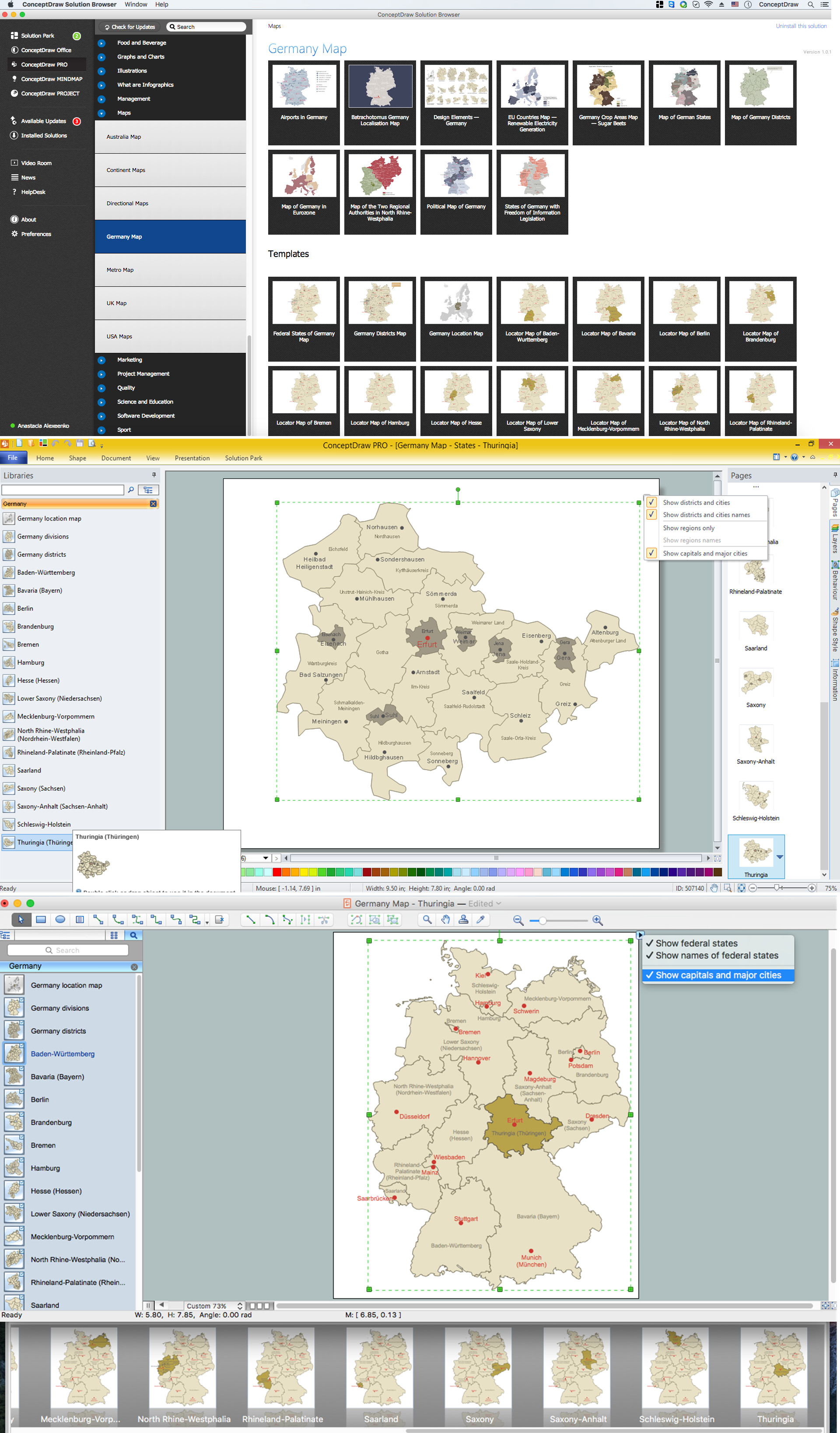
Example 1. Germany Map Solution — Thuringia State (Mac OS X, Windows)
Use of ready objects is a fastest way of drawing vivid and attractive maps and cartograms, and Germany maps are not exception. The Germany Map Solution offers for ConceptDraw DIAGRAM users wide variety of ready-to-use vector map objects, which compose the Germany library.

Example 2. Germany Library Design Elements
These objects allow easy design many kinds of Germany maps, among them geographic, topography, political map of Germany, detailed map of Germany with cities, various thematic Germany maps that are used for visually illustration important information and statistical data, and many other useful maps.
All source documents are vector graphic documents. They are available for reviewing, modifying, or converting to a variety of formats (PDF file, MS PowerPoint, MS Visio, and many other graphic formats) from the ConceptDraw STORE. The Germany Map Solution is available for all ConceptDraw DIAGRAM users.