Map of Germany — Bremen
“The City Municipality of Bremen is a Hanseatic city in northwestern Germany. A commercial and industrial city with a major port on the River Weser, Bremen is part of the Bremen/Oldenburg Metropolitan Region, with 2.4 million people. Bremen is the second most populous city in Northern Germany and tenth in Germany.Bremen is a major cultural and economic hub in the northern regions of Germany. Bremen is home to dozens of historical galleries and museums, ranging from historical sculptures to major art museums, such as the Übersee-Museum Bremen.“
[from Wikipedia]
“The Free Hanseatic City of Bremen is the smallest of Germany's 16 states. A more informal name, but used in some official contexts, is Land Bremen. The state consists of two cities (Bremen and Bremerhaven) in the North of Germany, separated from each other and surrounded by the larger state of Lower Saxony. It is the only landlocked, non-contiguous state in Germany.“
[from Wikipedia]
Boroughs
- Mitte
- Häfen
- Neustadt
- Obervieland
- Huchting
- Woltmershausen
- Seehausen
- Strom
- Östliche Vorstadt
- Schwachhausen
- Vahr
- Horn-Lehe
- Borgfeld
- Oberneuland
- Osterholz
- Hemelingen
- Blockland
- Findorff
- Walle
- Gröpelingen
- Burglesum
- Vegesack
- Blumenthal
Despite the fact that the maps surround us everywhere in our life, usually the process of their drawing is sufficienly complex and labor-intensive. But now, thanks to the ConceptDraw DIAGRAM diagramming and vector drawing software extended with Germany Map Solution from the Maps Area of ConceptDraw Solution Park, we have the possibility to make easier this process. Design fast and easy your own pictorial maps of Germany, map of Germany with cities, and thematic Germany maps in ConceptDraw DIAGRAM
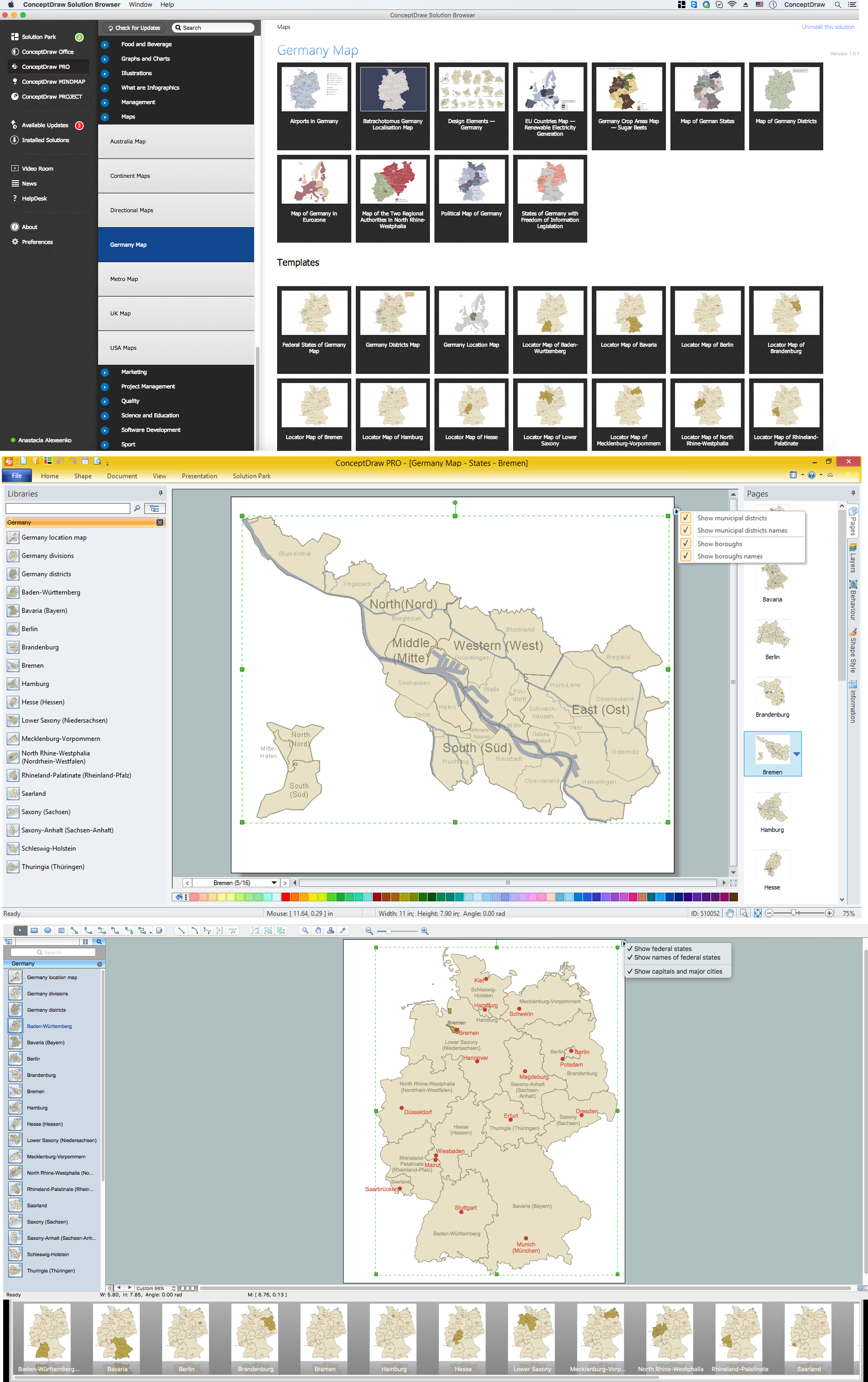
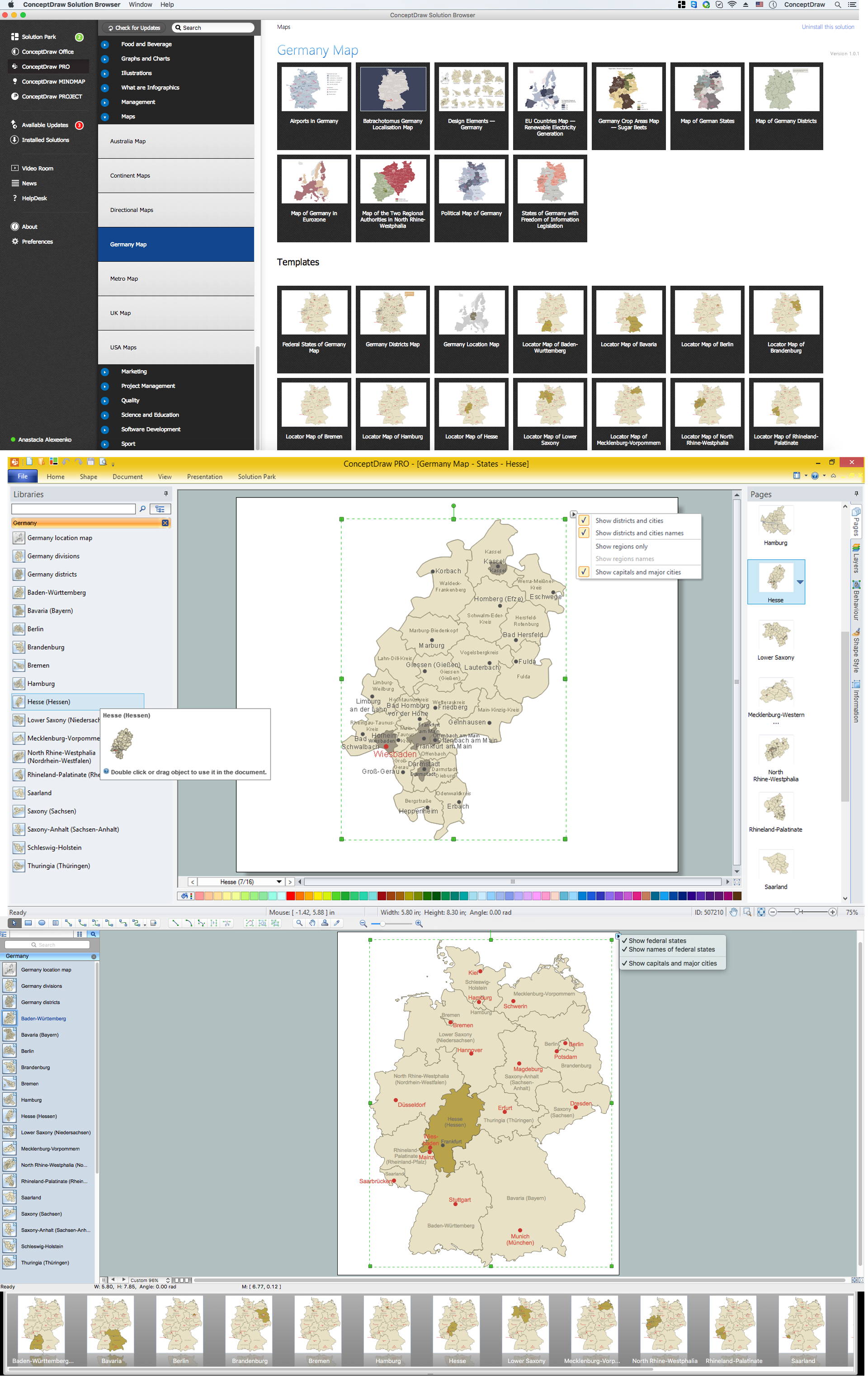
Example 1. Germany Map Solution — Bremen (Mac OS X, Windows)
Use of ready objects is a fastest way of drawing vivid and attractive maps and cartograms, and Germany maps are not exception. The Germany Map Solution offers for ConceptDraw DIAGRAM users wide variety of ready-to-use vector map objects, which compose the Germany library.

Example 2. Germany Library Design Elements
These objects allow easy design many kinds of Germany maps, among them geographic, topography, political map of Germany, detailed map of Germany with cities, various thematic Germany maps that are used for visually illustration important information and statistical data, and many other useful maps.
All source documents are vector graphic documents. They are available for reviewing, modifying, or converting to a variety of formats (PDF file, MS PowerPoint, MS Visio, and many other graphic formats) from the ConceptDraw STORE. The Germany Map Solution is available for all ConceptDraw DIAGRAM users.