Map of Germany — Hesse State
“Hesse is a federal state (Land) of the Federal Republic of Germany, with just over six million inhabitants. The state capital is Wiesbaden; the largest city is Frankfurt am Main. Until the formation of the German Reich in 1871, Hesse was an independent country ruled by a Grand Duke (Grand Duchy of Hesse). Due to divisions after World War II, the modern federal state does not cover the entire cultural region of Hesse which includes both the State of Hesse and the area known as Rhenish Hesse (Rheinhessen) in the neighbouring state of Rhineland-Palatinate. Capital - Wiesbaden.“
[from Wikipedia]
Landkreise
- Bergstraße
- Darmstadt-Dieburg
- Groß-Gerau
- Hochtaunuskreis
- Main-Kinzig-Kreis
- Main-Taunus-Kreis
- Odenwaldkreis
- Offenbach
- Rheingau-Taunus-Kreis
- Wetteraukreis
- Gießen
- Lahn-Dill-Kreis
- Limburg-Weilburg
- Marburg-Biedenkopf
- Vogelsbergkreis
- Fulda
- Hersfeld-Rotenburg
- Kassel
- Schwalm-Eder-Kreis
- Werra-Meißner-Kreis
- Waldeck-Frankenberg
Cities
- Wiesbaden
- Kassel
- Fulda
- Marburg
- Korbach
- Homberg (Efze)
- Eschwege
- Bad Hersfeld
- Lauterbach
- Giessen (Gießen)
- Gelnhausen
- Friedberg
- Bad Homburg vor der Höhe
- Limburg an der Lahn
- Bad Schwalbach
- Groß-Gerau
- Heppenheim
- Erbach
- Darmstadt
- Hofheim
- Frankfurt am Main
- Offenbach am Main
Despite the fact that the maps surround us everywhere in our life, usually the process of their drawing is sufficienly complex and labor-intensive. But now, thanks to the ConceptDraw DIAGRAM diagramming and vector drawing software extended with Germany Map Solution from the Maps Area of ConceptDraw Solution Park, we have the possibility to make easier this process. Design fast and easy your own pictorial maps of Germany, map of Germany with cities, and thematic Germany maps in ConceptDraw DIAGRAM
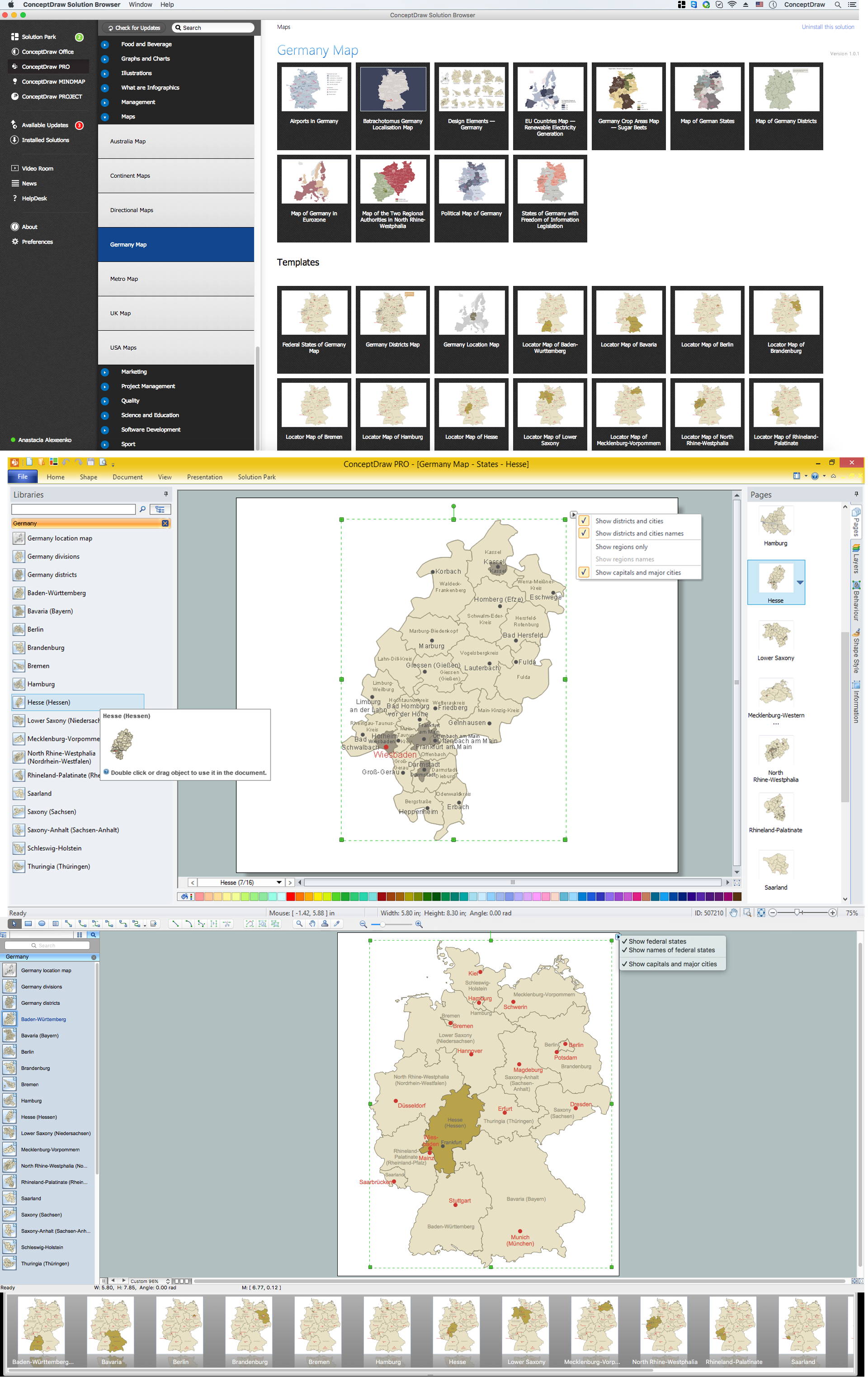
Example 1. Germany Map Solution — Hesse State (Mac OS X, Windows)
Use of ready objects is a fastest way of drawing vivid and attractive maps and cartograms, and Germany maps are not exception. The Germany Map Solution offers for ConceptDraw DIAGRAM users wide variety of ready-to-use vector map objects, which compose the Germany library.

Example 2. Germany Library Design Elements
These objects allow easy design many kinds of Germany maps, among them geographic, topography, political map of Germany, detailed map of Germany with cities, various thematic Germany maps that are used for visually illustration important information and statistical data, and many other useful maps.
All source documents are vector graphic documents. They are available for reviewing, modifying, or converting to a variety of formats (PDF file, MS PowerPoint, MS Visio, and many other graphic formats) from the ConceptDraw STORE. The Germany Map Solution is available for all ConceptDraw DIAGRAM users.