Geo Map — Europe — Sweden
Maps of Europe — Kingdom of Sweden
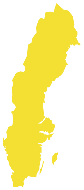
Sweden is officially called the Kingdom of Sweden. It is a country in the Scandinavian part of Northern Europe, bordering Denmark in its southwestern part and Norway to the north and west. There is also Finland to the east from the country, which is 450295 square kilometres large. The last one, Sweden, is on the third place among other largest countries in the EU, considering its area, having the population of about 10 million people, which is only 22 inhabitants per square kilometre. The highest concentration of the Swedish people is in the southern half of the country, when about 85% of the total population lives in the urban areas.
Germans were the first ones inhabiting Sweden, followed by so-called “sea peoples”, also known as the Norsemen. The southern part of Sweden is known to be a good place for developing the agriculture. Its northern part is quite forested. Sweden is part of the so-called “Fennoscandia” geographical area, having very mild climate because of the maritime influence. Being a constitutional monarchy there a monarch who is a head of the state in Sweden. It is also known to have a parliamentary democracy. The capital city of Sweden is Stockholm, being also the most densely populated city in the country. Sweden is also a unitary state, divided into 21 counties as well as 290 municipalities. It emerged as an independent as well as a unified country during the period of the Middle Ages: in the 17th century, it expanded its territories to form the so-called “Swedish Empire”, becoming one of the great powers of Europe up to the early 18th century.
All of the Swedish territories outside the “Scandinavian Peninsula” were lost during the 18th and 19th centuries. The last war, which Sweden was involved in, happened in 1814, when Norway was forced into the “personal union”, known as a union separating the kingdoms of Norway and Sweden under a common monarch as well as common foreign policy, which lasted from 1814 until its dissolution in 1905, when Sweden accepted Norway's leaving the union.
Since then, Sweden keeps the official policy of neutrality in all the foreign affairs. Later, Sweden joined the European Union in 1995 but declined the NATO membership, as well as “Eurozone” membership following a referendum. Nowadays this country is also a member of the “United Nations”, the Council of Europe, the Nordic Council, the Organisation for Economic Co-operation and Development and the World Trade Organization. Sweden provides the so-called “universal health care” as well as the “tertiary education” for its citizens, maintaining a “Nordic social welfare system” and providing the universities and institutions that teach specific capacities of higher learning such as technical training institutes, colleges, nursing schools, community colleges, research laboratories, distance learning centres as well as the “centres of excellence”.
Sweden takes the eighth place in the world for the high “capita income”, which is the value of all final services as well as goods produced within a nation in a given year, ranking in numerous metrics of national performance, such as education, quality of life, health, protection, economic competitiveness, prosperity, human development and equality. The official language in Sweden is Swedish, which is a North Germanic language, related to Norwegian and Danish, although different in pronunciation as well as its orthography. People, who live in Norway, find it quite easy to understand Swedish, as well as those, who live in Denmark. There are also a few dialects, popular in Scania, which is the region in the southernmost part of Sweden. These dialects were influenced by Danish people, as originally this region was a part of Denmark a long time ago. There are very many so-called “Sweden Finns” living in Sweden, being its largest linguistic minority (about 5% of Sweden's population). The Finnish is also recognised to be a minority language.
Apart from Finnish, there are other languages, which are quite popular for use in Sweden, such as Sami, Romani, Yiddish and Meankieli. Swedish, though, has been a Sweden's official language since 2009. At the same time, the majority of Swedes, especially the new generation, both understand and speak the English language as it is known to be an “international” one, used for travelling overseas, due to a strong Anglo-American influence. Thus, 89% of Swedes reported the ability to speak English. English also became a compulsory subject for all the students in secondary school. Depending on the local school authorities, English is currently a compulsory subject with all students continuing in secondary school studying English for at least one year.
Most of the students in most of the universities also study one or two other additional languages, which may include French, Spanish and/or German. Some Norwegian and Danish can also be taught as part of the Swedish courses for native speakers and the reason for such languages to be that popular can be the extensive mutual intelligibility between the three continental “Scandinavian” languages. The Swedish speakers often use their native language in their country, but visiting Norway or Denmark then speak Norwegian or Danish accordingly.
You can always mention any needed information about Sweden on the map, which you have an opportunity to create using ConceptDraw DIAGRAM software, enabling you to get the needed result within a very short period of time, providing all the necessary tools, such as stencil libraries and the pre-made templates in the solutions from ConceptDraw STORE or simply from this site. Thus, the vector stencils library “Sweden”, which contains the contours of Sweden, can be found in the “Continent Maps solution”, which you can always download from the “Maps area” of the “ConceptDraw Solution Park” from this site to be used while working in the ConceptDraw DIAGRAM diagramming and vector drawing software.

Use it for drawing the thematic maps, geospatial infographics or/and the great looking vector illustrations, which all can be used in your business documents, presentations or/and websites.
Geo Map — Europe — Kingdom of Sweden
Geo Map — Europe — Sweden Contour

Geo Map — Europe

Geo Map — Europe Contour

Geo Map — contours of Europe countries

See also Geo Maps of Europe Countries :
- Albania
- Austria
- Belarus
- Bulgaria
- Bosnia and Herzegovina
- Belgium
- Czech Republic
- Croatia
- Denmark
- Estonia
- France
- Finland
- Greece
- Germany
- Hungary
- Italy
- Ireland
- Iceland
- United Kingdom
- Latvia
- Luxembourg
- Lithuania
- Montenegro
- Macedonia
- Moldova
- Norway
- Netherlands
- Portugal
- Poland
- Russia
- Romania
- Switzerland
- Sweden
- Spain
- Slovenia
- Slovakia
- Serbia
- Ukraine