Geo Map — Europe — Finland
Maps of Europe - Republic of Finlands
The Republic of Finland is a country in Europe, to be clearer – in the northern part of it. The so-called Gulf of Finland which is the easternmost arm of the Baltic Sea is to the south from this sovereign state and so-called Gulf of Bothnia is to the west. This country has land borders with other countries, which are: Sweden to the north-west, Russia to the east and Norway to the north. There is also Estonia which is to the south of this Nordic country across the Gulf of Finland.
There are about 5,5 million people living in Finland and the majority of them is concentrated in the southern region. 88,7 % of the total population is Finnish people who speak their national language – Finnish. Finnish is a Uralic language, which is not related to the Scandinavian languages. The second major group of the total population consists of the Finland-Swedes (there are about 5 % of them).
Finland is a republic with its parliament based in the capital of this country – Helsinki. There are local governments in 311 so-called “municipalities”, which represent the local level of administration in Finland. Over 1,4 million people live in the metropolitan area called “Greater Helsinki”, producing a third of the country’s Gross domestic product. Finland used to be an integral part of Sweden, but in 1809 Finland was incorporated into the Russian Empire and it was named “Grand Duchy of England”. In 1906, Finland became the second nation in the world giving the right to vote to all of the adult citizens. It also became the first in the world to give all adult citizens the right to run for the public office.
Finland joined the “Organisation for Economic Co-operation and Development” in 1969, the “NATO Partnership for Peace” in 1994, the “European Union” in 1995, the “Euro-Atlantic Partnership Council” in 1997 and the “Eurozone” in 1999. There are a few facts about this country which may be interesting for those who intend to go there: Finland is one of the world's northernmost countries and its largest lake Saimaa is the fourth largest in Europe; the area with the most lakes is called “Finnish Lakeland” and the greatest concentration of islands is found in the south-west in the Archipelago Sea between the continental Finland and the main island of Aland.
The surface area of this country is expanding by about 7 square kilometers annually, so it looks like Finland is rising from the sea. The landscape is mostly covered with forests of little-cultivated land. 10 % of the total area of Finland is lakes, rivers and ponds and 78 % is forest. The forests are birch, spruce, pine and other species making Finland the largest producer of wood in Europe. It is also one of the largest producers of wood in the whole world. Granite is the most common type of rock in Finland.
Finland consists of 19 ”maakunta”, which are ”regions” in Finnish (known as “landskap” in Swedish). These regions are governed by regional councils which serve as forums of cooperation for the municipalities of a region, which main tasks are regional planning and development of enterprise and education. The public health services are usually organized on the basis of regions. There is only one region where a popular election is held for the council, and this region is called “Kainuu”. Other regional councils are elected by the local municipal councils.
Each of the regions has its own “state Employment and Economic Development Centre”, which is responsible for the local administration of agriculture, labour, fisheries, forestry and entrepreneurial affairs. The “Finnish Defence Forces regional offices” are in charge of the regional defence preparations and for the administration of conscription within the region. All of the regions represent the cultural, dialectal and economic variations better than the former “provinces”, which were purely administrative divisions of the central government. Historically, regions are divisions of the “provinces” of Finland representing the dialects and the culture of the country. There are also six “Regional State Administrative Agencies”, which were created by the state of Finland in 2010. Each of them is responsible for one of the regions called “alue” in Finnish (and “region” in Swedish).
Planning to create a map of Finland you may wonder which of the existing applications to use as, obviously, for saving your time and your money, you need something which can help you make the map you need within a short period of time to get a nice looking result paying not as much as if this job were done by someone else, e.g. the professional web designer. There are many web designers working in CS Odessa developing ConceptDraw DIAGRAM as a unique software providing its clients with the examples of pre-made maps, schemes, plans, charts, flowcharts, diagrams and other drawings. All of the samples can be found in the appropriate solutions and any or all of them can be used once downloaded from this site or from ConceptDraw STORE which is another product of CS Odessa having all of the necessary tools, including the stencil libraries for simplifying our clients work with their drawings.
The “Continent Maps” solution can also be found in ConceptDraw STORE or from the “Maps area” of ConceptDraw Solution Park on this site. There is a vector stencils library “Finland” in the solution containing the contours for using them while working in the ConceptDraw DIAGRAM diagramming and vector drawing software creating your great looking maps of Finland – whether they are geospatial infographics or simple vector illustrations which you want to use for your business documents, websites, presentations, etc. Having ConceptDraw DIAGRAM software means having an opportunity to make any needed map, including the one of Finland or other countries, and having ConceptDraw STORE with the solutions allows to make your drawing look truly professional.

Pic. 1. Geo Map Solution
Use the Finland library to draw thematic maps, geospatial infographics and vector illustrations for your business documents, presentations and websites.
Geo Map — Europe — Republic of Finland
Pic. 2. Geo Map Republic of Finland
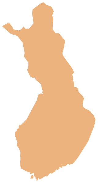
Geo Map — Europe — Finland Contour

Pic. 3. Geo Map Finland Contour
Geo Map — Europe

Pic. 4. Geo Map Europe
Geo Map — Europe Contour

Pic. 5. Geo Map Europe Contour
Geo Map — contours of Europe countries

Pic. 6. Contours of Europe Countries
All ConceptDraw DIAGRAM documents are vector graphic files and are available for reviewing, modifying, and converting to a variety of formats: image, HTML, PDF file, MS PowerPoint Presentation, Adobe Flash, MS Visio (.VDX, .VSDX).
See also Geo Maps of Europe Countries :
- Albania
- Austria
- Belarus
- Bulgaria
- Bosnia and Herzegovina
- Belgium
- Czech Republic
- Croatia
- Denmark
- Estonia
- France
- Finland
- Greece
- Germany
- Hungary
- Italy
- Ireland
- Iceland
- United Kingdom
- Latvia
- Luxembourg
- Lithuania
- Montenegro
- Macedonia
- Moldova
- Norway
- Netherlands
- Portugal
- Poland
- Russia
- Romania
- Switzerland
- Sweden
- Spain
- Slovenia
- Slovakia
- Serbia
- Ukraine